SE DEBE SOLICITAR COTIZACIÓN DE ENVÍO PARA ARTÍCULOS DE GRAN TAMAÑO
Request Quote
Experience flight like never before with the DJI Avata 2. Designed for immersive FPV performance, this compact drone combines a 4K stabilized camera, intuitive controls, and immersive goggles for precise and safe flying. Perfect for content creators and drone enthusiasts alike, the Avata 2 delivers smooth footage, real-time transmission, and unmatched maneuverability in any environment. Take your aerial perspective to new heights with total flight freedom.
The adrenaline-pumping DJI Avata 2 delivers an immersive FPV drone experience with improved imaging, safety, and battery life. Amp up the fun when you pair Avata 2 with the new DJI Goggles 3 and DJI RC Motion 3.
DJI Goggles 3
DJI Goggles 3 now has Real View PiP (Picture-in-Picture). Observe your surroundings without removing the goggles, for more safety and immersion. The micro-OLED high-definition display and ultra-low-latency transmission bring the world into view.
DJI RC Motion 3
Effortlessly perform difficult aerial acrobatics with DJI RC Motion 3. New pilots can now perform spectacular flips, drifts, and other captivating maneuvers.
Soar, dive, and roll for stunning aerial footage with a single push. Capturing epic FPV footage with DJI RC Motion 3 and Avata 2 is easier than ever.
Activate power loop with a single push, and the Avata 2 will instantly accelerate, ascend, flip, and descend, providing a seamless and thrilling loop flight experience.
* The power loop feature has a fixed radius and speed, which cannot be altered. The loop radius is set at 5 meters, and the minimum effective height is 1.5 meters.360° front/back flip, adding fresh twists to your footage.
High-speed lateral drifts to yaw spin 180° past objects and swiftly pull away, achieving dramatic visuals. One-Push Roll Roll 360° left/right, turning any shot from "meh" to magic.
Roll 360° left/right, turning any shot from "meh" to magic.
Fly nimbly through tight spaces with the new DJI FPV Remote Controller 3 in Manual mode to showcase flying prowess and gutsy creativity.
Must-Have App for DJI Users
Virtual Flight has just been updated, offering an exclusive sneak peek into one-tap acrobatics and the joy of FPV flight. Try all-new scenarios and flight tasks, and immerse yourself in the control experience of Avata 2.
Create breathtaking visuals with the 155° FOV of Avata 2 and its ability to swiftly approach and pull away from subjects. New pilots can quickly master aerobatic shots and capture fast-moving dynamic low-altitude shots that other drones can't.
The upgraded 1/1.3-inch CMOS sensor expands the captured dynamic range, handling low-light conditions more effectively to capture outstanding footage on every flight.
Effective Pixels
12 MP
Offline Stabilization
Gyroflow
Unleash your true aerial potential. The 4K/60fps HDR on Avata 2 captures all the awesome of high-speed flight. In the goggles, you can adjust the sharpness and noise reduction levels for more finely tuned videos.
4K UHD clarity captures vivid details, while the 100fps frame rate ensures a more delicate and smooth viewing experience, allowing you to fully appreciate awe-inspiring moments during flight.
Equipped with DJI's latest stabilization algorithm, Avata 2 captures smooth, steady footage even when flying at high speeds or in windy conditions.
HorizonSteady handles horizontal rotations up to 360°, ensuring the captured footage remains locked on the horizon even if the drone turns sharply or sways dramatically.
Amplify your vision and increase the immersion of low-altitude, high-speed flights. Avata 2 offers ultra-wide-angle, wide-angle, and normal-angle FOV options giving you the ability to adjust to the scenario.
Capture rich detail in highlights and shadows and enhance content post-production opportunities while further streamlining color-grading.
The updated integrated propeller guard design of Avata 2 makes it lighter and more agile, enabling it to navigate freely in tight spaces. Releasing the accelerator on RC Motion 3 or pressing the lock button brings the drone to a halt, allowing you to handle unexpected situations calmly. In addition, the automatic Return to Home (RTH) function is initiated when the drone's battery is low or in case of signal loss, adding an extra layer of security.
New binocular fisheye sensors enable downward and backward visual positioning during low-altitude and indoor flights, enhancing flight stability and safety.
Avata 2 can automatically flip itself back into takeoff position when upside down with Turtle mode enabled, so you can quickly get airborne again.
Avata 2 boasts a maximum flight time of 23 minutes and supports PD fast charging, so you can quickly recharge it and take to the skies again.
The new DJI Avata 2 Two-Way Charging Hub features a power accumulation function, allowing the transfer of remaining power from multiple batteries to the one with the highest charge level, giving you an "extra battery" in critical moments.
DJI O4 video transmission's enhanced stability lets you fully immerse yourself in each flight and provides greater safety. Its two-transmitter, four-receiver, four-antenna design ensures strong anti-interference performance, and it boasts up to 13 km of maximum video transmission distance, a transmission latency as low as 24 ms, 1080p/100fps high-definition image quality, and a maximum transmission bitrate of 60Mbps.
Watch the DJI Goggles 3 live feed from Avata 2 on your smart device's DJI Fly App. Connect up to 5 m away. Sharing the excitement of FPV just got easier, and learning how to fly is more accessible than ever.
Avata 2 comes equipped with 46GB internal storage, capable of storing approximately 90 minutes of 1080p/60fps video, ensuring you capture the best parts of each flight.
With Wi-Fi connectivity for fast file transfer to your phone, post-editing and sharing of your finished work is highly efficient.
The LightCut app, connecting directly to DJI Avata 2 via Wi-Fi, allows you to intelligently add Sky VFX during post based on the flight trajectory captured in your videos, helping you easily create engaging aerial footage. Without the need to download the footage, the app offers editing and, combined with One-Tap Edit, allows you to produce polished content effortlessly.
After connecting the device and importing the footage, tap Sky VFX to add unique overlays, through-the-air text animations, virtual cockpits, and dashboard effects, enhancing the interactive fun and engagement of your immersive flight footage.
With AI's intelligent recognition of video types and themes, you can effortlessly filter through and select highlights with smooth camera work and exquisite composition. Coupled with a vast array of thematic templates, enabling you to produce polished content. The app also boasts intelligent sound effects, color recovery, one-click addition of device watermarks, and end credits, among other features.
When Avata 2 is connected wirelessly to LightCut, you can preview the captured footage within the app and edit it without the need to download the footage, saving valuable space on your smartphone.
Feature | Specification |
---|---|
Takeoff Weight | Approx. 377 g |
Dimensions | 185×212×64 mm (L×W×H) |
Max Ascent Speed | 6 m/s (Normal mode) 9 m/s (Sport mode) |
Max Descent Speed | 6 m/s (Normal mode) 9 m/s (Sport mode) |
Max Horizontal Speed (near sea level, no wind) | 8 m/s (Normal mode) 16 m/s (Sport mode) 27 m/s (Manual mode)* * No faster than 19 m/s with the Manual mode in the EU regions. |
Max Takeoff Altitude | 5000 m |
Max Flight Time | Approx. 23 mins Measured in a windless environment when taking off from an altitude of 5000 m and ascending vertically by 500 m, using Sport mode, and from 100% battery level until 20%. Data is for reference only. Always pay attention to reminders on the goggles' screens during your flight. |
Max Hovering Time | Approx. 21 mins Measured when hovering in a windless environment at sea level, with camera parameters set to 1080p/30fps, video mode off, and from 100% battery level until 0%. Data is for reference only. Always pay attention to reminders on the goggles' screens during your flight. |
Max Flight Distance | 13.0 km Measured when flying forward at a speed of 43.2 kph in a windless environment at sea level, with camera parameters set to 1080p/30fps, video mode off, and from 100% battery level until 0%. Data is for reference only. Always pay attention to RTH reminders on the goggles screen during your flight. |
Max Wind Speed Resistance | 10.7 m/s (Level 5) |
Operating Temperature | -10° to 40° C (14° to 104° F) |
Global Navigation Satellite System | GPS + Galileo + BeiDou |
Hovering accuracy range | Vertical: ±0.1 m (with vision positioning), ±0.5 m (with GNSS positioning) Horizontal: ±0.3 m (with vision positioning), ±1.5 m (with GNSS positioning) |
Internal Storage | 46 GB |
Class | C1 (EU) |
Feature | Specification |
---|---|
Image Sensor | 1/1.3-inch image sensor Effective Pixels: 12 MP |
Lens | FOV: 155° Format Equivalent: 12 mm Aperture: f/2.8 Focus: 0.6 m to ∞ |
ISO Range | 100-25600 (Auto) 100-25600 (Manual) |
Shutter Speed | Video: 1/8000-1/30 s Photo: 1/8000-1/50 s |
Max Image Size | 4000×2256 (16∶9) 4000×3000 (4∶3) |
Still Photography Mode | Single shot |
Photo Format | JPEG |
Video Resolution | 4K (4∶3): 3840×2880@30/50/60fps 4K (16∶9): 3840×2160@30/50/60/100fps 2.7K (4∶3): 2688×2016@30/50/60fps 2.7K (16∶9): 2688×1512@30/50/120fps 1080p (4∶3): 1440×1080@30/50/120fps 1080p (16∶9): 1920×1080@30/50/120fps |
Video Format | MP4 (H.264/H.265) |
Max Video Bitrate | 130 Mbps |
Supported File System | exFAT |
Color Mode | Standard D-Log M |
Camera FOV | Supports normal mode, wide-angle mode, and ultra-wide-angle mode. |
EIS | Supports RockSteady 3.0+ and HorizonSteady Can be disabled* * When stabilization is turned off, footage captured with the wide-angle view supports offline stabilization Gyroflow. |
Feature | Specification |
---|---|
Stabilization | Single-axis mechanical gimbal (tilt) |
Mechanical Range | Tilt: -95° to 90° |
Controllable Range | Tilt: -85° to 80° |
Max Control Speed (tilt) | 100°/s |
Angular Vibration Range | ±0.01° |
Electronic Roll Axis | Real-time screen correction is unavailable during recording, but can be applied to the footage recorded on the drone. |
Feature | Specification |
---|---|
Sensing Type | Downward and backward visual positioning |
Downward | ToF Effective Measurement Height: 10 m Precise Hovering Range: 0.3-10 m Measurement Range: 0.3-20 m FOV: Horizontal 78°, Vertical 78° |
Backward | Measurement Range: 0.5-20 m FOV: Horizontal 78°, Vertical 78° |
Operating Environment | Diffuse reflective surfaces with discernible patterns, diffuse reflectivity > 20% (such as
concrete pavement) Adequate lighting (lux > 15, normal indoor lighting conditions) |
Feature | Specification |
---|---|
Video Transmission System | O4 |
Live View Quality | 1080p@30/50/60/100fps |
Operating Frequency | 2.400-2.4835 GHz 5.170-5.250 GHz* 5.725-5.850 GHz* * 5.170-5.250 GHz and 5.725-5.850 GHz can be used only in countries and regions where permitted by local laws and regulations. |
Transmitter Power (EIRP) | 2.4 GHz: <33 dBm (FCC), <20 dBm (CE/SRRC/MIC) 5.1 GHz: < 23 dBm (CE) 5.8 GHz: <33 dBm (FCC), <30 dBm (SRRC), < 14 dBm (CE) |
Communication Bandwidth | Max 60 MHz |
Max Transmission Distance (unobstructed, free of interference) | FCC: 13 km (subject to the aircraft's max flight distance) CE: 10 km SRRC: 10 km MIC: 10 km Measured in an unobstructed outdoor environment free of interference. The above data shows the farthest communication range for one-way, non-return flights under each standard. Always pay attention to RTH reminders on the goggles screen during your flight. |
Max Transmission Distance (unobstructed, with interference) | Strong Interference: Urban landscape, approx. 1.5-4 km Medium Interference: Suburban landscape, approx. 4-10 km Low Interference: Suburb/seaside, approx. 10-13 km Data tested under FCC standard in unobstructed environments with typical interference. Used for reference purposes only and provides no guarantee for actual transmission distance. |
Max Transmission Distance (obstructed, with interference) | Low Interference and Obstructed by Buildings: approx. 0-0.5 km Low Interference and Obstructed by Trees: approx. 0.5-3 km Data tested under FCC standard in environments with typical low interference. Used for reference purposes only and provides no guarantee for actual transmission distance. |
Max Download Speed | Wi-Fi: 30 MB/s* * Measured in a laboratory environment with little interference in countries/regions that support both 2.4 GHz and 5.8 GHz. Download speeds may vary depending on the actual conditions. |
Lowest Latency | With DJI Goggles 3: 1080p/100fps Video Transmission Quality: 24 ms, 1080p/60fps Video Transmission Quality: 40 ms |
Max Video Bitrate | 60Mbps |
Antennas | 4 antennas, 2T4R |
Wi-Fi | Protocol: 802.11a/b/g/n/ac Operating Frequency: 2.400-2.4835 GHz, 5.725-5.850 GHz Transmitter Power (EIRP): 2.4 GHz: <20 dBm (FCC/CE/SRRC/MIC), 5.8 GHz: <20 dBm (FCC/SRRC), < 14 dBm (CE) |
Bluetooth | Protocol: Bluetooth 5.0 Operating Frequency: 2.400-2.4835 GHz Transmitter Power (EIRP): <10 dBm |
Feature | Specification |
---|---|
Capacity | 2150 mAh |
Weight | Approx. 145 g |
Standard Voltage | 14.76 V |
Max Charging Voltage | 17 V |
Battery Type | Li-ion |
Energy | 31.7 Wh@0.5C |
Charging Temperature | 5° to 40° C (41° to 104° F) |
Charging Time | With Charging Hub (60W max charging power): From 0 to 100%: approx. 45 min, From 10 to 90%:
approx. 30 min Directly Charging the Drone (30 W max charging power): From 0 to 100%: approx. 88 min, From 10 to 90%: approx. 60 min |
Feature | Specification |
---|---|
Recommended Charger | DJI 65W Portable Charger DJI 65W Car Charger USB Power Delivery charger |
Battery Charging Hub | Input: 5-20 V, max 3 A Output (power accumulation): Max 65 W Output (charging): Max 17 V Output (USB): 5 V, 2 A Charging Type: Three batteries charged in sequence. Compatibility: DJI Avata 2 Intelligent Flight Battery |
Feature | Specification |
---|---|
Recommended microSD Cards | Kingston CANVAS Go! Plus 64GB U3 A2 V30 microSDXC Kingston CANVAS Go! Plus 128GB U3 A2 V30 microSDXC Kingston CANVAS Go! Plus 256GB U3 A2 V30 microSDXC Kingston CANVAS Go! Plus 512GB U3 A2 V30 microSDXC Lexar Professional 1066x 64GB U3 A2 V30 microSDXC Lexar Professional 1066x 128GB U3 A2 V30 microSDXC Lexar Professional 1066x 256GB U3 A2 V30 microSDXC Lexar Professional 1066x 512GB U3 A2 V30 microSDXC |
Feature | Specification |
---|---|
Max Operating Time | Approx. 10 hours |
Operating Temperature | -10° to 40° C (14° to 104° F) |
Charging Temperature | 0° to 50° C (32° to 122° F) |
Charging Time | 2 hours |
Charging Type | 5 V, 2 A |
Battery Capacity | 2600 mAh |
Weight | Approx. 240 g |
Dimensions | 165×119×62 mm (L×W×H) |
Operating Frequency | 2.400-2.4835 GHz |
Transmitter Power (EIRP) | 2.400 GHz: <26 dBm (FCC), <20 dBm (CE/SRRC/MIC) |
Feature | Specification |
---|---|
Guaranteed software updates until | 2026/12/31 |
Ver todos los detalles del producto »
Request Quote
The DJI Matrice 4D and 4TD drones, water and dust resistant, are specifically designed for DJI Dock 3, offering extended flight time, and can be paired with DJI RC Plus 2 Enterprise for standalone use. Both drones are equipped with a wide-angle camera, a medium telephoto camera, a telephoto camera, and a laser rangefinder. The Matrice 4D is highly effective for professional high-precision mapping and detailed surface inspections. The Matrice 4TD is equipped with an infrared thermal camera and a new NIR auxiliary light, making it suitable for a wide range of applications such as infrastructure inspections, emergency response, and public safety.
When fully charged, the Matrice 4D/4TD offer an impressive 47-minute flight time at a speed of 15 m/s, achieving a remarkable 37% increase in operation time. At a 10 km radius, these drones provide 18 minutes of operation. Both models are engineered to withstand harsh conditions with an impressive IP55 dust and water resistance rating.
54 Minutes Forward Flight.
47 Minutes Hovering.
IP55 Protection.
The Obstacle Sensing Module for Matrice 4D/4TD combines rotating LiDAR and millimeter-wave radar technologies for precise obstacle avoidance down to 12 mm wires at speeds of up to 15 m/s in complex power line crossings, as well as enhanced positioning in low-light conditions. Operational safety is ensured for diverse power grid environments and intricate substation layouts.
The Matrice 4D series drones feature four high-resolution, low-illumination fisheye lenses, significantly enhancing visual positioning and obstacle sensing capabilities in low light.
The new Night Scene mode offers full-color night vision. The Matrice 4TD further provides an IR-Cut filter function for black-and-white night vision and 24/7 operations, as well as a new NIR auxiliary light that can cover distances up to 100 m.
The infrared thermal camera on the Matrice 4TD supports UHR Infrared Image mode with image resolutions up to 1280 × 1024 and a High-Resolution mode for detailed temperature readings.
The Matrice 4D series drones are equipped with medium tele and tele cameras with foreground stabilization. The medium tele camera is effective for mid-range inspections, detecting pinpoints and cracks from 10 meters, and clearly reading instrument data in substations.
The 48MP tele camera captures details, such as signs, from up to 250 m away. When using the Matrice 4TD's tele camera while the aircraft is hovering in a windless environment, the gimbal can tilt upwards by 80 degrees, making bottom bridge defects clearly visible.
Enhanced stabilization keeps foreground subjects clear during telephoto shots at 10x zoom or higher.
The Matrice 4D series drones excel in high-precision mapping, offering a new 5-direction oblique photography function, 3-direction orthophoto photography, and real-time terrain following to meet diverse mapping requirements.
DJI FlightHub 2 has been upgraded for Matrice 4D/4TD operations. This upgrade introduces a range of flight route planning options, including 3D Intelligent Capture routes, geometric routes, and slope routes, enhancing efficiency while ensuring detailed modeling.
The Matrice 4D series can operate with the DJI RC Plus 2 Enterprise remote controller for standalone use, while also featuring an innovative onboard relay function. With this setup, one drone can fly high as a repeater, allowing another drone to operate at a greater distance. The repeater drone automatically orients itself towards the operating drone, ensuring smooth video transmission without a 4G signal or in obstructed conditions. This capability significantly extends the transmission range, making it ideal for SAR tasks and inspections in mountainous areas.
![]() |
![]() |
DJI Matrice 4D | DJI Matrice 4TD |
---|
Takeoff Weight (with propellers) | 1850 g | 1850 g |
Max Takeoff Weight | 2090 g | 2090 g |
Dimensions | 377.7×416.2×212.5 mm (L×W×H, without propellers) | 377.7×416.2×212.5 mm (L×W×H, without propellers) |
Wheelbase | Diagonal Wheelbase: 498.5 mm | Diagonal Wheelbase: 498.5 mm |
Max Ascent Speed | 6 m/s (N Mode) 10 m/s (S Mode) |
6 m/s (N Mode) 10 m/s (S Mode) |
Max Descent Speed | 6 m/s (N Mode) 8 m/s (S Mode) |
6 m/s (N Mode) 8 m/s (S Mode) |
Max Horizontal Speed (at sea level, no wind) | Normal Mode, With Obstacle Sensing Enabled: 15 m/s flying forward, 12 m/s flying backward, 10 m/s
flying sideways Sport Mode: 21 m/s flying forward, 19 m/s flying backward, 15 m/s flying sideways * When used with DJI Dock, only Normal mode is supported. |
Normal Mode, With Obstacle Sensing Enabled: 15 m/s flying forward, 12 m/s flying backward, 10 m/s
flying sideways Sport Mode: 21 m/s flying forward, 19 m/s flying backward, 15 m/s flying sideways * When used with DJI Dock, only Normal mode is supported. |
Max Wind Speed Resistance | During Operation: 12 m/s During Takeoff/Landing: 12 m/s |
During Operation: 12 m/s During Takeoff/Landing: 12 m/s |
Max Takeoff Altitude | 6500 m | 6500 m |
Operating Temperature | -20° to 50° C (-4° to 122° F) | -20° to 50° C (-4° to 122° F) |
Ingress Protection Rating | IP55 | IP55 |
Max Flight Time (without wind) | 54 minutes | 54 minutes |
Max Hover Time (without wind) | 47 minutes | 47 minutes |
GNSS | GPS + BeiDou + Galileo + QZSS + GLONASS (QZSS and GLONASS are supported only when the RTK module is enabled.) | GPS + BeiDou + Galileo + QZSS + GLONASS (QZSS and GLONASS are supported only when the RTK module is enabled.) |
RTK Module | Built-in, no installation required. | Built-in, no installation required. |
Cellular Dongle 2 Compartment | Yes | Yes |
AI Detection | Yes | Yes |
Image Sensor | 4/3 CMOS, Effective Pixels: 20 MP | 1/1.3-inch CMOS, Effective Pixels: 48 MP |
Lens | FOV: 84° Equivalent Focal Length: 24 mm Aperture: f/2.8-f/11 Focus: 1 m to ∞ |
FOV: 82° Equivalent Focal Length: 24 mm Aperture: f/1.7 Focus: 1 m to ∞ |
Night Scene Mode | Full-Color Night Scene | Full-Color Night Scene |
ISO Range | 100-25600 Night Scene Mode: 100-204800 |
100-25600 Night Scene Mode: 100-409600 |
Shutter Speed | Electronic Shutter: 2-1/8000 s Mechanical Shutter: 2-1/2000 s |
Electronic Shutter: 2-1/8000 s |
Max Photo Size | 5280×3956 | 8064×6048 |
Still Photography Modes | Single: 20 MP Timed: 20 MP (JPEG: 0.5/0.7/1/2/3/5/7/10/15/20/30/60 s, JPEG + RAW: 2/3/5/7/10/15/20/30/60 s) Smart Low-Light: 20 MP Panorama: 20 MP (raw image); 100 MP (stitched image) |
Single: 12 MP/48 MP Timed: 12 MP/48 MP (JPEG: 0.7/1/2/3/5/7/10/15/20/30/60 s*) * 0.7 and 1-second intervals not supported for 48MP photos. Smart Capture: 12 MP Panorama: 12 MP (raw image); 100 MP (stitched image) |
Minimum Photo Interval | 0.5 s | 0.7 s |
Video Codec and Resolution | H.264, H.265 4K: 3840×2160@30fps FHD: 1920×1080@30fps |
H.264, H.265 4K: 3840×2160@30fps FHD: 1920×1080@30fps |
Photo Format | JPEG/DNG (RAW) | JPEG |
Video Format | MP4 (MPEG-4 AVC/H.264) | MP4 (MPEG-4 AVC/H.264) |
Image Sensor | 1/1.3-inch CMOS, Effective Pixels: 48 MP | 1/1.3-inch CMOS, Effective Pixels: 48 MP |
Lens | FOV: 35° Equivalent Focal Length: 70 mm Aperture: f/2.8 Focus: 3 m to ∞ |
FOV: 35° Equivalent Focal Length: 70 mm Aperture: f/2.8 Focus: 3 m to ∞ |
Night Scene Mode | Full-Color Night Scene | Full-Color Night Scene |
ISO Range | 100-25600 Night Scene Mode: 100-409600 |
100-25600 Night Scene Mode: 100-409600 |
Shutter Speed | Electronic Shutter: 2-1/8000 s | Electronic Shutter: 2-1/8000 s |
Max Photo Size | 8064×6048 | 8064×6048 |
Still Photography Modes | Single: 12 MP/48 MP Timed: 12 MP/48 MP JPEG: 0.7/1/2/3/5/7/10/15/20/30/60 s Smart Capture: 12 MP |
Single: 12 MP/48 MP Timed: 12 MP/48 MP JPEG: 0.7/1/2/3/5/7/10/15/20/30/60 s Smart Capture: 12 MP |
Video Codec and Resolution | H.264, H.265 4K: 3840×2160@30fps FHD: 1920×1080@30fps |
H.264, H.265 4K: 3840×2160@30fps FHD: 1920×1080@30fps |
Photo Format | JPEG | JPEG |
Video Format | MP4 (MPEG-4 AVC/H.264) | MP4 (MPEG-4 AVC/H.264) |
Image Sensor | 1/1.5-inch CMOS, Effective Pixels: 48 MP | 1/1.5-inch CMOS, Effective Pixels: 48 MP |
Lens | FOV: 15° Equivalent Focal Length: 168 mm Aperture: f/2.8 Focus: 3 m to ∞ |
FOV: 15° Equivalent Focal Length: 168 mm Aperture: f/2.8 Focus: 3 m to ∞ |
Night Scene Mode | Full-Color Night Scene | Full-Color Night Scene Black-and-White Night Scene |
ISO Range | 100-25600 Night Scene Mode: 100-409600 |
100-25600 Night Scene Mode: 100-819200 |
Shutter Speed | Electronic Shutter: 2-1/8000 s | Electronic Shutter: 2-1/8000 s |
Max Photo Size | 8192×6144 | 8192×6144 |
Still Photography Modes | Single: 12 MP/48 MP Timed: 12 MP/48 MP JPEG: 0.7/1/2/3/5/7/10/15/20/30/60 s Smart Capture: 12 MP |
Single: 12 MP/48 MP Timed: 12 MP/48 MP JPEG: 0.7/1/2/3/5/7/10/15/20/30/60 s Smart Capture: 12 MP |
Video Codec and Resolution | H.264, H.265 4K: 3840×2160@30fps FHD: 1920×1080@30fps |
H.264, H.265 4K: 3840×2160@30fps FHD: 1920×1080@30fps |
Photo Format | JPEG | JPEG |
Video Format | MP4 (MPEG-4 AVC/H.264) | MP4 (MPEG-4 AVC/H.264) |
Digital Zoom | 16x (112x hybrid zoom) | 16x (112x hybrid zoom) |
Sensor Type | N/A | Uncooled VOx Microbolometer |
Pixel Pitch | N/A | 12 μm |
Frame Rate | N/A | 30 Hz |
Lens | N/A | DFOV: 45° Equivalent Focal Length: 53 mm Aperture: f/1.0 Focus: 5 m to ∞ |
Temperature Measurement Method | N/A | Spot Measurement, Area Measurement |
Temperature Measurement Range | N/A | High Gain Mode: -20° to 150° C (-4° to 302° F) Low Gain Mode: 0° to 550° C (32° to 1022° F) |
Palette | N/A | White Hot/Black Hot/Tint/Iron Red/Hot Iron/Arctic/Medical/Fulgurite/Rainbow 1/Rainbow 2 |
Photo Format | N/A | JPEG (8-bit), R-JPEG (16-bit) |
Video Resolution | N/A | 1280×1024@30fps (UHR Infrared Image function enabled, Night Scene mode not enabled)
640×512@30fps |
Video Bitrate | N/A | 6.5Mbps (H.264 640×512@30fps) 5Mbps (H.265 640×512@30fps) 12Mbps (H.264 1280×1024@30fps) 8Mbps (H.265 1280×1024@30fps) |
Video Format | N/A | MP4 (MPEG-4 AVC/H.264) |
Still Photography Modes | N/A | Single: 1280×1024/640×512 Timed: 1280×1024/640×512, JPEG: 0.7/1/2/3/5/7/10/15/20/30/60 s |
Digital Zoom | N/A | 28× |
Infrared Wavelength | N/A | 8-14 μm |
Infrared Temperature Measurement Accuracy | N/A | ±2° C or ±2% (whichever is greater) |
Infrared Illumination | N/A | FOV: 5.7°±0.3° |
Laser Rangefinding - Normal Incidence Range | 1800 m (1 Hz) | 1800 m (1 Hz) |
Laser Rangefinding - Oblique Incidence Range (1:5 Oblique Distance) | 600 m (1 Hz) | 600 m (1 Hz) |
Laser Rangefinding - Blind Zone | 1 m | 1 m |
Laser Rangefinding - Measurement Accuracy | 1-3 meters: System Error <0.3 meters, Random Error <0.1 meters @1σ Other Distances: ±(0.2+0.0015D) (Target distance in meters) (@20% reflectivity) Performance may degrade in rainy or foggy conditions. |
1-3 meters: System Error <0.3 meters, Random Error <0.1 meters @1σ Other Distances: ±(0.2+0.0015D) (Target distance in meters) (@20% reflectivity) Performance may degrade in rainy or foggy conditions. |
Sensing Type | Omnidirectional binocular vision system, supplemented with a 3D infrared sensor at the bottom of the aircraft. | Omnidirectional binocular vision system, supplemented with a 3D infrared sensor at the bottom of the aircraft. |
Video Transmission System | DJI O4+ Enterprise | DJI O4+ Enterprise |
Live View Quality | 720p/30fps, 1080p/30fps (with DJI RC Plus 2 Enterprise) 540p/30fps, 720p/30fps, 1080p/30fps (with DJI Dock 3 and DJI FlightHub 2) |
720p/30fps, 1080p/30fps (with DJI RC Plus 2 Enterprise) 540p/30fps, 720p/30fps, 1080p/30fps (with DJI Dock 3 and DJI FlightHub 2) |
Operating Frequency | 2.400-2.4835 GHz 5.150-5.250 GHz (CE: 5.170-5.250 GHz) 5.725-5.850 GHz * Operating frequency allowed varies among countries and regions. Please refer to local laws and regulations for more information. |
2.400-2.4835 GHz 5.150-5.250 GHz (CE: 5.170-5.250 GHz) 5.725-5.850 GHz * Operating frequency allowed varies among countries and regions. Please refer to local laws and regulations for more information. |
Max Transmission Distance (unobstructed, free of interference) | FCC: 25 km CE: 12 km SRRC: 12 km MIC: 12 km |
FCC: 25 km CE: 12 km SRRC: 12 km MIC: 12 km |
Max Transmission Distance (with interference) | Strong interference (dense buildings, residential areas, etc.): 1.5-5 km Medium interference (suburban counties, city parks, etc.): 5-15 km Weak interference (open spaces, remote areas, etc.): 15-25 km * Data is tested under FCC standards in unobstructed environments of typical interference. Only to serve as a reference and provides no guarantee as to the actual flight distance. In obstructed environments, it is recommended to install the D-RTK 3 Relay Fixed Deployment Version. |
Strong interference (dense buildings, residential areas, etc.): 1.5-5 km Medium interference (suburban counties, city parks, etc.): 5-15 km Weak interference (open spaces, remote areas, etc.): 15-25 km * Data is tested under FCC standards in unobstructed environments of typical interference. Only to serve as a reference and provides no guarantee as to the actual flight distance. In obstructed environments, it is recommended to install the D-RTK 3 Relay Fixed Deployment Version. |
Max Download Speed | 20 MB/s (with DJI Dock 3) 20 MB/s (with DJI RC Plus 2 Enterprise) |
20 MB/s (with DJI Dock 3) 20 MB/s (with DJI RC Plus 2 Enterprise) |
Latency (depending on environmental conditions and mobile device) | The video transmission latency from the aircraft to the dock is approximately 100 milliseconds
(affected by the actual environmental conditions). The video transmission latency from the dock to DJI FlightHub 2 is affected by the actual network conditions and the computer's configuration. |
The video transmission latency from the aircraft to the dock is approximately 100 milliseconds
(affected by the actual environmental conditions). The video transmission latency from the dock to DJI FlightHub 2 is affected by the actual network conditions and the computer's configuration. |
Antenna | 8 antennas, 2T4R | 8 antennas, 2T4R |
Others | DJI Cellular Dongle 2 | DJI Cellular Dongle 2 |
Screen Resolution | 1920×1200 | 1920×1200 |
Screen Size | 7.02 inches | 7.02 inches |
Brightness | 1400 nit | 1400 nit |
Storage Capacity | Internal Storage (ROM): 128GB Support microSD card to expand capacity |
Internal Storage (ROM): 128GB Support microSD card to expand capacity |
Operating Time | Built-in Battery: 3.8 hours External Battery: 3.2 hours |
Built-in Battery: 3.8 hours External Battery: 3.2 hours |
External Battery | Supported | Supported |
Output Port | HDMI port | HDMI port |
Model | TKPL 2 | TKPL 2 |
Ver todos los detalles del producto »
Request Quote
Equipped with Matrice 4D or Matrice 4TD high-performance drones, DJI Dock 3 empowers 24/7 remote operations and, for the first time, supports mobile vehicle-mounted deployment, effortlessly adapting to various environments. The drones utilize the same cameras as the Matrice 4 Series but offer improved flight and protection performance. They can also pair with DJI RC Plus 2 Enterprise for standalone use. With DJI FlightHub 2's intelligent features, pilots can significantly cut down on operational time and labor costs, maximizing efficiency and savings.
Built to withstand extreme heat, DJI Dock 3 operates and charges seamlessly even in temperatures soaring up to 50° C (122° F), ensuring efficient operations.
50° C Highest Operating Temperature
Perform critical tasks reliably despite frigid temperatures in environments where temperatures can plunge below -20°C (-4°F). After preheating, it can operate stably in harsh environments as low as -30° C (-22° F).
-30° C Lowest Operating Temperature
Both Matrice 4D and 4TD demonstrate remarkable flight performance. In winds as strong as 12 m/s, they can achieve stable takeoff and landing, and stay in the air for up to 32 minutes.
12 m/s Max Wind Speed Resistance
Dock 3's design safeguards its internal systems from external conditions by encapsulating electronic components, allowing for seamless operations even in harsh environments.
IP56
DJI Dock 3
IP55
DJI Matrice
4D/4TD
Standard equipped with low-noise anti-ice propellers, the Matrice 4D and 4TD drones can maintain stable flight even in freezing rain. The silent design reduces noise during operations.
DJI Dock 3 can be flexibly deployed, redefining the paradigm of operations. For fixed deployments, signal quality can be enhanced by installing the next-gen D-RTK 3 Relay at elevated locations, allowing for flexible site selection of the dock. With the new DJI Enterprise app, deployment can be completed using just a smartphone. Additionally, for the first time, a DJI Dock supports vehicle-mounted deployment, enabling more efficient dispatch during urgent operations and long-distance inspections.
The new D-RTK 3 Relay Fixed Deployment Version offers superior anti-interference performance for video transmission and satellite acquisition. Installing it at elevated locations can effectively address RTK and video transmission signal issues caused by obstructions, extending the maximum transmission distance to 25 km. This capability allows for flexible site selection of Dock 3 based on actual operational needs.
Installing the D-RTK 3 Relay on rooftops can significantly enhance signal quality, allowing Dock 3 to be deployed next to high-rise buildings or substation walls.
Deploying the D-RTK 3 Relay on a nearby communication tower can significantly enhance signal quality during Dock 3 operations, ensuring safe takeoffs and landings even in environments with interferences from the communication tower.
DJI Dock 3 is DJI's first Dock to support mobile vehicle-mounted deployment. Optimized for this purpose, the Dock's overall structure, components, and air conditioning have undergone vehicle vibration testing, with new features such as horizontal calibration and cloud-based dock location calibration. For emergency operations or long-distance inspections, using DJI Dock 3 Vehicle-Mounted Gimbal Mount for mobile deployment provides a convenient solution when fixed deployment is impractical in temporary scenarios.
Cloud-Based Dock Location Calibration.
During mobile operations, indoor personnel can use DJI FlightHub 2 to remotely set the dock's location and assign tasks on the cloud, thereby enhancing personnel and scheduling efficiency.
Safe Dual-Dock Deployment.
Two docks can be deployed on a single vehicle simultaneously, achieving a significant efficiency boost. DJI Dock 3 employs a special take-over pattern to avoid drone-to-drone collisions and ensure operational safety, allowing the two docks to alternate tasks in an orderly manner.
Dual-Drone Rotation.
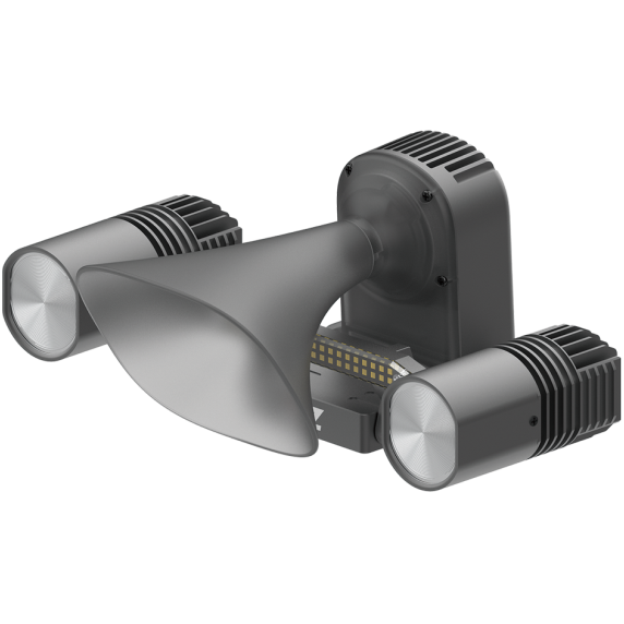
Automated hovering rotation of two drones enables continuous real-time aerial footage transmission. In emergency scenarios, a spotlight can be equipped to provide full-time illumination.
The all-new water and dust-resistant DJI Matrice 4D and 4TD are specifically designed for DJI Dock 3, offering extended flight time, and can pair with DJI RC Plus 2 Enterprise for standalone use. Both drones are equipped with a wide-angle camera, a medium tele camera, a tele camera and a Laser Range Finder. Matrice 4D is highly effective for professional high-precision mapping and detailed surface inspections. Matrice 4TD is equipped with an infrared thermal camera and a new NIR auxiliary light, making it suitable for a wide range of applications such as infrastructure inspections, emergency response, and public safety.
![]() |
![]() |
DJI Matrice 4D | DJI Matrice 4TD |
Wide-Angle Camera | |
4/3 CMOS | 1/1.3-inch CMOS |
20MP Effective Pixels | 48MP Effective Pixels |
f/2.8-f/11 | f/1.7 |
24mm Format Equivalent | 24mm Format Equivalent |
Mechanical Shutter | - |
Medium Tele Camera | |
1/1.3-inch CMOS | |
48MP Effective Pixels | |
f/2.8 | |
70mm Format Equivalent | |
Tele Camera | |
1/1.5-inch CMOS | |
48MP Effective Pixels | |
f/2.8 | |
168mm Format Equivalent | |
Laser Range Finder | |
Measurement Range: 1800 m (1 Hz); | |
Oblique Incidence Range (1: 5 Oblique Distance): 600 m (1 Hz) | |
Blind Zone: 1 m | |
Range Accuracy (m): ± (0.2 + 0.0015 × D) [7] | |
- | NIR Auxiliary Light |
- | 6° FOV, 100m [10] Illumination Distance |
- | Infrared Thermal Camera |
- | 640×512 Resolution |
- | f/1.0 |
- | 53mm Format Equivalent |
- | Uncooled VOx Microbolometer |
- | Supports UHR Infrared Image mode |
When fully charged, Matrice 4D/4TD delivers an impressive flight time of 47 minutes at a speed of 15 m/s, achieving a remarkable 37% increase in operation time. At a radius of 10 km, these drones provide 18 minutes of operation. Both models are designed to endure harsh conditions with an impressive IP55 dust and water resistance rating.
54 Minute Forward Flying.
47 Minute Hovering.
IP55 Protection.
The Obstacle Sensing Module for Matrice 4D/4TD combines rotating LiDAR and millimeter-wave radar technologies for precise 12mm wire-level obstacle avoidance at speeds up to 15 m/s in complex power line crossings, as well as enhanced positioning in low-light conditions. Operational safety are ensured for varying environments of power distribution network and the intricate layouts of substations.
Matrice 4D Series drones feature four high-resolution, low-light fisheye lenses, significantly enhancing visual low-light positioning and obstacle sensing capabilities.
The new Night Scene mode offers full-color night vision. Matrice 4TD additionally provides IR-Cut Filter feature for black-and-white night vision and 24/7 operations, as well as a new NIR auxiliary light that can cover distances up to 100 m.
Matrice 4TD's infrared thermal camera supports the UHR Infrared Image mode with image resolutions up to 1280 × 1024 and a High-Res mode for detailed temperature readings.
Matrice 4D Series drones are equipped with medium tele and tele cameras with foreground stabilization. The medium tele camera is effective for medium-range inspections, detecting pins and cracks from 10 meters, and clearly reading instrument data at substations.
The 48 MP tele camera captures details, like signs, from up to 250 m away. When using Matrice 4TD's tele camera as the aircraft is hovering in a windless environment, the gimbal can tilt upwards by 80 degrees, making bridge underside defects clearly visible.
Upgraded stabilization keeps foreground subjects clear during telephoto shots at 10x zoom or higher.
Matrice 4D Series drones excel in high-precision mapping, offering a new 5-direction oblique photography function, 3-direction orthophoto photography, and real-time terrain following to meet various mapping requirements.
DJI FlightHub 2 has been upgraded for Matrice 4D/4TD operations. This upgrade introduces a range of flight route planning options, including Smart 3D Capture routes, geometric routes, and slope routes, enhancing efficiency while ensuring detailed modeling.
Matrice 4D Series can operate with the DJI RC Plus 2 Enterprise remote controller for standalone use while featuring an innovative onboard relay function. With this setup, one drone can fly high as a relay, allowing another drone to operate at a greater distance. The relay drone automatically faces the operating drone, ensuring smooth video transmission without a 4G signal or in obstructed conditions. This capability significantly extends the transmission range, making it ideal for SAR tasks and inspections in mountainous areas.
The new automated flight route is useful across various scenarios, including public safety and inspections. Once a flight route is established, the drone can automatically detect and capture images or videos of subjects like vehicles and vessels and infrared temperature anomalies, and send notifications to the operators.
The new intelligent change detection feature enables efficient periodical analysis of changes in an area, assisting operators in environmental protection, natural disaster relief and crack detection for more effective and informed decision making.
Operators can utilize the powerful auto-zoom capabilities of the Matrice 4D Series to quickly track a subject, such as a vehicle or a vessel for efficient follow-up review.
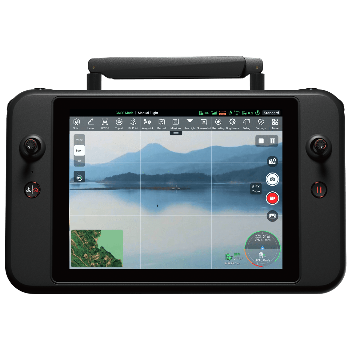
The Virtual Cockpit remote control interface has been significantly enhanced with the introduction of the new Mouselook feature. This enhancement allows the drone to adjusts its attitude and gimbal orientation automatically, enabling rapid and precise centering of the frame, thus achieving "point and see."
Take off quickly and arrive at the emergency site to improve situational awareness. After enabling optimal route planning, use FlyTo Tasks to reach a designated point 1 km away and at 100m height within 100 seconds.
Engine upgrade significantly reduces live view latency on FlightHub 2, providing reliable support for real-time decision-making.
In emergency scenarios, real-time data transmission and rapid modeling can be achieved during flight. Data transfer can be completed immediately upon landing, and a rough model can be quickly generated via the cloud, significantly enhancing efficiency.
Security Compliance | ![]() |
---|---|
FlightHub 2 Custom Permission Management | |
FlightHub 2 has upgraded its permission management, allowing users to configure management permissions according to actual needs. | |
![]() |
![]() |
FightHub 2 Achieves ISO 27001 Certification | 4G Dongle Private Deployment |
FlightHub 2 uploads, stores and manages data on Amazon Web Services (AWS) cloud servers, which are also ISO/IEC 27001 certified, ensuring secure and compliant data processing. | With DJI Cellular Dongle 2, the aircraft can connect to 4G networks. In complex operational environments, the 4G network works in tandem with O4+ video transmission system to ensure a stable transmission and enhance flight safety. 4G enhanced video transmission service can be privately deployed and used in conjunction with the FlightHub 2 on-premises version to further enhance the stability and security of data transmission. |
Provides necessary model training tools and assist in the third-party developer certification process, helping expand new intelligent applications.
E-Port and E-Port Lite encryption authentication ensure secure and worry-free payloads, enabling the Matrice 4D Series to have broader application scenarios.
Mobile SDK 5 simplifies the development of apps to control the Matrice 4D Series. Mobile SDK 5 is fully open source and comes with production code samples of core DJI Pilot 2 modules, ensuring its reliability.
Through DJI FlightHub 2's FlightHub Sync function, users can easily link it to a third-party cloud platform for flexible management of data.
With DJI Pilot 2's built-in Cloud API (MQTT-based protocol) you can directly connect the Matrice 4D Series to third-party cloud platforms. Access the drone's hardware, video live-stream, and photo data without having to develop an app.
Enable more functionality by connecting third-party payloads such as parachute via the aircraft's E-Port or remotely control added payloads via DJI FlightHub 2. It also features an additional port for PSDK payload at the rear.
With the DJI Terra API, users can integrate its powerful mapping capabilities into their own platforms, achieving automated 2D and 3D reconstructions. Additionally, users can customize photogrammetry workflows as needed, allowing the Matrice 4D's operational results to meet the needs of various industry applications better.
Product Name | DJI Dock 3 |
Total Weight | 55 kg (without aircraft) The actual product weight may vary due to differences in batch materials and external factors. |
Dimensions | Dock Cover Opened: 1760×745×485 mm (L×W×H) |
Dock Cover Closed: 640×745×770 mm (L×W×H) All data includes the RTK module width (160 mm), wind speed gauge height (145 mm), and mounting base brackets (58 mm). |
|
Input Voltage | 100-240 V (AC), 50/60 Hz |
Input Power | Max 800 W |
Operating Temperature | -30° to 50° C (-22° to 122° F) |
Ingress Protection Rating | IP56 |
Number of Drones Accommodated | 1 |
Max Allowable Landing Wind Speed | 12 m/s |
Max Operating Altitude | 4500 m |
Receiving Frequency of RTK Base Station Satellite | Simultaneously receive: GPS: L1 C/A, L2, L5 BeiDou: B1l, B2l, B3l, B2a, B2b, B1C GLONASS: F1, F2 Galileo: E1, E5a, E5b, E6 QZSS: L1, L2, L5 |
Positioning Accuracy of RTK Base Station | Horizontal: 1 cm + 1 ppm (RMS) Vertical: 2 cm + 1 ppm (RMS) |
Specification | Value |
---|---|
Output Voltage | 35 V DC |
Charging Time | 27 minutes The data was measured when charging the aircraft (when powered off) from 15% to 95% in a 25° C (77° F) environment. |
Operating Frequency | 2.400-2.4835 GHz 5.150-5.250 GHz (CE: 5.170-5.250 GHz) 5.725-5.850 GHz The supported operating frequency bands and their corresponding availability vary by country/region. |
Antenna | Built-in 9 antennas, 2T4R, supports intelligent switching |
Transmitter Power (EIRP) | 2.4 GHz: < 33 dBm (FCC), < 20 dBm (CE/SRRC/MIC) 5.2 GHz (CE: 5.170-5.250 GHz): < 23 dBm (FCC/CE) 5.8 GHz: < 33 dBm (FCC); < 14 dBm (CE); < 30 dBm (SRRC) |
Operating Voltage | 48 V DC |
Air Conditioning Type | Compressor-based air conditioning |
Battery Capacity | 12 Ah |
Output Voltage | 12 V |
Battery Type | Lead-acid battery |
Battery Life | > 4 hours Measured with a fully charged backup battery in a 25° C (77° F) environment. After a power outage, the dock does not support functions like aircraft charging, air conditioning operation, dock cover heating, and wind speed gauge heating. |
Ethernet Access | 10/100/1000Mbps adaptive Ethernet port |
4G Access | Requires DJI Cellular Dongle 2 Sold separately. This service is not available in some countries and regions. |
Wind Speed Sensor | Supported |
Rainfall Sensor | Supported |
Ambient Temperature Sensor | Supported |
Water Immersion Sensor | Supported |
In-Cabin Temperature Sensor | Supported |
In-Cabin Humidity Sensor | Supported |
Resolution | 1920×1080 |
Field of View (FOV) | 151° |
Auxiliary Light | Auxiliary White Light |
Resolution | 1920×1080 |
FOV | 151° |
Auxiliary Light | Auxiliary White Light |
AC Power Port | 20 kA (rated value), meets EN 61643-11 Type 2 and IEC 61643-1 Class Ⅱ protection level requirements |
Ethernet Port | 10 kA (I total),meets EN/IEC 61643-21 Category C protection level requirements |
Applications | DJI Enterprise app (used with Android phones for deployment and commissioning) |
Cloud Platform | FlightHub 2 FlightHub 2 On-Premises Version FlightHub 2 FlightHub Sync DJI Cloud API |
Edge Computing | Supports data communication with external switches |
Weight | 1850 g This value includes the weight of the battery, propellers, and a microSD card, but does not include third-party payloads. The actual weight may vary due to differences in batch materials and external factors. |
Max Takeoff Weight | 2090 g |
Dimensions | 377.7×416.2×212.5 mm (L×W×H, without propellers) |
Wheelbase | Diagonal: 498.5 mm Front Motor Left-Right: 383.0 mm Rear Motor Left-Right: 343.0 mm Front-Rear: 341.6 mm |
Max Ascent Speed | 6 m/s (Normal Mode) 10 m/s (Sport mode) |
Max Descent Speed | 6 m/s (Normal Mode) 8 m/s (Sport mode) |
Max Horizontal Speed | Normal Mode: 15 m/s forward, 12 m/s backward, 10 m/s sideways Sport Mode: 21 m/s forward, 19 m/s backward, 15 m/s sideways With DJI Dock, only Normal mode supported |
Max Wind Speed Resistance | 12 m/s (operation and takeoff/landing) |
Max Takeoff Altitude | 6500 m |
Max Flight Time | 54 minutes Measured in a controlled test environment. Specific test conditions are as follows: flying forward at a constant speed of 12 m/s in a windless laboratory environment at 20 meters above sea level, in photo mode (without photo-taking operation during flight), with Obstacle Avoidance Action set to Off, and from 100% battery level until 0%. Results may vary depending on the environment, actual use, and firmware version. |
Max Hovering Time | 47 minutes Measured with the DJI Matrice 4D Series drones hovering in a windless environment at 20 meters above sea level and from 100% battery level until 0%. Results may vary depending on the environment, actual use, and firmware version. |
Max Operating Radius | 10 km Measured in an environment of approximately 25° C (77° F) with a safe battery level of 15%, windless environment, round-trip flight speed of approximately 15 m/s, and hovering operation of 18 minutes. Results may vary depending on the environment, actual use, and firmware version. |
Max Flight Distance | 43 km Measured with Matrice 4D/4TD flying at a constant speed of 16 m/s in a windless environment at 20 meters above sea level and from 100% battery level until 0%. Results may vary depending on the environment, actual use, and firmware version. |
Max Pitch Angle | 25° (Normal Mode) 30° (Sport Mode) |
Max Angular Velocity | 200°/s |
Global Navigation Satellite System | GPS + BeiDou + Galileo + QZSS + GLONASS (QZSS/GLONASS require RTK module enabled) |
Hovering Accuracy (windless or breezy) | Vertical: ±0.1 m (vision) ±0.5 m (GNSS) ±0.1 m (RTK) Horizontal: ±0.3 m (vision) ±0.5 m (GNSS) ±0.1 m (RTK) |
Operating Temperature | -20° to 50° C (-4° to 122° F) |
Ingress Protection Rating | IP55 |
Motor Model | 2611 |
Propeller Model | 1364F foldable low-noise anti-ice propellers |
RTK Module | Integrated |
Beacon | Integrated |
DJI Matrice 4D | Wide-Angle: 4/3 CMOS, 20 MP Medium Tele: 1/1.3-inch CMOS, 48 MP Tele: 1/1.5-inch CMOS, 48 MP |
DJI Matrice 4TD | Wide-Angle: 1/1.3-inch CMOS, 48 MP Medium Tele: 1/1.3-inch CMOS, 48 MP Tele: 1/1.5-inch CMOS, 48 MP |
Lens | ||
---|---|---|
Wide-Angle | 4D | FOV: 84° Equivalent: 24mm Aperture: f/2.8-f/11 Focus: 1m-∞ |
4TD | FOV: 82° Equivalent: 24mm Aperture: f/1.7 Focus: 1m-∞ |
|
Medium Tele Camera | FOV: 35° Equivalent: 70mm Aperture: f/2.8 Focus: 3m-∞ |
|
Tele Camera | FOV: 15° Equivalent: 168mm Aperture: f/2.8 Focus: 3m-∞ |
|
Lens Defogging | DJI Matrice 4D and DJI Matrice 4TD: Wide-angle, medium tele, and tele cameras all support lens defogging |
ISO Range | Normal: 100-25600 Night Mode: 4D Wide: 100-204800 4D Medium/Tele: 100-409600 4TD Wide/Medium: 100-409600 4TD Tele: 100-819200 |
Shutter Speed | 4D Wide: 2-1/8000s (electronic), 2-1/2000s (mechanical) Medium, Tele & DJI Matrice 4TD Cameras: 2-1/8000s |
Max Image Size | 4D Wide: 5280×3956 4D Medium: 8064×6048 4D Tele: 8192×6144 4TD Wide/Medium: 8064×6048 4TD Tele: 8192×6144 |
Minimum Photo Interval | 4D: 0.5s 4TD: 0.7s |
Digital Zoom | Tele Camera: 16x (112x hybrid zoom) |
4D | 4TD | |
---|---|---|
Photo Modes | Wide: Single/Timed/Smart/Pano (20MP) Medium/Tele: Single/Timed/Smart (12MP/48MP) |
All cameras: Single/Timed/Smart (12MP/48MP) Wide: Pano (12MP raw, 100MP stitched) |
Photo Formats | Wide: JPEG/DNG Medium/Tele: JPEG |
JPEG |
Video Codecs | H.264, H.265 (CBR/VBR) | |
Video Resolutions | 4K: 3840×2160@30fps FHD: 1920×1080@30fps |
|
Video Bitrate | H264: 60Mbps H265: 40Mbps |
|
Video Format | MP4 (MPEG-4 AVC/H.264) | |
File System | exFAT |
Infrared Illumination (4TD) | FOV: 5.7°±0.3° |
Normal Incidence Range | 1800 m (1 Hz) @20% reflectivity* |
Oblique Incidence Range | 600 m (1 Hz, 1:5 oblique distance) |
Blind Zone | 1 m |
Distance Measurement Accuracy | 1-3m: <0.3m system error, <0.1m random error Other distances: ±(0.2+0.0015D) (D in meters) |
* Performance may degrade in rain/fog |
Sensor Type | Uncooled VOx Microbolometer Warning: Avoid strong energy sources |
Resolution | 640×512 |
Pixel Pitch | 12 μm |
Frame Rate | 30 Hz |
Lens | DFOV: 45° Equivalent: 53 mm Aperture: f/1.0 Focus: 5 m to ∞ |
Sensitivity | ≤ 50 mk@F1.0 |
Temperature Measurement | Methods: Spot/Area measurement Range: -40° to 500° C (-40° to 932° F) Accuracy: ±2℃/2% (High Gain), ±5℃/3% (Low Gain) |
Palettes | White Hot, Black Hot, Tint, Iron Red, Hot Iron, Arctic, Medical, Fulgurite, Rainbow 1, Rainbow 2 |
Photo | Formats: JPEG (8-bit), R-JPEG (16-bit) Modes: Single Normal Mode: 640×512 UHR Infrared Image Mode: 1280×1024 Timed Normal Mode: 640×512, 0.7/1/2/3/5/7/10/15/20/30/60 s UHR Infrared Image Mode: 1280×1024, 0.7/1/2/3/5/7/10/15/20/30/60 s |
Video | Resolutions: 640×512@30fps or 1280×1024@30fps (UHR) Bitrates: 5-12Mbps (H.264/H.265) Format: MP4 |
Digital Zoom | 28x |
Wavelength | 8-14 μm |
4D | 4TD | |
---|---|---|
Stabilization | 3-axis mechanical (tilt, roll, pan) | |
Mechanical Range | Tilt: -140° to +50° Roll: -52° to +52° Pan: -65° to +65° |
Tilt: -140° to +113° Roll: -52° to +52° Pan: -65° to +65° |
Controllable Range | Tilt: -90° to +35° Pan: Not controllable |
Tilt: -90° to +90°* Pan: Not controllable *70°-90° may cause camera obstruction |
Max Control Speed | 100°/s (tilt) | |
Angular Vibration | ±0.005° |
Direction | Measurement Range | Effective Sensing Speed | Field of View (FOV) |
---|---|---|---|
Forward | 0.5-20 m (Detection: 0.5-200 m) | ≤15 m/s | 95° (H) × 90° (V) |
Backward | 0.5-20 m | ≤12 m/s | 95° (H) × 90° (V) |
Lateral | 0.5-16 m | ≤10 m/s | 90° (H) × 90° (V) |
Upward | 0.5-20 m | ≤6 m/s | 95° (Front/Back) × 90° (Left/Right) |
Downward | 0.5-16 m | ≤6 m/s | 90° (Front/Back) × 95° (Left/Right) |
Operating Environment: Forward/Backward/Upward/Downward: Patterned surfaces with >0.1 lux Left/Right: Diffuse reflective surfaces (>20% reflectivity) with >6 lux |
System | DJI O4+ Enterprise |
Live View Quality | With RC Plus 2: 720p/1080p@30fps With Dock 3 & FlightHub 2: 540p/720p/1080p@30fps |
Operating Frequency | 2.400-2.4835 GHz 5.150-5.250 GHz (CE: 5.170-5.250 GHz) 5.725-5.850 GHz Frequency availability varies by region |
Max Transmission Distance |
Unobstructed: FCC: 25 km | CE/SRRC/MIC: 12 km With Interference: Strong: 1.5-5 km | Medium: 5-15 km | Weak: 15-25 km Tested under FCC standard, actual results may vary |
Max Download Speed | 20 MB/s (with Dock 3 or RC Plus 2 Enterprise) Lab conditions with minimal interference |
Latency | Aircraft to Dock: ~100ms Dock to FlightHub 2: Depends on network/computer |
Antenna | 8 antennas, 2T4R |
Transmitter Power (EIRP) | 2.4 GHz: <33 dBm (FCC), <20 dBm (CE/SRRC/MIC) 5.1 GHz: <23 dBm (FCC/CE) 5.8 GHz: <33 dBm (FCC/SRRC), <14 dBm (CE) |
Cellular Support | DJI Cellular Dongle 2 (sold separately, regional restrictions apply) |
Supported Cards | U3/Class10/V30 or higher microSD |
Recommended Cards | Lexar: 1066x 64GB/128GB/256GB/512GB U3 A2 V30 |
Kingston: Canvas Go! Plus 64GB/128GB/256GB/512GB U3 A2 V30 |
Capacity | 6768 mAh |
Voltage | 22.14 V |
Max Charging Voltage | 25.5 V |
Cell Type | Li-ion 6S |
Chemical System | LiNiMnCoO2 |
Energy | 149.9 Wh |
Weight | 640 g |
Cycle Count | 400 |
Charging Temperature | 5° to 45° C (41° to 113° F) |
Discharge Rate | 4C |
Max Charging Power | 1.8C |
Low-Temperature Charging | Supports self-heating charging |
Input | 100-240 V (AC), 50/60 Hz, 3 A |
Output Power | 240 W |
Output | Total: 240W max USB-C Port: 65W max (45W when charging with two ports) |
Input | 16.8 V to 25.5 V, 12.1 A |
Rated Power | 240 W |
Charging Type | 3 batteries in sequence Supports Standard Mode (100%) and Ready-to-Fly Mode (90%) |
Compatible Battery | DJI Matrice 4D Series Battery |
Charging Temperature | 5° to 40° C (41° to 104° F) |
Max Transmission Distance (unobstructed) | FCC: 25 km CE/SRRC/MIC: 12 km Measured in ideal conditions |
Operating Frequency | 2.4000-2.4835 GHz 5.725-5.850 GHz (Not in Japan) 5.2 GHz (receive only) Varies by region - check local regulations |
Antenna | 2T4R, built-in multi-beam high-gain |
Transmitter Power (EIRP) | 2.4 GHz: <33 dBm (FCC), <20 dBm (CE/SRRC/MIC) 5.2 GHz: <23 dBm (CE) 5.8 GHz: <33 dBm (FCC), <14 dBm (CE), <30 dBm (SRRC) |
4G Transmission | DJI Cellular Dongle 2 (sold separately, regional restrictions) |
Wi-Fi Protocol | Wi-Fi 6 (802.11ax), dual-band simultaneous Up to 1774.5 Mbps (2×2 + 2×2 11ax) |
Wi-Fi Frequency | 2.4000-2.4835 GHz 5.150-5.250 GHz (indoor-only in some regions) 5.725-5.850 GHz |
Wi-Fi Power (EIRP) | 2.4 GHz: <26 dBm (FCC), <20 dBm (CE/SRRC/MIC) 5.2 GHz: <26 dBm (FCC), <23 dBm (CE/SRRC/MIC) 5.8 GHz: <26 dBm (FCC/SRRC), <14 dBm (CE) |
Bluetooth | 5.2 (2.400-2.4835 GHz), <10 dBm EIRP |
Screen | 7.02" 1920×1200 @60fps, 1400 nits |
Touchscreen | 10-point multi-touch |
Battery (Internal) | 6500 mAh @7.2V (46.8Wh) |
Battery (External) | Optional WB37: 4920 mAh @7.6V (37Wh) |
Charging | PD fast charging (20V/3.25A max via USB-C) |
Storage | 8GB RAM + 128GB UFS + microSD expansion |
Runtime | Internal: 3.8 hrs External: 3.2 hrs |
Output Port | HDMI 1.4 |
Operating Temperature | -20° to 50°C (-4° to 122°F) |
Storage Temperature | 1 month: -30° to 45°C 1-3 months: -30° to 35°C 3-12 months: -30° to 30°C |
Charging Temperature | 5° to 40°C (41° to 104°F) |
Supported Aircraft | Matrice 4TD/4D, Matrice 4T/4E |
Dimensions | 268×163×94.5 mm (L×W×H) |
Weight | 1.15 kg (without external battery) |
Model | TKPL 2 |
Weight | 99 g (with bracket) 91 g (without bracket) No bracket needed for Matrice 4D Series |
Dimensions | With bracket: 95×164×30 mm Without bracket: 79×164×28 mm |
Max Power | 32 W |
Illuminance | 4.3 lux @100m, 17 lux @50m Lab conditions at 25°C |
Effective Illumination Angle | 23° (10% relative illumination) |
Effective Illumination Area | Normal: 1,300 m² @100m Wide FOV: 2,200 m² @100m |
Operating Modes | Always-on, Strobe |
Gimbal Mechanical Range (Tilt) | -140° to +50° |
Gimbal Controllable Range (Tilt) | -90° to +35° |
Gimbal Max Control Speed | 120°/s |
Gimbal Alignment Accuracy | ±0.1° |
Operating Temperature | -20° to 50°C (-4° to 122°F) |
IP Rating | IP55 |
Mounting | Quick-release screw Must tighten properly for aircraft/Dock use |
Supported Aircraft | Matrice 4TD/4D, Matrice 4T/4E |
Weight | 92.5 g (with bracket) 90 g (without bracket) No bracket needed for Matrice 4D Series |
Dimensions | With bracket: 73×70×52 mm Without bracket: 73×70×47 mm |
Max Power | 15 W |
Max Volume | 114 dB @1m Lab conditions at 25°C |
Effective Broadcast Distance | 300 m Lab conditions at 25°C |
Broadcast Modes | Real-time, Record & broadcast, File input, Text-to-speech* *English and Mandarin only |
Operating Temperature | -20° to 50°C (-4° to 122°F) |
IP Rating | IP55 |
Mounting | Quick-release screw Must tighten properly for aircraft/Dock use |
Supported Aircraft | Matrice 4TD/4D, Matrice 4T/4E |
Weight | 235 g |
Dimensions | 103.3×64×85.8 mm (L×W×H) |
IP Rating | IP55 |
Operating Temperature | -20° to 50°C (-4° to 122°F) |
Sensing Type | Rotating LiDAR + millimeter-wave radar |
Field of View | LiDAR: 58° (V) × 360° (H) Radar: 90° (V) × 90° (H) |
Measurement Range | 100 m max |
Effective Sensing Speed | ≤15 m/s (against 12mm steel-core wire) |
Notes: 1. Performance varies by environment and obstacle type 2. Cannot detect fast-moving objects |
Weight | Right Bracket: 440 g Left Bracket: 155 g |
Dimensions | Right: 112.8×152.2×157.8 mm Left: 126.3×172.9×70.3 mm |
Power Supply | 14 V |
IP Rating | IP55 |
Operating Temperature | -30° to 50°C (-22° to 122°F) |
HDMI, HDMI High-Definition Multimedia Interface, HDMI Trade dress and the HDMI Logos are trademarks or registered trademarks of HDMI Licensing Administrator, Inc.
Ver todos los detalles del producto »
Request Quote
Autel Alpha is an intelligent industrial drone for multi-purpose. Boasting significant enhancements in autonomous flight capabilities, anti-interference capabilities, obstacle avoidance capabilities, video transmission technology, and battery systems, it injects robust performance into the flight platform. With a foldable design and IP55-rating level, it tackles challenging environments. The built-in RTK dual-antenna system ensures precise control within millimeters when carrying out the missions.Paired with the next-gen DG-L35T gimbal, it integrates a 560x hybrid zoom camera, dual thermal imaging cameras, a visible light wide-angle camera, and a laser rangefinder. The dual thermal imaging cameras meet the needs of both short-range overview and long-range detail observation, achieving distant operation scenarios with unobstructed personnel recognition within an 8-kilometer range, providing more professional and comprehensive solutions for applications such as public safety, energy inspection, and emergency management.
Superior Anti-interference | High-precision Visual Navigation | AI Target Recognition and Positioning | 56x Dual Thermal Camera | 4K 35x Optical Zoom |
IP55 Rating | Hot-swappable Battery | Wire-Level Obstacle Avoidance and Pathfinding | 15 Kilometers Video Transmission Range | Flexible Payload Expansion |
The zoom camera supports 4K 35x optical zoom and 560x maximum hybrid zoom with clear observation up to 8 kilometers away. It efficiently empowers applications such as long-distance inspection.
The thermal camera supports 56x hybrid zoom, dual thermal imaging lenses, with a resolution of 640*512. It features a 13mm wide-angle lens and a 45mm telephoto lens, catering to overview with short focal lengths and detail-oriented viewing with long focal lengths.
Supports intelligent hardware multi-frame noise reduction and HDR fusion technology, even in moonlight conditions, it can capture target details, meeting the needs of various shooting scenarios.
The laser rangefinder supports one-click point positioning, allowing for quick acquisition of target positions, with a maximum ranging distance of up to 2 kilometers.
Autel DG-L35T Gimbal integrates dual thermal imaging cameras (short/long focal length), 4K 35x Optical Zoom Camera, a wide-angle camera and a laser rangefinder.
Exceptional Anti-Interference Capability,Autel Alpha's high-precision visual positioning capabilities, adaptive frequency-hopping and SLAM navigation technology empowers resistance from interference and enables the drone to fly confidently near powerlines, critical structures and in complex areas.
Autel's Autonomy Engine is continuously improving, enabling functions such as global path planning and 3D scene reconstruction in complex environments. It ofers various obstacle avoidance capabilities, including return-to-home, manual contro, and mision planning, providing a more professional solution for industries such as security, inspection, and surveying.
By integrating multi-source sensor fusion technology, including 5-direction dual fisheye vision + 6-direction millimeter-wave radar, the drone is equipped with wire-level obstacle avoidance and pathfinding capabilities. It can detect minor obstacles like glass, poles, and powerlines. Additionally, it supports nighttime obstacle avoidance for flight safety.
The aircraft features multiple mounting interfaces: mounting interfaces. The Autel PSDK developer platform is open for creating a new industry ecosystem such as searchlights, loudspeakers, and more.
Adopting a dual-battery redundant design, the flight time reaches 40 minutes, supporting hot-swappable batteries for seamless, efficient operations.
With Autel Skylink 3.0, the system comes with 4 antennas, 4 Frequency bands, enabling a transmission distance of up to 15 kilometers. It supports auto frequency hopping on 900M/2.4GHz/5.2GHz/5.8GHz*, automatically selecting the optimal channel based on electromagnetic interference for robust anti-interference capabilities, featuring a high transmission of 64Mbps and low transmission latency.
Temporary quick missions can be created while executing other missions, andmultiplesub-missions can be stacked for enhanced flexibility.
Users can add waypoints for flexible, non-structured flight paths.
Supports one-click automatic generation of polygon flight areas.
The gimbal locks onto the target, and follows the target's movement while hovering, ensuring the target remains at the center of the frame.
Based on Autel's AI recognition technology, the Autel Alpha can automatically identify and lock onto different types of targets such as human, boat or vehicles through zoom, wide, or infrared cameras, projecting the target's location onto the map.
Click on the remote controller screen, it will show the target latitude, longitude, height, and other information swiftly.
Privacy protection: Data involving user and aircraft information, including flight logs, locations, and account information can only be physically accessed via the aircraft locally.Encrypted Data Storage: It supports AES encryption for photos, videos, and flight logs, requiring a password input for access.
"The Autel SDK is open to the world, helping developers and partners reduce software and hardware development costs and jointly create a new industry ecosystem.
A well-designed software and hardware architecture enables developers to get started with ease, offering simplicity and convenience, and empowering the creation of exceptional UAV mobile application experiences.
Autel Alpha Empty Weight | 5535 g (Smart battery, propellers included and gimbal excluded) |
Autel Alpha Weight | 6480 g (Smart battery, gimbal and propellers included) |
Autel Alpha Maximum Take-Off Mass (MTOM) | 8400 g |
Fuselage Dimensions | 1205×980×278 mm (unfolded, incl. propellers) 780×568×278 mm(unfolded, excl. propellers) 455×263×248 mm (folded, excl. propellers) |
Diagonal Wheelbase | Diagonal: 814 mm |
Maximum Ascent Speed | Slow: 3 m/s Smooth: 5 m/s Standard: 6 m/s Ludicrous: 15 m/s |
Maximum Descent Speed | Slow: 3 m/s Smooth: 5 m/s Standard: 6 m/s Ludicrous: 10m/s |
Maximum Horizontal Flight Speed (Windless Near Sea Level) |
Slow: 3 m/s Smooth: 10 m/s Standard: 15 m/s (forward & backward), 10 m/s (sidewards) Ludicrous: 25 m/s (forward & backward & sidewards) |
Maximum Service Ceiling Above Sea Level | 4500 meters |
Maximum Flight Altitude | 800 meters (Altitude limit in the App) |
Maximum Flight Time (Windless, Speed: 10.5 m/s) |
40 minutes |
Maximum Range | 30 km (with carbon fiber propeller) 27.5km (with injection molded propeller) |
Maximum Hovering Time (Windless) | 38 minutes |
Maximum Wind Speed Resistance | 12 m/s |
Maximum Tilt Angle | Slow: 10° Smooth: 30° Standard: 30° Ludicrous: 36° |
Maximum Angular Velocity | Pitch axis: 300°/s Heading axis: 120°/s |
Operating Temperature | -20℃ to 50℃ |
Hot-swappable Batteries | Supported |
IP Rating | IP55 |
GNSS | GPS+Galileo+BeiDou+GLONASS |
Hovering Accuracy | Vertically ±0.1 m (when visual positioning works normally) ±0.3 m (when GNSS works normally) ±0.1 m (when RTK FIX) Horizontally ±0.15 m (when visual positioning works normally) ±0.3 m (when GNSS works normally) ±0.1 m (when RTK FIX) |
Operating Frequency | 900M: 902 – 928 MHz* 2.4G: 2.400 – 2.476GHz**, 2.400 – 2.4835 GHz 5.2G: 5.15 - 5.25 GHz***, 5.17 - 5.25 GHz**** 5.8G: 5.725 - 5.829GHz**, 5.725 - 5.850GHz * Only applicable to FCC and ISED regions. **Only applicable to SRRC regions. *** Only applicable to FCC, CE (except Germany), and UKCA regions. **** Only applicable to Germany. Note: Some frequencies are only available in some regions or for indoor use only. Check local laws and regulations for details. |
Maximum Transmission Distance (Without Interference and Blocking) |
FCC: 15km CE: 8km |
Effective Isotropic Radiated Power (EIRP) |
900M: ≤30dBm (FCC/ISED) 2.4G: ≤30dBm(FCC/ISED); ≤20dBm(CE/SRRC/UKCA) 5.2G: ≤30dBm(FCC); ≤23 dBm(CE/UKCA) 5.8G: ≤30dBm (FCC/ISED/SRRC); ≤14dBm (CE/UKCA) |
Sensing Range | Forward: 0.2 - 31 m Backward: 0.2 - 26 m Sidewards: 0.5 - 45 m Upward: 0.2 - 45 m Downward: 0.2 - 45 m |
FOV | Forward & Backward: 90°(H), 90°(V) Sidewards: 90°(H), 90°(V) Upward: 90°(H), 90°(V) Downward: 90°(H), 90°(V) |
Operating Environment | Forward, backward, sidewards, and upward: The surface has rich textures, under a sufficient lighting environment (>15 lux). Downwards: The surface is a diffuse material with a reflectivity >20% (walls, trees, humans, etc.), under a sufficient lighting environment (>15 lux). |
Operating Frequency | 60G: 60 - 64GHz 24G: 24.0 - 24.25GHz |
Effective Isotropic Radiated Power (EIRP) |
60G: ≤20dBm (CE/UKCA/FCC) 24G: ≤20mW(SRRC) |
Sensing Range | 60G radar: Upward: 0.3 - 20 m Downward: 0.15 - 40 m Forward & Backward: 0.3 - 30 m Sidewards: 0.3 - 30 m 24G radar: Downward: 0.8 - 20 m |
FOV | Horizontal (6dB): ±35°/±22° (60 GHz/24 GHz) Vertical (6dB): ±30°/±20° (60 GHz/24 GHz)) |
Operating Environment | 60G millimeter-wave radar sensing system: Supports all-weather obstacle avoidance for glass, water, wires, buildings, and trees in 6 directions. Its obstacle avoidance distance varies with the obstacle's ability to reflect electromagnetic waves and its surface size. 24G millimeter-wave radar sensing system: Supports downward sensing, and its sensing range varies by the ground material. For example, the sensing range of cement ground is 20 meters, and the sensing range of grass with a thickness of more than 3 cm is less than 10 meters. |
Aircraft Version Limitations* | In order to comply with the regulations of the country or region where the target market is located, aircraft bottom millimeter-wave radars in some markets use the 24G frequency band, and the five directions of front, rear, left, right, and top use the 60G frequency band. Among them, the 24G version of the aircraft has turned off the 60G radar function in the five directions of front, rear, left, right, and top in the flight control software before leaving the factory, and only turned on the bottom 24G radar for assisted landing. The 24G version of the aircraft only supports visual obstacle avoidance under good lighting conditions and does not support the millimeter-wave radar obstacle avoidance function at night. |
Wi-Fi Protocol | 802.11a/b/g/n/ac/ax |
Wi-Fi Operating Frequency | 2.4G: 2.400 – 2.476GHz*, 2.400 – 2.4835 GHz 5.2G: 5.15-5.25GHz**, 5.17-5.25GHz*** 5.8G: 5.725 - 5.829GHz*, 5.725 - 5.850 GHz *Only applicable to SRRC regions. ** Only applicable to FCC, CE (except Germany), and UKCA regions. *** Only applicable to Germany. Note: Some frequencies are only available in some regions or for indoor use only. Check local laws and regulations for details. |
Wi-Fi Transmitter Power (EIRP) | 2.4G: ≤30dBm (FCC/ISED); ≤20dBm (CE/SRRC/UKCA) 5.2G: ≤30dBm (FCC); ≤23dBm (CE/UKCA) 5.8G: ≤30dBm (FCC/ISED/SRRC); ≤14dBm (CE/UKCA) |
Dimension | 144.7×133.3×158.4 mm |
Weight | 920g |
IP Rating | IP55 |
Installation | Detachable (E-shape design) |
Operating Temperature | -20℃ to +50℃ |
Storage Temperature | -30℃ to +70℃ |
Data Storage | Support microSD |
Max. Expandable Memory | 256GB |
Recommended Memory Card List | UHS-I Speed Class U3 or V30, minimum write speed 30MB/s |
Mechanical Ranger | Pitch: -135° to 45° Roll: -60° to 60° Yaw: -90° to 90° |
Controllable Range | Pitch: -90° to 30° |
Stable system | 3-axis mechanical gimbal (pitch, yaw, roll) |
Max Control Speed (pitch) | 100°/s |
Angular Vibration Range | <0.005° |
Image Sensor | 1/1.8" CMOS. Effective pixels: 8M |
Lens | Focal length: 7.1 - 171.95 mm±5% 35 mm equivalent focal length: 34.7 - 838 mm Aperture: f/1.61(Wide)- f/5.19(Tele)±5% Focusing distance: 10 m ~ ∞ |
ISO Range | Normal mode ISO100 - ISO25600 Super Night ISO100 – ISO160000 |
Shutter Speed | Photo: 0.5s ~ 1/8000s Video: 1/30s ~ 1/8000s |
Exposure Compensation | ±3.0 (1/3 increments) |
Digital Zoom | 1.4 - 35x continuous optical zoom, 35-560x digital zoom |
IR-CUT | Default Setting: Auto - Disabled during daytime, activated during nighttime. Manual Activation: Turn on IR-CUT - Display in Black and White. Manual Deactivation: Turn off IR-CUT - Display in Color. |
Max Photo Resolution | 3840×2160 |
Photo Format | JPG |
Photo Taking Mode | Auto |
Video Resolution | 3840×2160 30P |
Video Format | MP4 |
Max Bit Rate | 30Mbps |
Supported File Systems | exFAT/Fat32 |
Image Sensor | 1/2" CMOS. Effective pixels: 48M |
Lens | Focal length: 4.49 mm Equivalent focal length: 24 mm Aperture: f/2.8 |
ISO Range | Auto: ISO100 - ISO3200 |
Shutter Speed | Photo: 0.5s ~ 1/8000s Video: 1/30s ~ 1/8000s |
Photo Size | 4000×3000 |
Photo Format | JPG |
Photo Taking Mode | Auto |
Video Resolution | 4000×3000 25P |
Video Format | MP4 |
Max Bit Rate | 30Mbps |
Supported File Systems | exFAT/Fat32 |
Image Sensor | Uncooled VOx Microbolometer |
Lens | FOV: 42° Focal length: 13 mm Aperture: f/1.2 Focusing distance: 6 m ~ ∞ |
Sensitivity | ≤50mK@f/1.0, 25°C |
Pixel Pitch | 12um |
Wavelength | 8 - 14um |
Radiometric Measurement Method | Center measurement/Pot measurement/Rectangular measurement |
Radiometric Temperature Range | -20°C to 150°C (high gain mode); 0 to 550°C (low gain mode) |
Radiometric Measurement Accuracy | 5-meter distance test in a windless laboratory environment at 25°C: ±3°C or reading ±3% (using the larger value) @ ambient temperature ranges from -20°C to 60°C |
Accurate Temperature Measurement Distance | 5 m |
Digital Zoom | 1-3.5x wide angle digital zoom |
Temperature Alert | High and low temperature alarm thresholds, Reporting coordinates and temperature values |
Palette | White Hot/Black Hot/Searing/ Rainbow/Grey/Ironbow/Cold and Hot |
Photo Size | 640×512 |
Photo Format | JPG (the images contain temperature information and are parsed by dedicated SDK and PC tools) |
Photo Taking Mode | Auto |
Video Resolution | 640×512@25FPS |
Video Format | MP4 |
Image Sensor | Uncooled VOx Microbolometer |
Lens | FOV: 12.3° Focal length: 45 mm Aperture: f/1.2 Focusing distance: 35 m ~ ∞ |
Sensitivity | ≤50mK@f/1.0, 25°C |
Pixel Pitch | 12um |
Wavelength | 8 - 14um |
Radiometric Measurement Method | Center measurement/Pot measurement/Rectangular measurement |
Radiometric Temperature Range | -20°C to 150°C (high gain mode); 0 to 550°C (low gain mode) |
Radiometric Measurement Accuracy | 35-meter distance test in a windless laboratory environment at 25°C: ±5°C or reading ±5% (using the larger value) @ ambient temperature ranges from -20°C to 60°C |
Accurate Temperature Measurement Distance | 35 m |
Digital Zoom | 3.5-56x tele digital zoom |
Temperature Alert | High and low temperature alarm thresholds, Reporting coordinates and temperature values |
Palette | White Hot/Black Hot/Searing/ Rainbow/Grey/Ironbow/Cold and Hot |
Photo Size | 640×512 |
Photo Format | JPG (the images contain temperature information and are parsed by dedicated SDK and PC tools) |
Photo Taking Mode | Auto |
Video Resolution | 640×512@25FPS |
Video Format | MP4 |
Wavelength | 905 nm |
Measurement Accuracy | <400m: +1m, >400m: D×0.3% where D is the distance to a vertical reflecting plane |
Measuring Range | 10 - 2000 m |
Dimensions | 269×189×87 mm (antennas folded horizontally) 269×189×173 mm (antennas folded vertically) 269×302×87 mm (antennas unfolded horizontally) |
Weight | 1194 g (protective case excluded) 1365 g (protective case included) |
Operating Temperature | -20℃ to 40℃ |
Storage Temperature | +15℃ ~ +25℃ (within a year) 0℃ ~ +30℃ (within three months) -20℃ ~ +45℃ (within a month) |
Protection Rating | IP43 |
Internal Storage | 128GB |
microSD Extension | Not supported |
Operating System | Based on Android 11 |
Application Installation | Supports the installation of third-party Android apps |
Video Performance | 4K@24FPS H.264/H.265 video smooth play |
HDMI | Outputs up to 1080P@60FPS video |
USB-C | Charging: supports PD/QC fast charging, up to 65W Data: USB3.1 Gen2 |
USB-A | Charging: 5V/2A Data: USB2.0 |
GNSS | GPS+Galileo+BeiDou+GLONASS |
Wi-Fi Protocol | 802.11a/b/g/n/ac Supports 2×2 MIMO Wi-Fi |
Wi-Fi Operating Frequency | 2.4G: 2.400–2.476GHz*, 2.400–2.4835GHz 5.8G: 5.725-5.829GHz*, 5.725-5.850GHz *Only applies to SRRC region Note: Some frequencies are only applicable in some regions or only used in door. For details, please refer to local laws and regulations. |
Wi-Fi Effective Isotropic Radiated Power (EIRP) |
2.4G: ≤30dBm(FCC/ISED); ≤20dBm(CE/SRRC/UKCA) 5.8G: ≤30dBm(FCC/ISED/SRRC); ≤14dBm(CE/UKCA) |
Bluetooth | Bluetooth 5.0 |
Bluetooth Operating Frequency | 2.400 - 2.4835 GHz Note: Some regions have designated frequency ranges. Check local laws and regulations for details. |
Bluetooth Effective Isotropic Radiated Power (EIRP) |
≤20dBm |
Antenna | Dual antennas, 1T2R, detachable design |
Operating Frequency | 900M: 902-928MHz* 2.4G: 2.400–2.476GHz**, 2.400–2.4835GHz 5.8G: 5.725-5.829GHz**, 5.725-5.850GHz * Only applicable to FCC and ISED regions. ** Only applicable to SRRC region. Note: Some frequencies are only applicable in some regions or only used in door. For details, please refer to local laws and regulations. |
Effective Isotropic Radiated Power (EIRP) |
900M: ≤30dBm(FCC/ISED) 2.4G: ≤30dBm(FCC/ISED); ≤20dBm (CE/SRRC/UKCA) 5.8G: ≤30dBm(FCC/ISED/SRRC); ≤14dBm (CE/UKCA) |
Maximum Transmission Distance (Without Interference and Blocking) |
FCC: 15 km CE/SRRC: 8 km |
Type | TFT LCD |
Dimensions | 7.9 inches |
Maximum Brightness | 2000 nits |
Resolution | 2048×1536 |
Refresh Rate | 60Hz |
Touch Control | Supports 10-point touch |
Battery Type | Li-Po 3S |
Rated Capacity | 5800 mAh |
Voltage | 11.55V |
Battery Energy | 67 Wh |
Charging Time | About 120 minutes |
Battery Endurance | 2.5 hours (Max brightness) 4.0 hours (50% brightness) |
Battery Replacement | Not supported |
Battery Dimension | 200×76.8×50 mm |
Operating Temperature | -20℃ to 50℃ |
Battery Type | LiPo 6S |
Rated Capacity | 10000mAh |
Battery Energy | 237Wh |
Voltage | 23.7V |
Charging Voltage Limit | 26.7V |
Rated Charging Power | 180W |
Maximum Charging Power | 260W |
Weight | 995 g |
Battery Charge Temperature | +10℃ ~ +40℃* (When the battery temperature is below 10℃, the battery stops charging and activates self-heating. When the battery temperature is above +40℃, the battery stops charging.) |
Ideal Storage Temperature | +22℃ ~ +28℃ |
Storage Temperature & Humidity | -10℃ ~ +30℃, 65±20%RH |
Ver todos los detalles del producto »
Request Quote
The Mavic 3 Enterprise series redefines industry standards for small commercial drones. With a mechanical shutter, a 56x zoom camera, and an RTK module for centimeter-level precision, the Mavic 3E takes mapping and mission efficiency to new heights. A thermal version is available for firefighting, search and rescue, inspection, and night operations.
![]() |
![]() |
![]() |
![]() |
Compact and Portable |
4/3 CMOS Wide Camera |
56x Hybrid Zoom |
Thermal Camera |
![]() |
![]() |
![]() |
![]() |
Maximum flight time of 45 minutes |
DJI O3 Enterprise Transmission |
Centimeter-level positioning with RTK |
High-volume speaker |
The Mavic 3E's 20 MP 4/3 wide-angle CMOS sensor has a mechanical shutter to prevent motion blur and supports rapid shooting at intervals of 0.7 seconds. Complete mapping missions with extraordinary efficiency without the need for ground control points.
The Mavic 3E's wide-angle camera features large 3.3 μm pixels, which, combined with the intelligent low light mode, offer significantly improved performance
in low light conditions.
Both the Mavic 3E and Mavic 3T are equipped with a 12MP zoom camera that supports a maximum hybrid zoom of up to 56x to see essential details from afar.
The Mavic 3T’s thermal camera has a 640 × 512 resolution and supports spot and area temperature measurement, high-temperature alerts, color palettes, and isotherms to help you locate your targets and make quick decisions.
The Mavic 3T’s thermal and zoom cameras support continuous 28x side-by-side zoom for easy comparisons.
Features |
|
---|---|
Weight (with propellers, without accessories) | DJI Mavic 3 Enterprise: 915 g DJI Mavic 3 Thermal: 920 g |
Maximum Takeoff Weight | DJI Mavic 3 Enterprise: 1050 g DJI Mavic 3 Thermal: 1050 g |
Dimensions | Folded (without propellers): 221 × 96.3 × 90.3 mm Unfolded (with propellers): 347.5 × 283 × 84.8 mm |
Camera | 1× 4/3 CMOS, 20 MP 1× 1/2 CMOS, 12 MP (Thermal) |
Zoom | Max 56× Hybrid Zoom |
Maximum Flight Time | 45 Minutes |
Maximum Flight Range | 15 km |
Transmission Range | 15 km (FCC) |
RTK | Compatible with DJI D-RTK 2 Mobile Station or base station |
Operating Temperature | -10°C to 40°C |
Ver todos los detalles del producto »