SHIPPING QUOTE FOR OVERSIZED ITEMS MUST BE REQUESTED | WhatsApp Global CLICK HERE
$ 50.00 USD – Vendido
This title is volume 92 of Memoirs of The New York Botanical Garden. Paramo is...
Ver todos os detalhes do produto »
Request Quote
An exquisitely illustrated volume in celebration of the world’s foremost library of botanical works The...
Ver todos os detalhes do produto »
Request Quote
Florapedia is an eclectic A–Z compendium of botanical lore. With more than 100 enticing entries—on...
Ver todos os detalhes do produto »
Request Quote
Florida has many unique and wonderful areas for viewing wildlife. Rainforest Publications has developed these...
Ver todos os detalhes do produto »
$ 995.95 USD
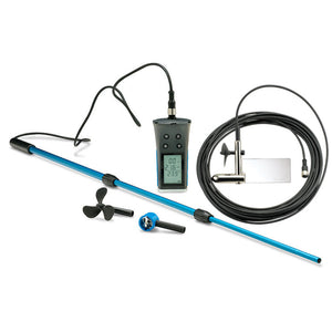
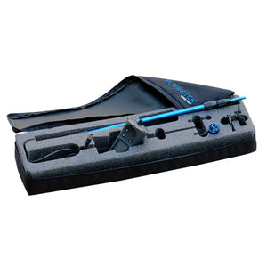
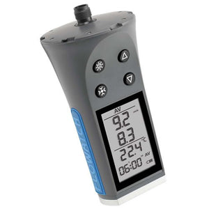
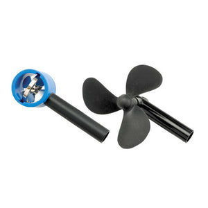
Developed for use under various challenging field conditions. Its different impellers measure almost any fluid, liquid or gaseous medium. Fluid measurements can be taken in knots, km/h, mph, and m/s. The meter also takes temperature measurements in either °F or °C, including minimum and maximum temperature and current temperature. Also included is a wind speed impeller which allows you to take air velocity and wind chill measurements.
To take flow measurements from a bridge or other elevated location, use the optional flow sensor with 15 meter cable (included in this kit). Kit includes the display, 2 m cable, telescoping rod, a 60mm water impeller, 25 mm air impeller, hanging water sensor with 15m cable and carrying case. Weatherproof.
Applications
- Measure rivers flows
- Irrigation canals
- Ocean flows
- Air conditioning conduits
- Sewage flows
- Ventilation shafts
- Hydrological studies
- Aerological studies
- Chimney flues
Flujómetro / Anemómetro Flowatch
Ver todos os detalhes do produto »
$ 545.00 USD
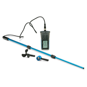
Developed for use under various challenging field conditions. Its different impellers measure almost any fluid, liquid or gaseous medium. Fluid measurements can be taken in knots, km/h, mph, and m/s. The meter also takes temperature measurements in either °F or °C, including minimum and maximum temperature and current temperature. Also included is a wind speed impeller which allows you to take air velocity and wind chill measurements.
To take flow measurements from a bridge or other elevated location, use the optional flow sensor with 15 meter cable (sold separately). Kit includes the display, 2 m cable, telescoping rod, a 60mm water impeller, 25 mm air impeller and carrying case. Weatherproof.
Applications
- Measure rivers flows
- Irrigation canals
- Ocean flows
- Air conditioning conduits
- Sewage flows
- Ventilation shafts
- Hydrological studies
- Aerological studies
- Chimney flues
Flujómetro / Anemómetro Flowatch
Ver todos os detalhes do produto »
$ 50.00 USD
Silver medal winner of the 2008 Book of the Year Award in the category of...
Ver todos os detalhes do produto »
$ 88.50 USD
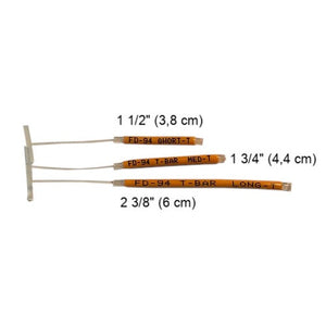
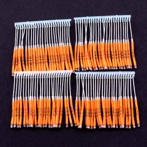
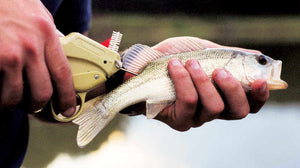
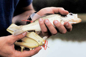
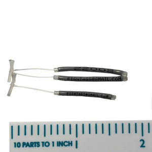
Floy® T-Bar Anchor Fish Tags work well with medium and small fish. Tags come in...
Ver todos os detalhes do produto »
$ 35.75 USD
Traps are sold from 10 units and up These traps are simple to operate, can...
Ver todos os detalhes do produto »
Request Quote
Combines the comfort of a camping cot with the protection of a tent, giving you a safe and comfortable rest on any terrain. Its elevated design keeps you off damp ground, insects, and dirt, while the waterproof coating with integrated rainfly ensures protection against rain and sun. Ideal for campers, hikers, and travelers seeking convenience, durability, and quick setup in seconds.
| Specification | Detail |
|---|---|
| Dimensions | 83" L x 47" W x 47" H |
| Maximum Height | 109 cm |
| Occupancy | 2 people |
| Item Weight | 20 kg / 32.9 lbs |
| Load Capacity | 250 kg / 551 lbs |
| Materials | Ferroalloy, nylon, mesh |
| Water Resistance | 2000-3000 mm (waterproof) |
| Seasons | 4-season |
| Color | Military Green |
Ver todos os detalhes do produto »
$ 620.00 USD
The Folsom plankton sub-sampler provides a quick and easy method for dividing large plankton samples into suitable amounts for later analysis.
This plankton sub-sampler divides samples into two equal halves; this process can be repeated successively until the desired sample quantity is reached.
![]() |
Design
|
|
Specifications |
||
|---|---|---|
| Materials | Made of methacrylate | Includes plastic elements in nylon. |
| Sizes | Capacity 1 L (150mmØ) | Capacity 2 L (220mmØ). |
EO20232403
Ver todos os detalhes do produto »
$ 1,985.00 USD
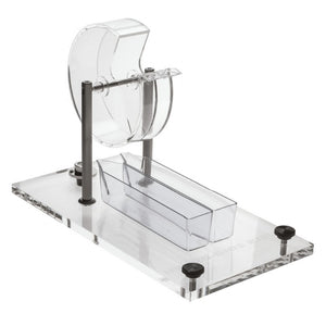
Folsom’s Plankton Sample Divider provides a fast and easy method to divide large plankton samples...
Ver todos os detalhes do produto »
$ 132.50 USD
Use to determine forest overstory density or as one indicator in wetland delineation work. Helpful...
Ver todos os detalhes do produto »
$ 22.75 USD
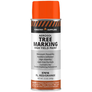
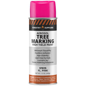
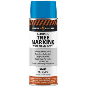
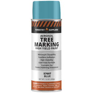
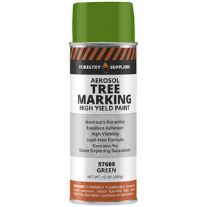
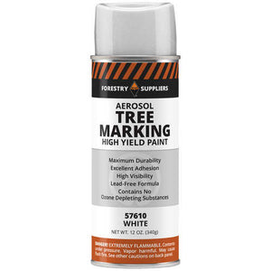
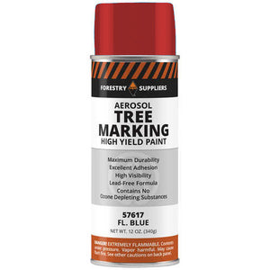
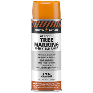
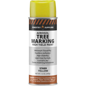
Ideal for use in marking trees, identifying lumber, and grading logs. Highly visible paint produces...
Ver todos os detalhes do produto »
$ 21.90 USD
Designed for dissection work at the middle school, high school, and college level. Contains all...
Ver todos os detalhes do produto »
Request Quote
Lightweight and comfortable, this field shirt effectively repels insects, dries quickly, and provides 30+ UPF...
Ver todos os detalhes do produto »
$ 36.25 USD
Standard 44-1/2” snake hook is designed for the safe handling of snakes, keeping them at...
Ver todos os detalhes do produto »
$ 54.95 USD
Black graduations on white enameled steel line or bright graduations on black steel line available....
Ver todos os detalhes do produto »
$ 28.65 USD
This mirror sighting height gauge is great for teaching students how to quickly determine tree...
Ver todos os detalhes do produto »
$ 97.25 USD
Forestry Suppliers “Al Tag” Double Faced Aluminum Tags, 3/4” x 3”, Box of 1,000 Write...
Ver todos os detalhes do produto »
Request Quote
Explore what fossils reveal about the history of life on Earth with a world-renowned paleontologist....
Ver todos os detalhes do produto »
$ 24.95 USD
Four Seasons of Flowers is an illustrated volume that presents a selection of the manuscripts, herbals,...
Ver todos os detalhes do produto »
$ 238.00 USD
The Electronic Caliper offers precise measuring capabilities ranging from 0 inches to 12 inches (0mm to 300mm) with a resolution of ±0.0005 inches (±0.01mm) and an accuracy of ±0.0015 inches (±0.04mm). This stainless steel caliper is designed to measure depth, internal diameter, external diameter, and step. With a jaw length of 60.00 mm, stainless steel jaws, and data output capabilities, it ensures accurate and reliable measurements. With an IP67 rating, this caliper is resistant to dust and water, making it durable for various environments and applications.
| Specifications | |||
|---|---|---|---|
| Max Measurement (Decimal Inch) | 12 | Max Measurement (mm) | 300 |
| Measuring Range | 0in to 12in, 0mm to 300mm | Resolution | ±0.0005in, ±0.01mm |
| Accuracy | ±0.0015in, ±0.04mm | Data Output | Yes |
| Data Output Type | For use with Wireless Transmitter | IP Rating | IP67 |
| Calibrated | No | Caliper Material | Stainless Steel |
| Jaw Material | Stainless Steel | Jaw Style | Inside/Outside |
| Jaw Length (Decimal Inch) | 2.3500 | Jaw Length (mm) | 60.00 |
| Traceability Certification Included | NIST | Application | Inside Diameter; Step; Outside Diameter; Depth |
| Jaw Type | Knife-Edge | Offset Jaw | No |
| Maximum Inside Diameter Measurement (Inch) | 12 | Jaw Adjustment Type | Thumb Wheel |
| Power Source | Battery | ||
| Batteries Included | Yes | Battery Chemistry | Lithium |
| Battery Size | CR2032 | Finish | Stainless Steel |
| Includes Inside Diameter Jaws | Yes | Includes Depth Measuring Rod | Yes |
| Includes | Case, Battery | Standards | NIST Traceable Certificate |
| Series | IP67 Plus | UNSPSC Code | 41111621 |
Ver todos os detalhes do produto »
$ 149.50 USD
The Freeman Cage Net is a highly effective and humane tool designed to safely capture...
Ver todos os detalhes do produto »
Request Quote
An hourly illustrated guide that follows twenty-four frogs as they feed, find mates, care for...
Ver todos os detalhes do produto »
Request Quote – Vendido
Immerse Yourself in Comfort and Protection with Frogg Toggs® Amphib™ Neoprene Chest Waders! Get ready...
Ver todos os detalhes do produto »
$ 29.95 USD
With more than 7,600 known species, frogs exhibit an extraordinary range of forms and behaviors,...
Ver todos os detalhes do produto »
$ 55.00 USD
Our intuitive assumption that only organisms are the real individuals in the natural world is...
Ver todos os detalhes do produto »
$ 55.00 USD
The Montreal Protocol has been cited as the most successful global environmental agreement, responsible for phasing...
Ver todos os detalhes do produto »
$ 45.00 USD
Engineering has been an essential collaborator in biological research and breakthroughs in biology are often...
Ver todos os detalhes do produto »
$ 96.25 USD
The Davis 7345.114 Front Cover with Solar Panel for ISS Transmitter Box is the ideal replacement part to keep your Vantage Pro-2 wireless weather station in peak condition. This component includes a renewed solar panel that ensures constant power supply to your system, even in demanding conditions. Designed to fit all versions of the Vantage Pro-2, it guarantees a simple and effective integration.
| Product | Front Cover for ISS Transmitter Box (with Solar Panel) |
|---|---|
| Brand | Davis Instruments |
| Model | 7345.114 |
| Compatibility | Vantage Pro-2 (wireless) |
| Includes Solar Panel | Yes |
Ver todos os detalhes do produto »
$ 24.95 USD
In this engrossing and accessible book, Doug Macdougall explores the causes and effects of ice...
Ver todos os detalhes do produto »
Request Quote
Fundamentals of Plant Physiology emphasizes essential concepts, offering a concise, accessible, and focused approach to...
Ver todos os detalhes do produto »
Request Quote – Vendido
Fungipedia presents a delightful A–Z treasury of mushroom lore. With more than 180 entries—on topics as...
Ver todos os detalhes do produto »
Request Quote
The device is designed for adventurers and explorers, providing constant connection with loved ones through two-way messaging and location tracking. It also offers advanced features such as preloaded topographic maps, satellite imagery, and ABC sensors, all in equipment built to withstand the harshest conditions.
| Dimensions | 2.5” x 6.4” x 1.4” (6.2 x 16.3 x 3.5 cm) |
|---|---|
| Screen Size | 1.5" wide x 2.5" high (3.8 x 6.3 cm); 3" diagonal (7.6 cm) |
| Screen Resolution | 240 x 400 pixels |
| Display Type | Transflective color TFT |
| Weight | 230 g (8.1 oz) with batteries |
| Waterproof | IPX7 |
| Battery Type | Internal rechargeable lithium-ion |
| Battery Life | Up to 165 hours with inReach® enabled with 10-minute tracking Up to 180 hours in GPS mode Up to 425 hours in Expedition mode with inReach enabled Up to 840 hours in Expedition mode |
| MIL-STD-810 | Yes (thermal, shock, water); bare unit only |
| Interface | USB-C |
| Memory/Storage | 16 GB (user space varies based on included mapping) |
| Preloaded Maps | Yes (TopoActive, routable) |
|---|---|
| Ability to Add Maps | Yes |
| Base Map | Yes |
| Auto Routing | Yes (turn-by-turn routing on roads for outdoor activities) |
| Map Segments | 15,000 |
| Satellite Imagery | Yes (direct to device) |
| Includes Hydrographic Features | Yes (coasts, lake/river shores, wetlands, and perennial/seasonal streams) |
| Includes Points of Interest | Yes (parks, campsites, scenic lookouts, and picnic sites) |
| Displays Parks, Forests, and Wilderness Areas | Yes (national, state, and local) |
| External Memory Storage | Yes (microSD™ card up to 32 GB) |
| Waypoints/Favorites/Locations | 10,000 |
| Courses | 250, 200 course points per course |
| Tracks | 250 |
| Navigation Track Log | 20,000 points, 250 saved gpx tracks, 300 saved fit activities |
| High-Sensitivity Receiver | Yes |
|---|---|
| GPS | Yes |
| Galileo | Yes |
| QZSS | Yes |
| Beidou | Yes |
| IRNSS | Yes |
| Barometric Altimeter | Yes |
| Compass | Yes (3-axis with tilt compensation) |
| GPS Compass (in motion) | Yes |
| Multi-Band Frequency Support | Yes |
| Active Weather | Yes |
|---|---|
| Connect IQ™ | Yes (downloadable watch faces, data fields, widgets, and apps) |
| Pairs with Garmin Connect™ Mobile | Yes |
| Smart Notifications | Yes (on the handheld device) |
| VIRB® Remote Control | Yes |
| LiveTrack | Yes |
|---|
| Point-to-Point Navigation | Yes |
|---|---|
| TracBack® | Yes |
| Area Calculation | Yes |
| Hunting/Fishing Calendar | Yes |
| Sun and Moon Information | Yes |
| Xero™ Locations | Yes |
| Geocaching Compatible | Yes (Live Geocaching) |
| Custom Maps Compatible | Yes (500 custom map tiles) |
| Image Viewer | Yes |
| LED Flashlight Beacon | Yes |
| Interactive SOS | Yes |
|---|---|
| inReach Weather | Yes |
| Send and Receive Text Messages to SMS and Email | Yes |
| Send and Receive Text Messages to Another inReach Device | Yes |
| Send and Receive Group Messages | Yes |
| Exchange Locations with Another inReach Device | Yes |
| MapShare Tracking Compatible | Yes |
| Virtual Keyboard for Custom Messaging | Yes |
| Send Waypoints to MapShare During Trip | Yes |
| Send Route Selection to MapShare During Trip | Yes |
| Compatible with Garmin Explore™ App | Yes |
|---|---|
| Compatible with Garmin Explore Website | Yes |
| Compatible with Garmin Messenger App | Yes |
| Smart Switching Between Wi-Fi, Cellular, and Satellite with Garmin Messenger App | Yes |
| Wireless Connectivity | Yes (Wi-Fi®, BLUETOOTH®, ANT+®) |
|---|
Ver todos os detalhes do produto »
$ 142.00 USD
1080p Tiny Dash Cam with a 140-degree Field of View Notice: Some jurisdictions regulate or...
Ver todos os detalhes do produto »
$ 199.99 USD
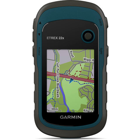
eTrex 22x and eTrex 32x offer the same ease-of-use, durability and affordability that the eTrex handheld GPS series is known for — along with preloaded TopoActive maps. These devices are perfect for ATVs, bicycles, boats or hiking.
eTrex 22x and 32x offer enhanced 2.2”, 65K color, sunlight-readable displays. Durable and water resistant, these handhelds are built to withstand the elements.

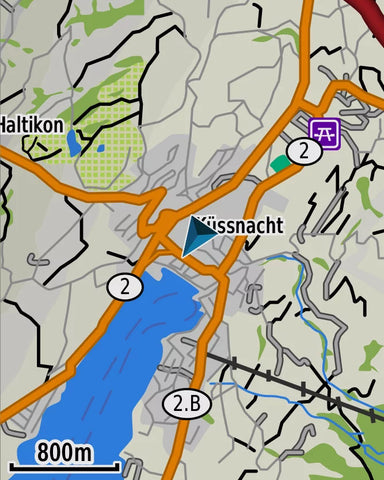
The eTrex 22x and 32x handheld devices come preloaded with road-routable TopoActive maps for outdoor activities that feature streets and trails so you can take the journey off the grid. Now you can know your surroundings — such as waterways, natural features as well as buildings, international boundaries and more. You can also find thousands of points of interests, including shops, restaurants, universities, car parks and accommodations.
The eTrex series uses both GPS and GLONASS satellite systems so the receiver has the ability to track in more challenging environments than GPS alone. eTrex 32x adds a 3-axis compass and barometric altimeter, making it easy for you to keep your bearings.


eTrex 22x and eTrex 32x support paperless geocaching. Upload GPX files straight to your device, and view key information such as location, terrain and hints from Geocaching.com
With an array of compatible mounts, eTrex is designed as a handheld — for use on ATVs or bicycles, in boats or on foot. Use the auto mount capability and City Navigator® NT maps for turn by turn driving directions for motorized vehicles, or use the rugged mount for your motorcycle or ATV. Wherever you think you might take eTrex, it has the mapping and mounts to get you there.
| Ref | 22x | 32x |
|---|---|---|
| Dimension | 2.1" x 4.0" x 1.3" | |
| Display Size | 1.4" x 1.7" 2.2" diag | |
| Display Resolution | 240 x 320 pixels | |
| Display Type | 2.2" transflective, 65K color TFT | |
| Weight | 5 oz with batteries | |
| Waterproof | IPX7 | |
| Battery Type | 2 AA batteries (not included); NiMH or Lithium recommended | |
| Battery Life | 25 hours | |
| Interface | mini USB | |
| Memory/History | 8 GB | |
| Maps And Memory | ||
| Preloaded Maps | yes (TopoActive; routable) | |
| Ability to add Maps | ![]() |
|
| Basemap | ![]() |
|
| Automatic Routing(TURN BY TURN ROUTING ON ROADS)for Outdoor Activities | ![]() |
|
| Map Segments | 3000 | |
| Include Detailes Hydrographic Features (COASTLINES, LAKE/RIVER SHORELINES, WETLANDS AND PERENNIAL AND SEASONAL STREAMS) | ![]() |
|
| Includes Searchable Points of Interests (PARKS, CAMPGROUNDS, SCENIC LOOKOUTS AND PICNIC SITES) | ![]() |
|
| Displays National, State and Local Parks, Forest, and Wilderness Areas | ![]() |
|
| External Memory Storage | yes (32 GB max microSD™ card) | |
| Waypoints/Favorites/Locations | 2000 | |
| Tracks | 200 | |
| Navigation Track Log | 10000 points, 200 saved tracks | |
| Navigation Routes | 200 routes, 250 points per route; 50 points auto routing | |
| Sensors | ||
| High-Sensitivity Receiber | ![]() |
|
| GPS | ![]() |
|
| GLONASS | ![]() |
|
| GPS COMPASS (WHILE MOVING) | ![]() |
|
| Barometric Altimeter | N/A | ![]() |
| Compass | N/A | Yes (tilt-compensated 3-axis) |
| Outdoor Recreation | ||
| Point-to-Point Navigation | ![]() |
|
| Area Calculation | ![]() |
|
| Hunt/Fish Calendar | ![]() |
|
| Sun and Moon Information | ![]() |
|
| Geocaching-Friendly | Yes (Paperless) | |
| Custom Maps Compatible | yes (100 custom map tiles) | |
| Picture Viewer | ![]() |
|
EO20233003
Ver todos os detalhes do produto »
Request Quote
The eTrex® Solar is an ultra-rugged handheld navigator that combines multiband GPS technology with solar charging, providing unlimited runtime under high-light conditions. Designed for outdoor exploration, it includes a digital compass, live geocaching, real-time weather forecasting, and syncs with the Garmin Explore app to take your adventure further. Ideal for hiking, scientific expeditions, and outdoor activities that demand reliable positioning and environmental resilience.
| Specification | eTrex® Solar |
|---|---|
| Dimensions | 6.4 x 10.5 x 3.1 cm |
| Weight | 141 g |
| Display Type | 2.2″ transflective, monochrome |
| Display Size | 3.3 x 4.4 cm (2.16″ diagonal) |
| Display Resolution | 240 x 320 pixels |
| Lens Material | Chemically strengthened glass |
| Battery | Rechargeable lithium-ion |
| Battery Life | GPS up to 200 h / Multiband GNSS up to 100 h / Expedition mode up to 1800 h / Unlimited with 75,000 lux |
| Solar Charging | Yes |
| Water Rating | IPX7 |
| Internal Memory | 28 MB |
| Interface | USB-C |
| Connectivity | Bluetooth® |
| Maps | Basemap (cities only) |
| Waypoints | 1,000 |
| Routes | 50 |
| Activities | 200 |
| GNSS Systems | GPS, GLONASS, Galileo, QZSS, BeiDou, IRNSS |
| Digital Compass | Yes (3-axis tilt-compensated) |
| GPS Compass (while moving) | Yes |
| Multiband Frequency | Yes |
| LiveTrack | Yes |
| Dual Grid Coordinates | Yes |
| TracBack® | Yes |
| Area Calculation | Yes |
| Astronomical Information | Yes |
| Geocaching Mode | Yes (live geocaches) |
| Compatible App | Garmin Explore™ (app and website) |
| Smart Notifications | Yes |
| Smart Weather Forecasting | Yes |
Ver todos os detalhes do produto »
$ 249.95 USD – Vendido
We offer the new eTrex 22x and 32x
Ver todos os detalhes do produto »
$ 599.99 USD
Discover the Garmin GPSMAP 86 Series: a family of handheld devices designed for those who live on the water and demand reliability, connectivity, and precise mapping. Each variant combines durability (it floats and is water-resistant), advanced sensors, and the ability to integrate with onboard systems to display vessel data — all on a sunlight-readable 3” display. Choose the variant that fits your needs, from BlueChart® g3 mapping to global inReach® communication.
| Specification | GPSMAP 86s | GPSMAP 86sc | GPSMAP 86i | GPSMAP 86sci |
|---|---|---|---|---|
| Short Description | Handheld preloaded with Worldwide Basemap; onboard system integration. | Marine handheld preloaded with BlueChart® g3 (U.S.) and autopilot/Fusion control. | Marine handheld with inReach® capabilities; worldwide basemap. | Marine handheld with BlueChart® g3 (U.S.) + inReach® capabilities. |
| Preloaded Maps | Worldwide basemap | BlueChart® g3 (U.S.) | Worldwide basemap | BlueChart® g3 (U.S.) |
| Satellite Communication / inReach® | No (wireless features supported) | No (supports notifications and onboard control) | Yes, inReach® (satellite messaging, interactive SOS) | Yes, inReach® + BlueChart® g3 |
| Battery Life (depending on mode) | Up to 40 hours in standard mode (depending on use) | Up to 40 hours in standard mode (depending on use) | Up to 35 hours (10-min tracking); up to 200 hours (30-min power save) | Up to 35 hours (10-min tracking); up to 200 hours (30-min power save) |
| Internal Memory | 16 GB (user space varies by included maps) | |||
| Expansion (microSD) | Yes (microSD™ up to 32 GB) | |||
| Display | Transflective 65K color TFT — 3" diagonal (240 x 400 px) | |||
| Dimensions | 6.75 x 17.8 x 4.4 cm (2.65" x 7" x 1.7") | |||
| Weight | 272 g (9.59 oz) | |||
| Water Resistance | IPX7 (floats) | |||
| MIL-STD Certification | Yes (thermal, shock, and water resistance — MIL-STD-810) | |||
| Sensors | GPS, GLONASS, Galileo, barometric altimeter, 3-axis compass | GPS, GLONASS, Galileo, barometric altimeter, 3-axis compass | GPS, Galileo, barometric altimeter, 3-axis compass | GPS, Galileo, barometric altimeter, 3-axis compass |
| Waypoints / Routes / Tracks | Waypoints: 10,000 · Routes: 250 · Tracks: 250 · Track log: 20,000 points | |||
| Connectivity | Wi-Fi®, Bluetooth®, ANT+®, and NMEA 0183 compatibility (boat data and Garmin app sync) | |||
| Key Notes | Preloaded worldwide basemap; optional BlueChart® g3 available. | BlueChart® g3 preloaded (U.S.); includes autopilot and Fusion control. | Built-in inReach® for global messaging and safety. | BlueChart® g3 + inReach® combo (messaging + interactive SOS). |
Ver todos os detalhes do produto »
Request Quote
GPSMAP serie 62 features a 2.6" sunlight-readable 65K color screen that supports BirdsEye Satellite imagery (subscription required) and Custom Maps. Rugged and waterproof, GPSMAP serie 62 features a quad helix antenna for unparalleled reception and sleek new design. Support for Custom Maps and BirdsEye Satellite imagery (subscription required).
GPSMAP serie 62s, 62sc, 62st and 62stc handheld navigator feature a 3-axis tilt-compensated compass, a barometric altimeter, a 5 megapixel autofocus camera with photo navigation, and connect wirelessly to compatible handheld devices.
Explore
GPSMAP serie 62 comes with built-in worldwide basemap with shaded relief, so you can navigate anywhere with ease. With photo navigation, you can download geotagged pictures from the Internet and navigate to them.
Get Your Bearings
GPSMAP 62s, 62sc, 62st and 62stc has a built-in 3-axis tilt-compensated electronic compass, which shows your heading even when you’re standing still, without holding it level. Its barometric altimeter tracks changes in pressure to pinpoint your precise altitude, and you can even use it to plot barometric pressure over time, which can help you keep an eye on changing weather conditions.
Share Wirelessly
With GPSMAP 62s, 62sc, 62st and 62stc you can share your waypoints, tracks, routes and geocaches wirelessly with other compatible devices. Your friends can enjoy your favorite hike or cache — simply press “send” to transfer your information.
Explore the Terrain
GPSMAP 62st and 62stc come preloaded with TOPO 100K, which includes coverage of the full U.S., including Alaska, Hawaii and Puerto Rico, and a worldwide basemap with shaded relief — all the tools for serious climbing or hiking. Map detail includes national, state and local parks and forests, along with terrain contours, elevation information, trails, rivers, lakes and points of interest.
Document Your Journey
With GPSMAP 62sc and 62stc built-in 5 megapixel autofocus camera, you'll be able to capture the highlights of your outings. Each photo is automatically geotagged with the location of where it was taken, allowing you — or those you share your photos with — to easily navigate back to that spot in the future.
Keep Your Fix
With its quad helix antenna and high-sensitivity, WAAS-enabled GPS receiver and HotFix® satellite prediction, GPSMAP 62 locates your position quickly and precisely and maintains its GPS location even in heavy cover and deep canyons. The advantage is clear — whether you’re in deep woods or just near tall buildings and trees, you can count on GPSMAP 62 to help you find your way when you need it the most. BirdsEye satellite image.
Add Maps
Adding more maps is easy with our array of detailed topographic, marine and road maps. With 1.7 GB (62 and 62s) 3.5 GB (62sc, 62st and 62stc) of onboard memory, you can conveniently download 24K and 100K TOPO maps and hit the trail or City Navigator NT map data for turn-by-turn routing on roads (see maps tab for compatible maps). GPSMAP serie 62 also supports BirdsEye Satellite Imagery (subscription required), that lets you download satellite images to your device and integrate them with your maps. In addition, the 62 is compatible with Custom Maps, free software that transforms paper and electronic maps into downloadable maps for your device.
Get Connected
You've been busy exploring and now you want to store and analyze your activities. With a simple connection to your computer and to the Internet, you can get a detailed analysis of your activities and send tracks to your outdoor device using Garmin Connect. This one-stop site offers an activity table and allows you to view your activities on a map using Google Earth. Explore other routes uploaded by millions of Garmin Connect users and share your experiences on Twitter and Facebook. Getting started is easy, so get out there, explore and share.
Find Fun
GPSMAP serie 62 supports geocaching GPX files for downloading geocaches and details straight to your unit. By going paperless, you're not only helping the environment but also improving efficiency. GPSMAP 62 stores and displays key information, including location, terrain, difficulty, hints and descriptions, which means no more manually entering coordinates and paper printouts! Simply upload the GPX file to your unit and start hunting for caches. Slim and lightweight, 62 is the perfect companion for all your outdoor pursuits.
Plan Your Next Trip
Take charge of your next adventure with BaseCamp, software that lets you view and organize maps, waypoints, routes, and tracks. This free trip-planning software even allows you to create Garmin Adventures that you can share with friends, family or fellow explorers. BaseCamp displays topographic map data in 2-D or 3-D on your computer screen, including contour lines and elevation profiles. It also can transfer an unlimited amount of satellite images to your device when paired with a BirdsEye Satellite Imagery subscription.
GPS de Mano Garmin GPSMAP Serie 62
Ver todos os detalhes do produto »
Request Quote
GPSMAP serie 64 features a 2.6" sunlight-readable color screen that supports BirdsEye Satellite Imagery (subscription required) and Garmin Custom Maps. Rugged and waterproof, GPSMAP 64 uses a quad helix antenna for superior reception.
GPSMAP 64s and 64st handheld navigator feature a 3-axis tilt-compensated compass, a barometric altimeter and connect wirelessly to compatible handheld devices.
Get Your Bearings
GPSMAP 64s and 64st has a built-in 3-axis tilt-compensated electronic compass, which shows your heading even when you’re standing still, without holding it level. Its barometric altimeter tracks changes in pressure to pinpoint your precise altitude, and you can even use it to plot barometric pressure over time, which can help you keep an eye on changing weather conditions.
Share Wirelessly
Share your waypoints, tracks, routes and geocaches wirelessly with other compatible devices. Your friends can enjoy your favorite hike or cache without waiting for you to plug in to your computer — simply press “send” to transfer your information to another Garmin handheld.
GPSMAP 64st also connects to compatible Garmin devices, including compatible VIRB and accessory sensors, including tempe™, foot pod and heart rate monitor.
Explore the Terrain
GPSMAP serie 64 comes with a built-in worldwide basemap with shaded relief so you can navigate anywhere with ease. With photo navigation, you can download geotagged pictures from the Internet and navigate to them.
GPSMAP 64st comes preloaded with TOPO 100K, which includes coverage of the full U.S., including Alaska, Hawaii and Puerto Rico, and a worldwide basemap with shaded relief — all the tools for serious climbing or hiking. Map detail includes national, state and local parks and forests, along with terrain contours, elevation information, trails, rivers, lakes and points of interest.
Keep Your Fix
With its quad helix antenna and high-sensitivity, GPS and GLONASS, receiver, GPSMAP 64st locates your position quickly and precisely and maintains its location even in heavy cover and deep canyons. The advantage is clear — whether you’re in deep woods or just near tall buildings and trees, you can count on GPSMAP 64st to help you find your way when you need it the most.
Add Maps
Adding more maps to GPSMAP serie 64 is easy with our array of detailed topographic, marine and road maps. With 4 GB of onboard memory and microSD card slot, you can conveniently download TOPO 24K and 100K maps and hit the trail, plug in BlueChart® g2 preloaded cards for a great day on the water or City Navigator NT® map data for turn-by-turn routing on roads (see maps tab for compatibility). GPSMAP 64 also supports BirdsEye Satellite Imagery (subscription required) that lets you load satellite images onto your device and integrate them with your maps. In addition, the 64 is compatible with Custom Maps, a map format that allows you to transform paper and electronic maps easily into downloadable maps for your device, for free.
GPSMAP 64st comes with a built-in worldwide basemap with shaded relief, preloaded TOPO 100K and a 1-year subscription of BirdsEye Satellite Imagery for a photo-realistic view. Adding more maps is easy with our array of detailed topographic, marine and road maps. With 8 GB of onboard memory and microSD™ card slot, you can conveniently download TOPO 24K maps and hit the trail, plug in BlueChart® g2 preloaded cards for a great day on the water or City Navigator NT® map data for turn-by-turn routing on roads (see maps tab for compatibility). In addition, the 64st is compatible with Garmin Custom Maps, a map format that allows you to transform paper and electronic maps easily into downloadable maps for your device, for free.
Get Connected
You've been busy exploring and now you want to store and analyze your activities. With a simple connection to your computer and to the Internet, you can get a detailed analysis of your activities and send tracks to your outdoor device using Garmin Connect. This one-stop site offers an activity table and allows you to view your activities on a map using Google Earth. Explore other routes uploaded by millions of Garmin Connect users and share your experiences on Twitter and Facebook. Getting started is easy, so get out there, explore and share.
Find Fun
GPSMAP serie 64 supports paperless geocaching with 250,000 preloaded caches with hints and descriptions from Geocaching.com, and has a 16-hour battery life. By going paperless, you're not only helping the environment, but also improving efficiency. GPSMAP serie 64 stores and displays key information, including location, terrain, difficulty, hints and descriptions, which means there’s no more manually entering coordinates and paper printouts! Slim and lightweight, serie 64 is the perfect companion for all your outdoor pursuits.
Plan Your Next Trip
Take charge of your next adventure with BaseCamp, software that lets you view and organize maps, waypoints, routes, and tracks. This free trip-planning software even allows you to create Garmin Adventures that you can share with friends, family or fellow explorers. BaseCamp displays topographic map data in 2-D or 3-D on your computer screen, including contour lines and elevation profiles. It also can transfer an unlimited amount of satellite images to your device when paired with a BirdsEye Satellite Imagery subscription.
GPS de Mano Garmin GPSMAP Serie 64
Ver todos os detalhes do produto »
$ 359.00 USD
GPSMAP serie 64 features a 2.6" sunlight-readable color screen that supports BirdsEye Satellite Imagery (subscription required) and Garmin Custom Maps. Rugged and waterproof, GPSMAP 64 uses a quad helix antenna for superior reception.
GPSMAP 64s and 64st handheld navigator feature a 3-axis tilt-compensated compass, a barometric altimeter and connect wirelessly to compatible handheld devices.
Get Your Bearings
GPSMAP 64s and 64st has a built-in 3-axis tilt-compensated electronic compass, which shows your heading even when you’re standing still, without holding it level. Its barometric altimeter tracks changes in pressure to pinpoint your precise altitude, and you can even use it to plot barometric pressure over time, which can help you keep an eye on changing weather conditions.
Share Wirelessly
Share your waypoints, tracks, routes and geocaches wirelessly with other compatible devices. Your friends can enjoy your favorite hike or cache without waiting for you to plug in to your computer — simply press “send” to transfer your information to another Garmin handheld.
GPSMAP 64st also connects to compatible Garmin devices, including compatible VIRB and accessory sensors, including tempe™, foot pod and heart rate monitor.
Explore the Terrain
GPSMAP serie 64 comes with a built-in worldwide basemap with shaded relief so you can navigate anywhere with ease. With photo navigation, you can download geotagged pictures from the Internet and navigate to them.
GPSMAP 64st comes preloaded with TOPO 100K, which includes coverage of the full U.S., including Alaska, Hawaii and Puerto Rico, and a worldwide basemap with shaded relief — all the tools for serious climbing or hiking. Map detail includes national, state and local parks and forests, along with terrain contours, elevation information, trails, rivers, lakes and points of interest.
Keep Your Fix
With its quad helix antenna and high-sensitivity, GPS and GLONASS, receiver, GPSMAP 64st locates your position quickly and precisely and maintains its location even in heavy cover and deep canyons. The advantage is clear — whether you’re in deep woods or just near tall buildings and trees, you can count on GPSMAP 64st to help you find your way when you need it the most.
Add Maps
Adding more maps to GPSMAP serie 64 is easy with our array of detailed topographic, marine and road maps. With 4 GB of onboard memory and microSD card slot, you can conveniently download TOPO 24K and 100K maps and hit the trail, plug in BlueChart® g2 preloaded cards for a great day on the water or City Navigator NT® map data for turn-by-turn routing on roads (see maps tab for compatibility). GPSMAP 64 also supports BirdsEye Satellite Imagery (subscription required) that lets you load satellite images onto your device and integrate them with your maps. In addition, the 64 is compatible with Custom Maps, a map format that allows you to transform paper and electronic maps easily into downloadable maps for your device, for free.
GPSMAP 64st comes with a built-in worldwide basemap with shaded relief, preloaded TOPO 100K and a 1-year subscription of BirdsEye Satellite Imagery for a photo-realistic view. Adding more maps is easy with our array of detailed topographic, marine and road maps. With 8 GB of onboard memory and microSD™ card slot, you can conveniently download TOPO 24K maps and hit the trail, plug in BlueChart® g2 preloaded cards for a great day on the water or City Navigator NT® map data for turn-by-turn routing on roads (see maps tab for compatibility). In addition, the 64st is compatible with Garmin Custom Maps, a map format that allows you to transform paper and electronic maps easily into downloadable maps for your device, for free.
Get Connected
You've been busy exploring and now you want to store and analyze your activities. With a simple connection to your computer and to the Internet, you can get a detailed analysis of your activities and send tracks to your outdoor device using Garmin Connect. This one-stop site offers an activity table and allows you to view your activities on a map using Google Earth. Explore other routes uploaded by millions of Garmin Connect users and share your experiences on Twitter and Facebook. Getting started is easy, so get out there, explore and share.
Find Fun
GPSMAP serie 64 supports paperless geocaching with 250,000 preloaded caches with hints and descriptions from Geocaching.com, and has a 16-hour battery life. By going paperless, you're not only helping the environment, but also improving efficiency. GPSMAP serie 64 stores and displays key information, including location, terrain, difficulty, hints and descriptions, which means there’s no more manually entering coordinates and paper printouts! Slim and lightweight, serie 64 is the perfect companion for all your outdoor pursuits.
Plan Your Next Trip
Take charge of your next adventure with BaseCamp, software that lets you view and organize maps, waypoints, routes, and tracks. This free trip-planning software even allows you to create Garmin Adventures that you can share with friends, family or fellow explorers. BaseCamp displays topographic map data in 2-D or 3-D on your computer screen, including contour lines and elevation profiles. It also can transfer an unlimited amount of satellite images to your device when paired with a BirdsEye Satellite Imagery subscription.
GPS de Mano Garmin GPSMAP Serie 64
Ver todos os detalhes do produto »
$ 535.00 USD
garmin
Ver todos os detalhes do produto »
Request Quote
The inReach® Messenger Plus is an advanced satellite communicator capable of sending and receiving text messages, photos, and voice notes even in areas without cellular service. With a rugged design, long-lasting battery, and features like group messaging, live tracking, interactive SOS, and TracBack®, this device is the ideal companion for scientific expeditions, outdoor adventures, and remote field missions. Compatible with the Garmin Messenger™ and Garmin Explore™ apps, it provides a complete, reliable, and continuous communication experience from anywhere in the world.
| Specification | inReach® Messenger Plus |
|---|---|
| Display | 1.08" diagonal, monochrome MIP, 160 x 68 pixels |
| Lens Material | Chemically strengthened glass |
| Water Resistance | IPX7 |
| Battery Type | Internal rechargeable lithium-ion |
| Battery Life | Up to 600 h (low 10-min mode), 25 days at 10-min tracking |
| Messaging | Text, voice (30 sec), photos, groups, 1600 characters |
| Connectivity | Bluetooth®, USB-C, Wi-Fi, Iridium Satellite |
| GPS and Navigation | GPS, Galileo, QZSS, BeiDou, TracBack®, compass |
| Compatible Apps | Garmin Messenger™, Garmin Explore™ |
| SOS Transmission | Interactive via Garmin Response℠ 24/7 |
| Reverse Charging | Can charge other devices via USB-C |
Ver todos os detalhes do produto »