SHIPPING QUOTE FOR OVERSIZED ITEMS MUST BE REQUESTED | WhatsApp Global CLICK HERE
$ 475.00 USD
- NEW GPS and GLONASS: better and faster satellite positioning.
- 4" display with dual orientation optimized for outdoors: for easy reading in any condition.
- NEW Pre-Installed Content: 250,000 geo-caches from Geocaching.com and 1 free year of BirdsEye1 satellite imagery. Ref. 680t includes recreational topographic route map with United States coverage.
- NEW Includes a new Track Manager that offers a better user experience and more control.
- NEW 8 megapixel camera for high resolution geo-tagged photos.
- Full navigation on any site with more versatile features, display and support.
- Barometric altimeter and three-axis compass.
Designed for use on trails, on roads or in the water, Garmin's Montana 680 device will guide you wherever you go. With an improved large 4" (10.16 Cm) touch screen, dual orientation and GPS and GLONASS positioning to control your position faster and more accurately, even in the most difficult environments. With the new Track Manager, it's easy to see where you are at all times and comfortably control your track recording.The Montana 680 includes a 3-axis electronic compass with barometric altimeter and a free 1-year subscription to Bird's Eye satellite imagery.The Montana 680 is Rugged, waterproof, includes an 8-megapixel camera and is designed to withstand the elements2.
The Montana 680 features a 4" dual-orientation touch screen optimized for outdoor use that offers the best readability in any light condition. The easy-to-use touch screen user interface will allow you to enjoy nature more and spend less time searching information.Montana's display is loved by outdoor enthusiasts for its optimal readability thanks to large data fields and numerous mapping functions.Rugged and waterproof, the Montana 680 is designed to withstand inclement weather Shocks, dust, dirt, humidity or water will no longer be a problem for this resistant navigator2.
Capture locations and memories with the Montana 680's 8-megapixel digital camera. Each photo is automatically geotagged with the location where it was taken, allowing you to navigate back to that exact spot in the future. Take and view photos in a landscape or portrait orientation. Track your photos and check their locations on a map with BaseCamp™. Pop in a microSD™ card for more storage space or to view photos from other devices.
With the new high-sensitivity GPS and GLONASS receiver, the Montana 680 locates your position quickly and accurately, and maintains its location even in thick forests and deep valleys. The advantage is clear, you can count on the Montana 680 device to help you find your way when you need it most.
With a wide range of compatible mounts, the Montana is designed for use on bikes, 4x4s, boats, and as a handheld device or for convenient everyday car navigation. Use the optional car mount with City Navigator maps for voice turn-by-turn directions, or try the optional rugged mount for your motorcycle or ATV.
The Montana 680 includes a 1-year BirdsEye satellite imagery subscription with incredible aerial imagery to enhance your navigation. If you want more detailed information, you can easily add more maps to the Montana1 device. Load TOPO maps and hit the road in no time, pop in preloaded BlueChart® g2 cards for a great day on the water, or load City Navigator map data for turn-by-turn directions. Or transform paper maps into files you can download for your Montana device with Custom Maps.
Navigate with ease
The new Montana 680 device includes a Track Manager application that allows you to record, view and analyze your tracks in a very comfortable and intuitive way. The handheld has key features for outdoor activities like a 3-axis tilt-compensated compass that shows your direction even when you're standing still and held tilted. It also includes a barometric altimeter that tracks changes in air pressure to determine your altitude and even graphs barometric pressure over time, which can help you keep an eye on changing weather conditions.
The Montana 680 comes preloaded with over 250,000 assorted geocaches from geocaching.com and supports "paperless" geocaching. This allows the Montana 680 to save and display key cache information such as location, terrain, difficulty, hints and descriptions, so you no longer have to manually enter coordinates or carry paper printouts. When you want to add more caches, you just have to load the GPX file on your device and continue with the search.
With the Montana 680 device you can share your waypoints, tracks, routes and geocaches wirelessly with other compatible Garmin GPS users. Just press "Send" to transfer your information to other units.
The Montana 680 device includes Garmin's dual battery system that guarantees maximum independence. It will allow you to use the option that suits you best: rechargeable lithium-ion batteries or traditional AA alkaline batteries.
Take command of your next adventure with our free BaseCamp™, software that lets you view and organize maps, waypoints, routes, and tracks. This free trip planning software even lets you create Garmin Adventures that you can share with friends, family, or fellow explorers. BaseCamp displays topographic map data in 2D or 3D on your computer screen, including elevation profiles and bathymetric lines. Plus, you can transfer an almost unlimited amount of satellite imagery to your device from the included BirdsEye satellite imagery subscription.
| Unit Dimensions (Width/Height/Depth) | 7,48 x 14,42 x 3,64 cm |
| Weight | 289 g (10,2 oz) with a lithium-ion battery (included); 333 g (11,7 oz) with three AA batteries (not included) |
| Waterproof | IPX7 |
| Drums | Rechargeable lithium-ion battery (included) or 3 AA batteries (not included); NiMH or lithium recommended |
| Touch screen | ![]() |
| screen type | Bright, sunlight-readable, dual-orientation, 65,000-colour transflective TFT touchscreen |
| Screen size (Width/Height) | 5,06 x 8,93 cm; 4" in diagonal (10,2 cm) |
| Screen resolution (Width/Height) | 272 x 480 pixels |
| Cell/battery autonomy | Up to 16 hours (lithium-ion); up to 22 hours (AA batteries) |
| memory/history | 2,7 GB |
| High sensitivity receiver | ![]() |
| computer interface | Compatible with Hi-Speed USB and NMEA 0183 |
| Basemap | ![]() |
| pre-installed maps | 1 year subscription to BirdsEye Satellite Imagery ready to download once you have registered your device. Ref 680t 100K maps preloaded with TOPO U.S. |
| Ability to add maps | ![]() |
| Supports data cards | microSD™ card (not included) |
| Customizable points of interest (possibility to add additional points of interest) | ![]() |
| Waypoints | 4000 |
| Routes | 200 |
| Tracks | 10.000 points, 200 saved tracks |
| barometric altimeter | ![]() |
| Compass | Yes (Three Axis Tilt Compensated) |
| Calculation of areas | ![]() |
| Automatic route creation (turn by turn on the road) |
(with optional maps with detailed road information) |
| geocaching mode |
(paperless) |
| Compatible with custom maps | ![]() |
| Hunting and fishing calendar | ![]() |
| astronomical information | ![]() |
| Camera |
(8 megapixels with autofocus and geotagging) |
| Pictures viewer | ![]() |
| Compatible with Garmin Connect™ (online community where you can analyze, classify and share data) | ![]() |
| Additional characteristics | - High sensitivity GPS receiver for GPS and GLONASS signals - 250000 pre-installed geocaches - New and improved track manager |
Ver todos os detalhes do produto »
Request Quote
The Garmin Rino series combines the best of satellite navigation and field communication, designed for professional adventurers and outdoor enthusiasts. These devices integrate high-sensitivity GPS/GLONASS technology with powerful 5W GMRS radios, offering a range of up to 20 miles. With models ranging from the basic Rino 700 to the advanced Rino 755t with 8MP camera, the series provides essential tools like real-time position reporting, preloaded topographic maps (on 750t/755t models), and IPX7 water resistance. Ideal for tactical operations, rescues, expeditions, or recreational activities in remote environments.
Garmin Rino, GPS two-way radio, GMRS handheld, outdoor navigation device, rugged GPS, hunting GPS, hiking communication device, Rino 700, Rino 750, Rino 755t, GPS with radio, position reporting GPS, waterproof GPS, geotagging camera, TOPO maps GPS, dual battery GPS, outdoor adventure gear
| Feature | Rino 750 | Rino 750t | Rino 755t |
|---|---|---|---|
| Lens Material | - | Chemically strengthened glass | Chemically strengthened glass |
| Dimensions | 2.6” x 7.9” x 1.6” (6.6 x 20.1 x 4.1 cm) | 2.6” x 7.9” x 1.6” (6.6 x 20.1 x 4.1 cm) | 2.6” x 7.9” x 1.6” (6.6 x 20.1 x 4.1 cm) |
| Weight | 12.3 oz (348 g) | 12.3 oz (348 g) | 12.3 oz (348 g) |
| Water Resistance | IPX7 | IPX7 | IPX7 |
| Display Type | 3.0" transflective TFT, 65K colors | 3.0" transflective TFT, 65K colors | 3.0" transflective TFT, 65K colors |
| Display Size | 3.0" diagonal (7.6 cm) | 3.0" diagonal (7.6 cm) | 3.0" diagonal (7.6 cm) |
| Display Resolution | 240 x 400 pixels | 240 x 400 pixels | 240 x 400 pixels |
| Battery Type | Removable Li-ion or AA | Removable Li-ion or AA | Removable Li-ion or AA |
| Battery Life | Up to 14 hours (18h with AA) | Up to 14 hours (18h with AA) | Up to 14 hours (18h with AA) |
| Memory | 4.5 GB | 1.7 GB | 4.5 GB |
| Interface | High-speed Mini USB and NMEA 0183 | High-speed Mini USB and NMEA 0183 | High-speed Mini USB and NMEA 0183 |
| Special Features | Color touchscreen | Preloaded TOPO maps | 8MP Camera + TOPO Maps |
| Feature | Rino 750 | Rino 750t | Rino 755t |
|---|---|---|---|
| Preloaded Maps | TOPO 100k U.S. (non-routable) | No | TOPO U.S. 100K (non-routable) |
| External Memory | Yes (32GB microSD) | Yes (32GB microSD) | Yes (32GB microSD) |
| Waypoint Capacity | 10,000 | 10,000 | 10,000 |
| Saved Tracks | 250 | 250 | 250 |
| Track Log Points | 20,000 | 20,000 | 20,000 |
| Navigation Routes | 250 (50 auto-routing) | 250 (50 auto-routing) | 250 (50 auto-routing) |
| Map Segments | 15,000 | 15,000 | 15,000 |
| Automatic Routing | Yes (with optional maps) | Yes (with optional maps) | Yes (with optional maps) |
| Hydrographic Features | Optional | No (requires add-ons) | Optional |
| Points of Interest | Optional | No (requires add-ons) | Optional |
| Parks/Natural Areas | Optional | No (requires add-ons) | Optional |
| Sensor Feature | Rino 750 | Rino 750t | Rino 755t |
|---|---|---|---|
| GPS | Yes | Yes | Yes |
| GLONASS | Yes | Yes | Yes |
| High-Sensitivity Receiver | Yes | Yes | Yes |
| Barometric Altimeter | Yes | Yes | Yes |
| Compass | 3-axis with tilt compensation | 3-axis with tilt compensation | 3-axis with tilt compensation |
| GPS Compass (while moving) | Yes | Yes | Yes |
| Feature | Rino 750 | Rino 750t | Rino 755t |
|---|---|---|---|
| Point-to-point navigation | Yes | Yes | Yes |
| Fish forecast | No | No | No |
| Sun and moon information | No | No | No |
| Geocaching friendly | Yes | Yes | Yes |
| Connect IQ™ (apps/widgets) | Yes | Yes | Yes |
| Smart notifications | Yes | Yes | Yes |
| Weather forecasts | Yes | Yes | Yes |
| VIRB® Remote | Yes | Yes | Yes |
| Garmin Connect™ Mobile | Yes | Yes | Yes |
| Radio Feature | Rino 750 | Rino 750t | Rino 755t |
|---|---|---|---|
| Frequency Band | GMRS | GMRS | GMRS |
| Channels | 22 | 22 | 22 |
| Squelch Codes | 38 CTCSS 83 DCS |
38 CTCSS 83 DCS |
38 CTCSS 83 DCS |
| Range | Up to 32 km | Up to 32 km | Up to 32 km |
| VOX (Voice Activation) | Yes | Yes | Yes |
| Location Reporting | Yes | Yes | Yes |
| Vibration Alert | Yes | Yes | Yes |
| Contact Capacity | 50 contacts (2000 track points each) |
50 contacts< (2000 track points each) | 50 contacts (2000 track points each) |
| Model | Sonar Feature | Specification |
|---|---|---|
| Rino 750 | Transmit Power | 5.0 watts, GMRS |
| Rino 750t | Transmit Power | 5.0 watts, GMRS |
| Rino 755t | Transmit Power | 5.0 watts, GMRS |
| Feature Category | Rino 750 | Rino 750t | Rino 755t |
|---|---|---|---|
| LiveTrack | Yes | Yes | Yes |
| XERO™ Locations | Yes | Yes | Yes |
| Feature | Rino 750 | Rino 750t | Rino 755t |
|---|---|---|---|
| Point-to-point navigation | Yes | Yes | Yes |
| Area calculation | Yes | Yes | Yes |
| Fish forecast | No | No | No |
| Sun/moon information | No | No | No |
| Geocaching friendly (Geocache Live) | Yes | Yes | Yes |
| Custom maps (500 tiles) | Yes | Yes | Yes |
| Picture viewer | No | No | No |
| 8MP Camera (with geotagging) | No | No | Yes |
| LED flashlight | No | No | Yes |
| Wireless (Bluetooth®, ANT+®) | Yes | Yes | Yes |
Ver todos os detalhes do produto »
Request Quote
The Garmin Rino series (750, 750t, and 755t models) combines professional-grade GPS navigation with powerful two-way radio communication in a single rugged device. These IPX7 waterproof handhelds feature dual GPS+GLONASS satellite reception for reliable positioning even in challenging environments. With their unique position reporting system, you can share your location with other Rino users in your group. The series includes models with preloaded topographic maps (750t/755t) and an 8MP geotagging camera (755t only). The 3" sunlight-readable touchscreen works in landscape or portrait mode, while the dual battery system offers flexibility with rechargeable Li-ion or AA battery options.
| Feature | Rino 750 | Rino 750t | Rino 755t |
|---|---|---|---|
| Lens Material | - | Chemically strengthened glass | Chemically strengthened glass |
| Dimensions | 2.6” x 7.9” x 1.6” (6.6 x 20.1 x 4.1 cm) | 2.6” x 7.9” x 1.6” (6.6 x 20.1 x 4.1 cm) | 2.6” x 7.9” x 1.6” (6.6 x 20.1 x 4.1 cm) |
| Weight | 12.3 oz (348 g) | 12.3 oz (348 g) | 12.3 oz (348 g) |
| Water Resistance | IPX7 | IPX7 | IPX7 |
| Display Type | 3.0" transflective TFT, 65K colors | 3.0" transflective TFT, 65K colors | 3.0" transflective TFT, 65K colors |
| Display Size | 3.0" diagonal (7.6 cm) | 3.0" diagonal (7.6 cm) | 3.0" diagonal (7.6 cm) |
| Display Resolution | 240 x 400 pixels | 240 x 400 pixels | 240 x 400 pixels |
| Battery Type | Removable lithium-ion or AA | Removable lithium-ion or AA | Removable lithium-ion or AA |
| Battery Life | Up to 14 hours (18h with AA) | Up to 14 hours (18h with AA) | Up to 14 hours (18h with AA) |
| Memory | 4.5 GB | 1.7 GB | 4.5 GB |
| Interface | High-speed Mini USB and NMEA 0183 | High-speed Mini USB and NMEA 0183 | High-speed Mini USB and NMEA 0183 |
| Special Features | Color touchscreen | Preloaded TOPO maps | 8MP Camera + TOPO Maps |
| Feature | Rino 750 | Rino 750t | Rino 755t |
|---|---|---|---|
| Preloaded Maps | TOPO 100k US (non-routable) | No | TOPO US 100K (non-routable) |
| External Memory | Yes (32GB microSD) | Yes (32GB microSD) | Yes (32GB microSD) |
| Waypoint Capacity | 10,000 | 10,000 | 10,000 |
| Saved Tracks | 250 | 250 | 250 |
| Track Log Points | 20,000 | 20,000 | 20,000 |
| Navigation Routes | 250 (50 auto-routing) | 250 (50 auto-routing) | 250 (50 auto-routing) |
| Map Segments | 15,000 | 15,000 | 15,000 |
| Auto-Routing | Yes (with optional maps) | Yes (with optional maps) | Yes (with optional maps) |
| Hydrographic Features | Optional | No (requires add-ons) | Optional |
| Points of Interest | Optional | No (requires add-ons) | Optional |
| Parks/Nature Areas | Optional | No (requires add-ons) | Optional |
| Sensor Feature | Rino 750 | Rino 750t | Rino 755t |
|---|---|---|---|
| GPS | Yes | Yes | Yes |
| GLONASS | Yes | Yes | Yes |
| High-Sensitivity Receiver | Yes | Yes | Yes |
| Barometric Altimeter | Yes | Yes | Yes |
| Compass | 3-axis with tilt compensation | 3-axis with tilt compensation | 3-axis with tilt compensation |
| GPS Compass (while moving) | Yes | Yes | Yes |
| Feature | Rino 750 | Rino 750t | Rino 755t |
|---|---|---|---|
| Point-to-point navigation | Yes | Yes | Yes |
| Fish prediction | No | No | No |
| Sun and moon information | No | No | No |
| Geocaching compatible | Yes | Yes | Yes |
| Connect IQ™ (apps/widgets) | Yes | Yes | Yes |
| Smart notifications | Yes | Yes | Yes |
| Weather forecasts | Yes | Yes | Yes |
| VIRB® remote control | Yes | Yes | Yes |
| Garmin Connect™ Mobile | Yes | Yes | Yes |
| Radio Feature | Rino 750 | Rino 750t | Rino 755t |
|---|---|---|---|
| Frequency Band | GMRS | GMRS | GMRS |
| Channels | 22 | 22 | 22 |
| Squelch Codes | 38 CTCSS 83 DCS |
38 CTCSS 83 DCS |
38 CTCSS 83 DCS |
| Range | Up to 32 km | Up to 32 km | Up to 32 km |
| VOX (Voice Activated) | Yes | Yes | Yes |
| Location Reporting | Yes | Yes | Yes |
| Vibration Alert | Yes | Yes | Yes |
| Contact Capacity | 50 contacts (2000 waypoints each) |
50 contacts (2000 waypoints each) |
| Model | Sonar Feature | Specification |
|---|---|---|
| Rino 750 | Transmit Power | 5.0 watts, GMRS |
| Rino 750t | Transmit Power | 5.0 watts, GMRS |
| Rino 755t | Transmit Power | 5.0 watts, GMRS |
| Feature Category | Rino 750 | Rino 750t | Rino 755t |
|---|---|---|---|
| LiveTrack | Yes | Yes | Yes |
| XERO™ Locations | Yes | Yes | Yes |
| Feature | Rino 750 | Rino 750t | Rino 755t |
|---|---|---|---|
| Point-to-point navigation | Yes | Yes | Yes |
| Area calculation | Yes | Yes | Yes |
| Fish prediction | No | No | No |
| Sun/moon information | No | No | No |
| Geocaching compatible (Geocache Live) | Yes | Yes | Yes |
| Custom maps (500 tiles) | Yes | Yes | Yes |
| Picture viewer | No | No | No |
| 8MP Camera (with geotagging) | No | No | Yes |
| LED flashlight | No | No | Yes |
| Wireless (Bluetooth®, ANT+®) | Yes | Yes | Yes |
Ver todos os detalhes do produto »
Request Quote
The Garmin Rino series represents the pinnacle of outdoor communication and navigation technology, blending high-sensitivity GPS/GLONASS positioning with powerful 5-watt GMRS two-way radios. Available in four models (700, 750, 750t, and 755t), these rugged devices are built for hunters, hikers, climbers, and outdoor enthusiasts who demand reliable performance in challenging environments. The series offers varying features from basic navigation (Rino 700) to advanced mapping and camera capabilities (Rino 755t), all sharing core functionality like position reporting, extended-range communication, and exceptional durability with IPX7 water resistance.
Garmin Rino, GPS two-way radio, GMRS handheld, outdoor navigation device, rugged GPS, hunting GPS, hiking communication device, Rino 700, Rino 750, Rino 755t, GPS with radio, position reporting GPS, waterproof GPS, geotagging camera, TOPO maps GPS, dual battery GPS, outdoor adventure gear
| Feature | Rino 700 | Rino 750 | Rino 750t | Rino 755t |
|---|---|---|---|---|
| Lens Material | Acrylic | - | Chemically strengthened glass | Chemically strengthened glass |
| Dimensions | 2.38” x 7.02” x 1.74” (6.0 x 17.8 x 4.4 cm) | 2.6” x 7.9” x 1.6” (6.6 x 20.1 x 4.1 cm) | 2.6” x 7.9” x 1.6” (6.6 x 20.1 x 4.1 cm) | 2.6” x 7.9” x 1.6” (6.6 x 20.1 x 4.1 cm) |
| Weight | 8.6 oz (268 g) | 12.3 oz (348 g) | 12.3 oz (348 g) | 12.3 oz (348 g) |
| Water Rating | IPX7 | IPX7 | IPX7 | IPX7 |
| Display Type | Monochrome; 4-level gray | 3.0" transflective, 65K color TFT | 3.0" transflective, 65K color TFT | 3.0" transflective, 65K color TFT |
| Display Size | 2.2" diag (5.6 cm) | 3.0" diag (7.6 cm) | 3.0" diag (7.6 cm) | 3.0" diag (7.6 cm) |
| Display Resolution | 128 x 160 pixels | 240 x 400 pixels | 240 x 400 pixels | 240 x 400 pixels |
| Battery Type | Internal lithium-ion | Removable lithium-ion or AA | Removable lithium-ion or AA | Removable lithium-ion or AA |
| Battery Life | Up to 13 hours | Up to 14 hours (18h with AA) | Up to 14 hours (18h with AA) | Up to 14 hours (18h with AA) |
| Memory | - | 4.5 GB | 1.7 GB | 4.5 GB |
| Interface | High speed mini USB | High speed mini USB and NMEA 0183 | High speed mini USB and NMEA 0183 | High speed mini USB and NMEA 0183 |
| Special Features | Basic model | Color touchscreen | Preloaded TOPO maps | 8MP camera + TOPO maps |
| Feature | Rino 700 | Rino 750 | Rino 750t | Rino 755t |
|---|---|---|---|---|
| Preloaded Maps | No | TOPO 100k U.S. (not routable) | No | TOPO U.S. 100K (not routable) |
| External Memory | No | Yes (32GB microSD) | Yes (32GB microSD) | Yes (32GB microSD) |
| Waypoints Capacity | 1,000 | 10,000 | 10,000 | 10,000 |
| Saved Tracks | 200 | 250 | 250 | 250 |
| Track Log Points | 10,000 | 20,000 | 20,000 | 20,000 |
| Navigation Routes | 50 | 250 (50 auto routing) | 250 (50 auto routing) | 250 (50 auto routing) |
| Map Segments | N/A | 15,000 | 15,000 | 15,000 |
| Automatic Routing | No | Yes (with optional maps) | Yes (with optional maps) | Yes (with optional maps) |
| Hydrographic Features | No | Optional | No (additional needed) | Optional |
| Points of Interest | No | Optional | No (additional needed) | Optional |
| Parks/Wilderness Areas | No | Optional | No (additional needed) | Optional |
| Sensor Feature | Rino 700 | Rino 750 | Rino 750t | Rino 755t |
|---|---|---|---|---|
| GPS | Yes | Yes | Yes | Yes |
| GLONASS | Yes | Yes | Yes | Yes |
| High-sensitivity Receiver | Yes (GPS+GLONASS) | Yes | Yes | Yes |
| Barometric Altimeter | No | Yes | Yes | Yes |
| Compass | GPS compass (while moving) | 3-axis tilt-compensated | 3-axis tilt-compensated | 3-axis tilt-compensated |
| GPS Compass (while moving) | Yes | Yes | Yes | Yes |
| Feature | Rino 700 | Rino 750 | Rino 750t | Rino 755t |
|---|---|---|---|---|
| Point-to-point navigation | Yes | Yes | Yes | Yes |
| Fish forecast | No | No | No | No |
| Sun and moon information | No | No | No | No |
| Geocaching-friendly | Yes | Yes | Yes | Yes |
| Connect IQ™ (apps/widgets) | No | Yes | Yes | Yes |
| Smart notifications | No | Yes | Yes | Yes |
| Weather forecasts | No | Yes | Yes | Yes |
| VIRB® Remote | No | Yes | Yes | Yes |
| Garmin Connect™ Mobile | No | Yes | Yes | Yes |
| Radio Feature | Rino 700 | Rino 750 | Rino 750t | Rino 755t |
|---|---|---|---|---|
| Frequency Band | GMRS | GMRS | GMRS | GMRS |
| Channels | 22 | 22 | 22 | 22 |
| Squelch Codes | 38 CTCSS 83 DCS |
38 CTCSS 83 DCS |
38 CTCSS 83 DCS |
38 CTCSS 83 DCS |
| Range | Up to 20 miles | Up to 20 miles | Up to 20 miles | Up to 20 miles |
| VOX (Voice Activation) | Yes | Yes | Yes | Yes |
| Location Reporting | Yes | Yes | Yes | Yes |
| Vibration Alert | No | Yes | Yes | Yes |
| Contacts Capacity | 50 contacts (2000 track points each) |
50 contacts (2000 track points each) |
| Model | Sonar Feature | Specification |
|---|---|---|
| Rino 700 | Transmit Power | 5.0 watts, GMRS |
| Rino 750 | Transmit Power | 5.0 watts, GMRS |
| Rino 750t | Transmit Power | 5.0 watts, GMRS |
| Rino 755t | Transmit Power | 5.0 watts, GMRS |
| Feature Category | Rino 700 | Rino 750 | Rino 750t | Rino 755t |
|---|---|---|---|---|
| LiveTrack | No | Yes | Yes | Yes |
| XERO™ Locations | No | Yes | Yes | Yes |
| Feature | Rino 700 | Rino 750 | Rino 750t | Rino 755t |
|---|---|---|---|---|
| Point-to-point navigation | Yes | Yes | Yes | Yes |
| Area calculation | Yes | Yes | Yes | Yes |
| Fish forecast | No | No | No | No |
| Sun and moon information | No | No | No | No |
| Geocaching-friendly (Geocache Live) | Yes | Yes | Yes | Yes |
| Custom maps compatible (500 tiles) | Yes | Yes | Yes | Yes |
| Picture viewer | No | No | No | No |
| 8MP Camera (with geotagging) | No | No | No | Yes |
| LED beacon flashlight | No | No | No | Yes |
| Wireless (Bluetooth®, ANT+®) | Yes | Yes | Yes | Yes |
Ver todos os detalhes do produto »
$ 109.95 USD
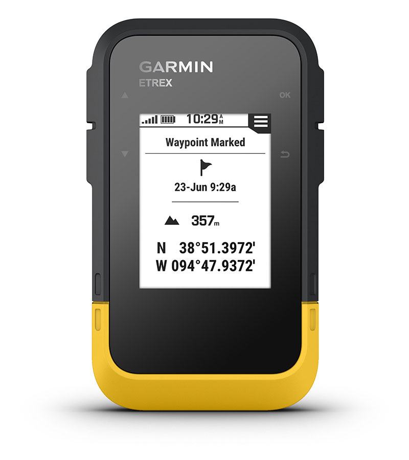
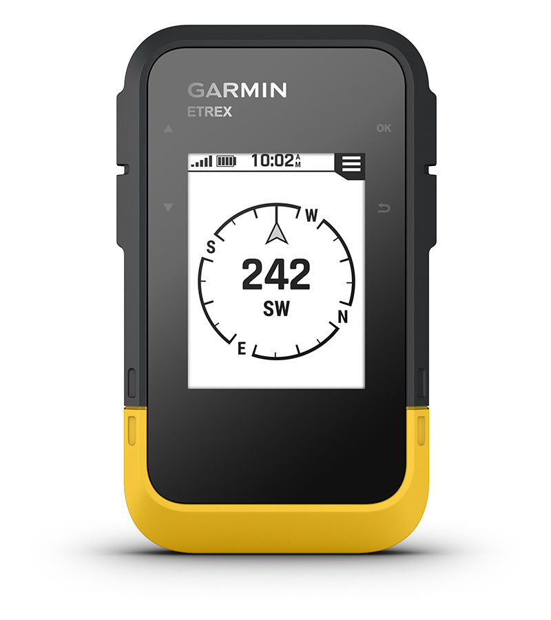
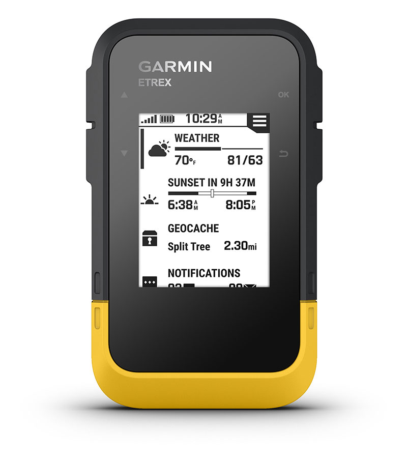
Only Garmin could make the eTrex better. The new serie eTrex retains the core functionality, rugged construction, affordability and long battery life that made eTrex the most dependable GPS device available. We improved the user interface and added a worldwide basemap, paperless geocaching and added support for spine mounting accessories. You’ll recognize the name. You’ll recognize the quality. But the serie eTrex is an entirely new device – a device that only Garmin could offer.
See the Way
eTrex 10 has an enhanced 2.2 in monochrome display that’s easy to read in any lighting situation. Its easy-to-use interface means you’ll spend more time enjoying the outdoors and less time searching for information. eTrex 20, eTrex 20x, eTrex 30 and eTrex 30x has an enhanced 2.2 in 65K colour, brilliant, sunlight-readable display. Durable and waterproof, feature the legendary toughness that’s built to withstand the elements – be it dust, dirt, humidity or water, none of which are a match for these legendary navigators.
Find Fun
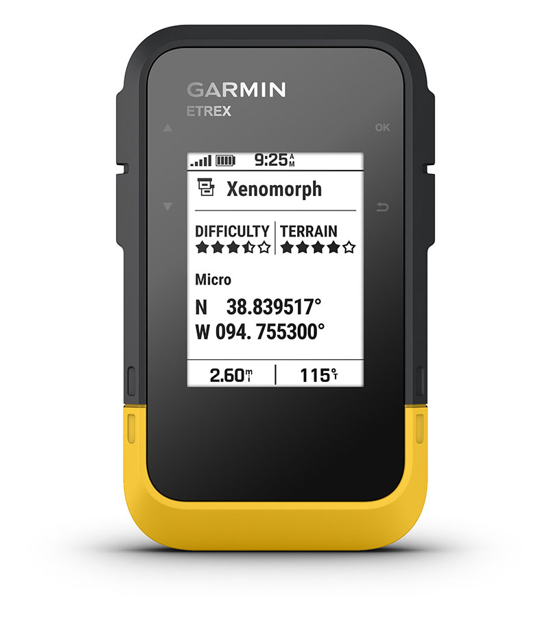
The serie eTrex features paperless geocaching by supporting GPX files for downloading geocaches and details straight to your unit. Visit OpenCaching.com to start your geocaching adventure. By going paperless, you're not only helping the environment but also making your geocaching more fun. The serie eTrex stores and displays all the information you need, including location, terrain, difficulty, hints and descriptions, which means no more manually entering coordinates and paper print outs. Simply upload the geocache to your unit and start hunting for caches.
Keep Your Fix
With its high-sensitivity, EGNOS-enabled GPS receiver and HotFix satellite prediction, the serie eTrex locates your position quickly and precisely and maintains its GPS location even in heavy cover and deep canyons. The advantage is clear — whether you’re in deep woods or just near tall buildings and trees, you can count on the eTrex to help you find your way when you need it the most.
Go Global
The new eTrex series is the first-ever consumer-grade receivers that can track both GPS and GLONASS satellites simultaneously. GLONASS is a system developed by the Russian Federation that will be fully operational in 2012. When using GLONASS satellites, the time it takes for the receiver to “lock on” to a position is (on average) approximately 20 percent faster than using GPS. And when using both GPS and GLONASS, the receiver has the ability to lock on to 24 more satellites than using GPS alone.
Add Maps
With its microSD card slot and 1.7 GB of internal memory, eTrex 20 and eTrex 30 and 3.7 GB for eTrex 20x and eTrex 30x lets you load our range of Ordnance Survey maps such as Garmin GB Discoverer and hit the trail, plug in BlueChart g2preloaded cards for a great day on the water or City Navigator NT map data for turn-by-turn routing on roads (see maps tab for compatible maps).The eTrex 20, eTrex 20x, eTrex 30 and eTrex 30x also supports BirdsEye select map download service, that lets you download premium raster maps to your device and integrate them with your existing maps.
Go Anywhere
With an array of compatible mounts, eTrex 20, eTrex 20x, eTrex 30 and eTrex 30x can be used on your bicycle, boat, in your car or motorbike and off-road vehicle. You even get turn-by-turn directions with the auto mount and City Navigator NT maps. Wherever you think you might take eTrex, it has the mapping and mounts to get you there.
Share Wirelessly
The eTrex 30 and eTrex 30x lets you share your waypoints, tracks, routes and geocaches wirelessly with other compatible Garmin GPS devices. So now your friends also can enjoy your favorite hike or cache – simply press “send” to transfer your information to similar units, and let the games begin.
GPS de Mano Garmin Serie eTrex
Ver todos os detalhes do produto »
$ 149.99 USD
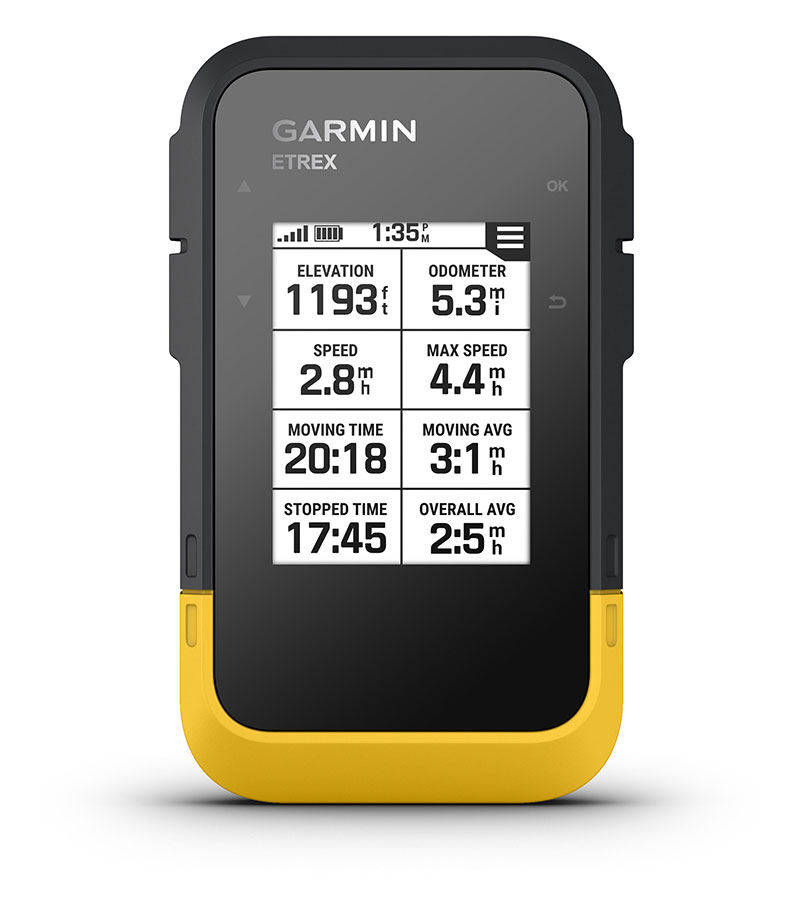
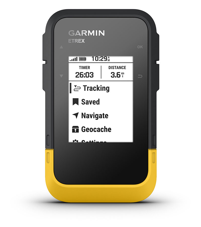
Adventure easily with this simple-to-use GPS handheld with extra battery life, wireless connectivity and multi-GNSS support — so you can enjoy exploring more.
| Bright sunlight is no problem with the high-resolution 2.2” screen. | Head out more often with up to 168 hours of battery life. | Into geocaching? Get automatic updates from Geocaching Live to find your next cache. | Plan trips and more when you pair with the Garmin Explore™ smart-device app. | Need accurate tracking? You got it, even in challenging environments with multi-GNSS support. |
Keep your bearings with the digital compass so you’re always on course.
|
![]() |
MULTI-GNSS SUPPORTAccess multiple global navigation satellite systems (GPS, GLONASS, Galileo, BeiDou and QZSS) to track in more challenging environments than GPS alone. |
GEOCACHINGGet automatic cache updates from Geocaching Live, including descriptions, logs and hints. When connected to the Garmin Explore app, each find will upload to your Geocaching.com profile. |
![]() |
![]() |
DIGITAL COMPASSFollow your bearing on the digital compass, which provides an accurate heading even when stationary. |
ACTIVE WEATHERWhen connected to the Garmin Explore app, you can get real-time forecast information, so you’re aware of the changing conditions. |
![]() |
![]() |
GARMIN EXPLORE APPConnect with the Garmin Explore app for wireless software updates, cloud storage, trip planning, smart notifications and additional mapping. |
BATTERY LIFEGet long battery life of up to 168 hours in standard mode and up to 1,800 hours in expedition mode with 2 field-replaceable AA batteries (not included). |
![]() |
Note: Requires two (2) AA batteries
| General |
|
|---|---|
|
Dimension |
2.4" x 4.0" x 1.3" |
| Display Size | 1.3" x 1.7" 2.16" diag |
| Display Resolution | 240 x 320 pixels |
| Display Type | 2.2" transflective, monochrome |
| Weight | 5.5 oz with batteries |
| Waterproof | IPX7 |
| Battery Type | 2 AA batteries (not included) |
| Battery Life | 168 hours in standard mode; 1,800 hours in expedition mode |
| Interface | USB-C |
| Memory/History | 28MB |
| Maps and Memory | |
| Basemap | yes (cities only) |
| Waypoints/Favorites/Locations | 1,000 |
| Courses | 50 |
| TRACKS | ![]() |
| Activities | 200 |
| Navegation Routes | ![]() |
| Sensors | |
| High-Sensitivity Receiver | ![]() |
| GPS | ![]() |
| GLONASS | ![]() |
| GALILEO | ![]() |
| QZSS | ![]() |
| BEIDOU | ![]() |
| Compass | ![]() |
| GPS Compass (While Moving) | ![]() |
| Daily Smart Features | |
| Smart Notifications on Handheld | ![]() |
| Weather | ![]() |
| Outdoor Recreation | |
| Point-to-Point Navigation | ![]() |
| TRACBACK® | ![]() |
| Area Calculation | ![]() |
| Sun and Moon Information | ![]() |
| GEOCACHING-Friendly | ![]() |
| Outdoor Applications | |
| Compatible With GARMIN EXPLORE™ App | ![]() |
| Connections | |
| Connections Wireless Connectivity | yes (BLUETOOTH®) |
EO20233003
Ver todos os detalhes do produto »
$ 799.95 USD
The rugged Montana 700 navigation device combines the flexibility of on-road or off-road navigation with global messaging and interactive SOS alerts using inReach1 satellite communication technology, plus an integrated 8 megapixel camera.
Text your loved ones, post on social media, or communicate with another inReach device in the same area (requires an active subscription to a satellite service).
In an emergency, activate an interactive SOS message to GEOS, a professional 24-hour global control and response center (requires an active subscription to a satellite service).
Instead of relying on mobile coverage, your messages, SOS alerts and tracking options are now transferred via the Iridium® satellite network with fully global coverage (active subscription to satellite service required).
The available inReach weather forecast service provides detailed updates directly to the Montana navigation device or paired devices, so you know what to expect along the way.
This waterproof and navigation device is tested to US military standards and features a 5 ”glove-friendly touchscreen that is 50% larger than previous Montana models.
Capture images of your exploits with Montana's 8 megapixel digital camera. Geotag photos with coordinates so you can return to your favorite places in the future.
Seamless transition between trail and road navigation with the preloaded City Navigator street map, which guides you as you drive with easy-to-follow turn-by-turn directions. (EUROPE).
Use direct-to-device downloads of BirdsEye satellite imagery (no annual subscription required) to see realistic views and create waypoints based on landmark locations.
Use ABC sensors on your next ride, including an altimeter for elevation data, a barometer to monitor weather changes, and a three-axis electronic compass.
Use mobile connectivity2 to access up-to-date Active Weather forecasts through the Garmin Connect ™ app.
Ideal for hunters and trainers, Montana syncs with Astro® or Alpha® series navigation devices (sold separately) to keep track of sporting dogs in the field.
| Specs | |
|---|---|
| Physical and Performance Characteristics | |
| Dimensiones | 9,1 x 18,30 x 3,27 cm |
| Screen Dimensions | 6,48 x 10,80 cm; 12,70 cm in diagonal |
| Screen Resolution | 480 x 800 px |
| Screen Type | Transflective WVGA, dual orientation |
| Weight | 410 g with included lithium-ion battery |
| Battery | rechargeable lithium-ion (included) |
| Battery Life |
|
| Water Resistance Classification | IPX7 |
| Interface | High-speed micro-USB and NMEA 0183 compatible |
| Record | 16GB (user space varies based on included maps) |
| Maps and Memory | |
| Pre-installed Maps | Yes (Europe TopoActive) |
| Automatic Route Creation | Yes (with optional maps with detailed road information) |
| Map Tracking | 15000 |
| Includes hydrographic features with a high level of detail (coastlines, river coastlines, swamps, perennial and seasonal streams) | |
| Includes searches for points of interest (parks, camping areas, scenic watchtowers and picnic areas) | |
| It shows national, regional and local parks, forests and natural landscapes. | |
| Storage and Loading Capacity | Yes (max 32GB microSD ™ card) |
| Route Points | 10000 |
| Tracks | 20,000 points, 250 saved gpx tracks and 300 saved exercise activities |
| Routes | 250, 250 points per route; 50 automatic route points |
| Sensors | |
| Compass | 250, 250 points per route; 50 automatic route points |
| Outdoor Leisure Functions | |
| Geocaching Mode | Yes (live geocaches) |
| Compatible with Custom Maps | Yes (500 custom map tiles) |
| Camera | Yes (8 megapixels with autofocus; automatic geotagging) |
| Outdoor Applications | |
| Dog Tracking | Yes (when linked to a compatible dog tracking system) |
| Connections | |
| Wireless Connectivity | Yes (Wi-Fi®, Bluetooth®, ANT + ®) |
(S 23/9/2021)
Ver todos os detalhes do produto »
$ 479.99 USD
With high-sensitivity GPS and GLONASS satellite tracking, worldwide basemap with shaded relief and customizable buttons for 1-touch image capture and waypoint marking, Oregon 650 opens a new world of GPS mapping and positioning.
Quality Photos
Take quality photos with Oregon 650's built-in 8 MP autofocus digital camera. Each photo is geotagged, allowing you to navigate back to that exact spot. Share the photos with all your friends through Garmin Adventures. For more storage, insert a microSD™ card; you can even view pictures from other devices on microSD card with Oregon's picture viewer.
Touch and Go
Oregon 650 has reflective display technology for the most brilliant, sunlight readable touchscreen we’ve ever made. It's as vivid in full bright sunlight as it is in shade. The screen has been strengthened for impact resistance but still accommodates gloved operation. And with dual-orientation, multi-touch screen, you won’t just look at maps, you’ll interact with them when you zoom in, pan out and rotate the display.
Double Your Power
Oregon 650 features our state-of-the-art dual battery system. You’ll have the option of using the internally rechargeable NiMH pack (included) or traditional AA batteries — NiMH pack charges when the device is connected to external power.
Get Your Bearings
Oregon 650 has a built-in 3-axis electronic compass with accelerometer tilt compensation to show where you're heading even when standing still, or not holding it level. Its barometric altimeter tracks changes in pressure to pinpoint your precise altitude. You can even use it to plot barometric pressure over time to keep an eye on changing weather conditions.
With its high-sensitivity, WAAS- and GLONASS-enabled GPS receiver and HotFix® satellite prediction, Oregon 650 locates your position quickly and precisely, and maintains its GPS location even in heavy cover and deep canyons.
Share Wirelessly
With Oregon 650 you can share your waypoints, tracks, routes and geocaches up to 50 times faster with other wireless compatible Garmin handheld devices. Plus, you can share large files too like photos, Garmin Adventures and Custom Maps. Just touch “send” to transfer your information.
Add Maps
Adding more maps to Oregon is easy. Load TOPO U.S. 24K maps and hit the trail; add Trailhead Series TOPO maps and explore famous treks like the Appalachian Trail and the Pacific Crest Trail; plug in BlueChart® g2 preloaded cards for a great day on the water; or load City Navigator® map data for turn-by-turn routing on roads. Add satellite images to your maps with BirdsEye Satellite Imagery (subscription required).
Load All the Geocaches
No more picking, choosing and planning, just download them all. The Oregon 650 can hold up to 4 million. Download every cache on Geocaching.com. Load caches using your favorite program or website that supports GGZ files. All your paperless geocaching features will be there for every cache. Read full descriptions, hints and logs. Filter caches by size, terrain, difficulty and type. Connect to chirp-enabled caches. Record your logs in the field. Do it all.
Plan Your Next Trip
Take charge of your next adventure with BaseCamp™, software that lets you view and organize maps, waypoints, routes and tracks. This free trip-planning software even allows you to create Garmin Adventures that you can share with friends, family or fellow explorers. BaseCamp displays topographic map data in 2-D or 3-D on your computer screen, including contour lines and elevation profiles. It also can transfer an unlimited amount of satellite images to your device when paired with a BirdsEye Satellite Imagery subscription.
GPS de Mano Garmin GPSMAP Serie 64
Ver todos os detalhes do produto »
$ 499.99 USD
Thanks to a redesigned antenna for better satellite reception, the Oregon 750 GPS and GLONASS handheld puts even more of the great outdoors at your fingertips. Whether you’re hiking, hunting, climbing, kayaking, trail riding or whatever, this rugged navigator is ready for anything. It features multilink wireless connectivity (Wi-Fi, Bluetooth and ANT+), Active Weather support with animated radar overlays, a 1-year BirdsEye Satellite Imagery subscription and a built-in 3-axis compass with barometric altimeter.
More Connectivity, Less Complexity
The expanded wireless capabilities of Oregon 750 make it easier than ever to download software, receive smart notifications¹ and upload adventures to Garmin Connect. You can even share LiveTrack location data or geocache discoveries, unit-to-unit, with other compatible Garmin handheld devices. Smart notifications via Bluetooth connectivity with a compatible smartphone let you receive emails, texts and alerts right on your device. So you can see what’s going on while you’re getting away from it all. Comes standard with a dual battery system that lets you use traditional AA batteries or a rechargeable NiMH power pack.
Find Fun with Geocaching.com
The wireless Wi-Fi and Bluetooth links on your Oregon 750 makes it easier than ever to enjoy a superior geocaching experience. You can set your device to automatically stay up to date with all the latest caches from Geocaching.com. No more manual entry of coordinates or printing out cache details on paper.
Take Geotagged Pictures
Capture locations and memories with the 8 megapixel digital camera. Each photo is automatically geotagged, allowing you to easily navigate back to that exact spot in the future. You can upload and share your favorite photos with friends via Garmin Adventures™, part of the Garmin online community.
Navigate Your Way
The Oregon 750 handheld provides comprehensive navigation and tracking to guide you on and off the beaten path, using GPS and GLONASS plus ABC (altimeter, barometer and compass) sensor capabilities. The built-in altimeter provides elevation data to accurately monitor ascent and descent, while the barometer can be used to predict weather changes by showing short-term trends in air pressure. The 3-axis electronic compass keeps your bearing, whether you’re moving or not. There’s also a TracBack® feature on Oregon 750 to help you navigate back to your starting point the same way you came. You can also mark locations, such as your campsite, vehicle or other points of interest, to which you'd like return navigation.
Enjoy the View on a Vivid Display
The Oregon 750 handheld features a bright, sunlight-readable 3-inch color touchscreen display with dual orientation for landscape or portrait views. It easily supports multiple mapping options such as BlueChart® g2 HD for water navigation or City Navigator® NT for turn-by-turn driving directions. Durable and water-rated to IPX7, the Oregon series is built to keep delivering vital mapping and tracking data, no matter what the elements throw at you. Plus, you can even customize your Oregon’s display with free downloads of apps, widgets and data fields from the Garmin Connect IQ™ online store².
Plan Your Next Trip
Take charge of your next adventure with BaseCamp™, software that lets you view and organize maps, waypoints, routes and tracks. This free trip-planning software even allows you to create Garmin Adventures that you can share with friends, family or fellow explorers online. BaseCamp displays on your computer screen any topographic map data stored on the device, including contour lines and elevation profiles. It also can transfer an unlimited amount of satellite images to your device when paired with a BirdsEye Satellite Imagery subscription.
¹See Garmin.com/BLE for compatibility ²Apps, widgets and data fields will be introduced when they become available; not all products may be available all the time. Please check the website for current inventory of Connect IQ products.
The Bluetooth® word mark and logos are registered trademarks owned by Bluetooth SIG, Inc. Wi-Fi® is a registered trademark of the Wi-Fi Alliance.
GPS de Mano Garmin GPSMAP Serie 64
Ver todos os detalhes do produto »
Request Quote
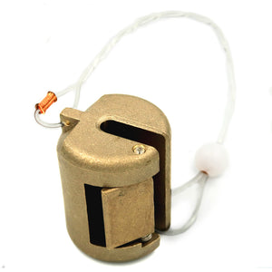
Used to activate all volume Niskin and GO-FLO Bottles The standard messenger will accomodate up...
Ver todos os detalhes do produto »
$ 65.99 USD
Measures the pH and moisture value of soil Range pH: 3~8 pH, Moisture: 1~8. pH...
Ver todos os detalhes do produto »
$ 45.00 USD
Can genes determine which fifty - year-old will succumb to Alzheimer's, which citizen will turn...
Ver todos os detalhes do produto »
$ 45.00 USD
Although there is scientific consensus that genetic factors play a substantial role in an individual’s...
Ver todos os detalhes do produto »
$ 24.95 USD
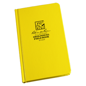
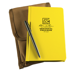
This All-Weather Bound Book comes equipped with 20 helpful geological reference pages, standard and metric...
Ver todos os detalhes do produto »
Request Quote
A garden of geologic delights for all Earthlings. Geopedia is a trove of geologic wonders...
Ver todos os detalhes do produto »
$ 40.00 USD
Perhaps the world’s most distinctive tree, ginkgo has remained stubbornly unchanged for more than two...
Ver todos os detalhes do produto »
$ 39.95 USD
The most comprehensive book on giraffes to appear in the last fifty years, this volume...
Ver todos os detalhes do produto »
$ 9.00 USD
These glass vials with polyseal cone-in caps are perfect for the bug picker in all...
Ver todos os detalhes do produto »
$ 40.00 USD
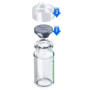
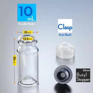
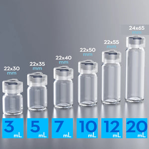
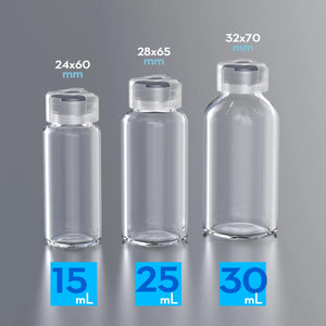
Innovative product, designed with convenience and security in mind, the anti-sheft clasp vial offers a...
Ver todos os detalhes do produto »
$ 29.95 USD
Planet Earth is heating up, and so is the debate over why our climate is...
Ver todos os detalhes do produto »
Request Quote
Global Warming Science introduces undergraduate students to the concepts and methods of global warming science,...
Ver todos os detalhes do produto »
Request Quote
Ver todos os detalhes do produto »
$ 21.25 USD
Getting your children excited about beekeeping is a wonderful opportunity to participate in an activity...
Ver todos os detalhes do produto »
Request Quote
The Spartan GoCam Solar Kit with Battery is the perfect solution for those seeking a sustainable power source for their trail cameras. This kit includes everything you need to keep your GoCam running for extended periods without needing to change batteries. Ideal for wildlife observers and nature enthusiasts, this kit ensures your camera is always ready to capture detailed images and videos without disturbing the natural environment.
| Specification | Detail |
|---|---|
| Warranty | 90 Days |
| Camera Compatibility | GoCam |
Ver todos os detalhes do produto »
$ 89.75 USD
Ver todos os detalhes do produto »
$ 103.25 USD
The AudioMoth GPS Hat is an add-on product designed to serve as a receiver for...
Ver todos os detalhes do produto »
Request Quote
| Capacity | 320 g | 500 g | 3200 g | 5000 g |
|---|---|---|---|---|
| Resolution (g) | 0.001 | 0.001 | 0.01 | 0.01 |
| Linearity (g) | ± 0.002 | ± 0.002 | ± 0.02 | ± 0.03 |
| Reproducibility (g) | ± 0.001 | ± 0.001 | ± 0.01 | ± 0.01 |
| Eccentricity (g) | ± 0.002 | ± 0.002 | ± 0.02 | ± 0.03 |
| Reading Time | Less than 1.5 seconds | |||
| Power Supply | 220 V / 50 Hz | |||
| Temperature | 0 ºC / 30 ºC | |||
| Warm-up Time | 50 minutes | |||
| Calibration | External | |||
| Weight Units | g | |||
| Interface | RS-232 | |||
| Air Humidity | Max 80% non-condensing | |||
| Hydrostatic Weighing | Optional | |||
| Weighing Plate Dimensions (mm) | 115 Ø | 160 Ø | ||
| Weighing Chamber Dimensions (mm) | 180 x 185 x 235 | N/A | ||
| Total Dimensions (mm) | 310 x 201 x 300 | 310 x 201 x 70 | ||
| Weight (kg) | 4 | 2 | ||
EO 20230721
Ver todos os detalhes do produto »
Request Quote
| Capacity | 120 g | 220 g |
|---|---|---|
| Resolution | 0.1 mg | |
| Linearity | +/- 0.4 mg | |
| Reproducibility | +/- 0.2 mg | |
| Eccentricity | +/- 0.2 mg | |
| Reading Time | 4 seconds | |
| Power Supply | 110V-265V, 50-60Hz, 2.0A | |
| Operating Temperature | +10ºC – +30ºC | |
| Warm-up Time | 8 h | |
| Calibration | external | |
| Weighing Units | g, ct, lb, oz | |
| Interface | RS232C | |
| Air Humidity | 20% – 85% | |
| Weighing Pan Dimensions (mm) | 90 Ø | |
| Weighing Chamber Dimensions | 185 x 180 x 230 | |
| Balance Dimensions (mm) | 210 x 310 x 320 | |
| Net Weight of Balance (kg) | 4.4 kg | |
| Packaging Dimensions (mm) | 370 x 485 x 450 | |
| Total Weight with Packaging (kg) | 7.2 kg | |
EO 20230810
Ver todos os detalhes do produto »
Request Quote
A portable, practical, and expertly illustrated field guide to more than a hundred grasses, rushes,...
Ver todos os detalhes do produto »
$ 95.00 USD
The first book of its kind for South America. This is the first volume of...
Ver todos os detalhes do produto »
$ 42.90 USD
Enjoy the beauty of hummingbirds in your own garden with this stunning hand-blown glass feeder. Designed to attract these birds with its vibrant colors and nature-inspired details, this feeder offers a unique and delightful experience for wildlife enthusiasts. Each piece is one-of-a-kind and crafted with attention to detail to provide you with a beautiful, functional, and durable product.
| Target species | Hummingbird |
|---|---|
| Recommended uses | Nectar |
| Material | Glass |
| Special features | Fade-resistant, built-in ant moat |
| Mounting type | Hanging mount |
Ver todos os detalhes do produto »
$ 108.95 USD
GRS Densitometer: Precision Canopy and Cover Mapping, Redefined. The GRS Densitometer™ is the most accurate...
Ver todos os detalhes do produto »
$ 42.50 USD – Vendido
The world’s most bird-rich nation finally has a new field guide. The book is easy...
Ver todos os detalhes do produto »
Request Quote
The identification and analysis of the particular habitat needs of a species has always been...
Ver todos os detalhes do produto »
Request Quote
The first field guide to all of the world’s major land habitats―richly illustrated and packed...
Ver todos os detalhes do produto »
$ 119.00 USD
With the classic Barktax instrument you will instantly have a reliable measure of the bark thickness. Bark thickness...
Ver todos os detalhes do produto »
$ 244.75 USD
The CI is the ideal instrument to measure the inclination of trees, buildings, walls, tunnels, roads, etc. Any field professional will appreciate the CI's simplicity and accuracy. Simply point and press the button, and the angle will be presented to you.
| specs | |
|---|---|
| Dimensions | 20 x 63 x 44 mm |
| Weight | 50 g |
| Temperature | Min -15 ° Max 45 ° C |
| Drums | 1 x 1,5 V AA alkaline. warning when low |
| Display | LCD, backlit |
| Consumption | 15 mW |
| Angle | -55˚ < angle <85˚. Resolution: 0,1˚. Precision: + -0,2˚ |
(DR 20220822)
Ver todos os detalhes do produto »
$ 2,055.00 USD
The DP II+ has been significantly enhanced to deliver superior performance. With a 120 MHz floating-point processor, 8 GB flash memory, and an upgraded backlit display, the DP II+ is nearly three times faster than its predecessor. This device is field-ready, fully adapted, rugged, and features a durable and balanced construction. Additionally, it offers a wide range of communication options, being compatible with Vertex 5, Vertex Laser Geo, Laser Geo, PC, or other handheld devices.
All Haglöf Sweden products are designed for professionals who work in extreme conditions. The DP II+ caliper meets the demands and specifications of foresters regarding dust, shock, vibration, temperature, pressure, moisture, and overall user friendliness.
Haglöf Sweden has been working on software programming for field applications for 25 years. We have a wide selection of ready-made solutions for most forest field jobs, available in many languages. Contact us with your ideas, and together we will find a solution that suits you and your organization.
The DP II+ incorporates significant data processing and calculation capacity. Your workday can start and end in the forest, with your portable office in the pocket-size DP II+ computer terminal. All data securely stored and processed in one place!
The unique accessories and add-ons designed for use with the DP II+ add value and versatility. With Gator Eyes laser pointers, you can measure tree diameter from a distance, even in adverse conditions such as strong winds or moving water.
| Specification | Detail |
|---|---|
| Memory | 1GB Flash File System non-volatile high security. 2Mb high-speed RAM. 8Mb Flash for program storage. |
| Processor | Low power Arm Cortex Cpu 120MHz inc. floating point unit. |
| Temperature | Min -20° Max 60° C/ Min -4° Max 140° F. |
| Battery | Rechargeable Li-ion, USB-interface charge. |
| Consumption | One week/charge/ software depending. |
| Key/Buttons | 6 Keys. 2 Execution/Enter; One on keyboard and one on handle for index finger. 4 Navigation keys on the keyboard; Up, Down, Left and Right. Double key quick commands: Display light, Sleep mode, Escape/Return and IR input. |
| Measuring system | Technical: Non contact, sealed. Scale: Aluminum, non reflecting, clear digits. Jaws: Foldable aluminum, Patented. |
| Accuracy | +-1mm or 0.039 inch |
| Resolution | Min 0.1mm/0.01” |
| Measuring range | Standard; 500, 650, 800, 950 and 1020 milimeter and 18”, 24”, 30”, 36” and 40” inch. Scale lengths German certification/classification: 500mm; 600mm; 800mm, 1000mm. |
| Weight | Caliper and terminal: <1kg/2.20 lbs (500mm/18” standard). Terminal only: 150g/6oz. |
| Display | Graphic, 128 x 64 pixles. Highly efficient background light. |
| Communication | USB 2.0 MSD; External serial port via adapter USB (CDC) via adapter. Bluetooth® v4.2 dual mode: (SPP, HID KEYBOARD, BLE) IR receiver for all Vertex and Geo models. |
| Bluetooth® | Bluetooth® v4.2 dual mode: (SPP, HID KEYBOARD, BLE) |
| Clock | Real Time Clock with calendar and time. |
| Signal | Built-in loudspeaker. |
| IP Classification | IP67 Moist/dust resistant |
| Classification | PTB, FPA, CE, FCC. |
Ver todos os detalhes do produto »
$ 878.50 USD
Add-on combination module for navigation and distance measuring with ultrasound on your DP computer caliper....
Ver todos os detalhes do produto »
$ 3,988.50 USD
The DP II+ has been significantly upgraded for top performance. With a 120 MHz floating-point processor, 8 GB flash memory, and an improved backlit screen, it's nearly three times faster than its predecessor. Built tough for fieldwork, it’s fully adapted, durable, and well-balanced. It supports a wide range of communication options and is compatible with Vertex 5, Vertex Laser Geo, Laser Geo, PC, and other portable devices.
All Haglöf Sweden products are built for professionals working in tough conditions. The DP II+ meets forestry standards for dust, shock, vibration, temperature, pressure, humidity, and ease of use.

Haglöf Sweden has developed field software for 25 years. We offer a wide selection of ready-made solutions for forestry tasks, in many languages. Contact us with your ideas and we’ll help you find the right solution for your needs.
The DP II+ has strong processing power for calculations and data handling. You can start and finish your workday in the forest with this pocket-sized field computer. All data is securely stored and processed in one place!
Special accessories made for the DP II+ add value and versatility. The Gator Eyes laser pointers let you measure tree diameters from a distance, even in challenging conditions like strong wind or running water.

| Specification | Details |
|---|---|
| Memory | 1GB high-security non-volatile flash file system. 2MB high-speed RAM. 8MB flash for software storage. |
| Processor | Low-power Arm Cortex CPU 120MHz with floating-point unit. |
| Temperature Range | Min -20°C / -4°F, Max 60°C / 140°F |
| Battery | Rechargeable lithium-ion, charges via USB interface. |
| Battery Life | Lasts up to one week per charge, depending on software use. |
| Keys/Buttons | 6 keys. 2 Enter/Execute (one on the keyboard, one on the handle). 4 directional keys (Up, Down, Left, Right). Dual-key shortcuts: Display light, Sleep mode, Escape/Return, IR input. |
| Measurement System | Technical: contactless, sealed. Scale: non-reflective aluminum with clear digits. Jaws: foldable aluminum, patented. |
| Accuracy | ±1mm or 0.039 inches |
| Resolution | Min 0.1mm / 0.01 inches |
| Measurement Range | Standard: 500, 650, 800, 950, 1020 mm and 18", 24", 30", 36", 40". Certified German scale lengths: 500mm, 600mm, 800mm, 1000mm. |
| Weight | Caliper + terminal: <1kg / 2.20 lbs (500mm standard). Terminal only: 150g / 6oz. |
| Display | Graphic display, 128 x 64 pixels. High-efficiency backlight. |
| Communication | USB 2.0 MSD; external serial port via USB adapter (CDC). Bluetooth® v4.2 dual mode (SPP, HID KEYBOARD, BLE). IR receiver for all Vertex and Geo models. |
| Bluetooth® | Bluetooth® v4.2 dual mode (SPP, HID KEYBOARD, BLE) |
| Clock | Real-time clock with calendar and time. |
| Signal | Built-in speaker. |
| IP Rating | Dust/moisture resistant IP67 |
| Certifications | PTB, FPA, CE, FCC |
Ver todos os detalhes do produto »
$ 3,320.00 USD
The market-leading and technically advanced DP II caliper - program, customize and & accessorize it to fit your exact diameter measuring requirements!
The DP II is an easy-to-use, versatile and super efficient diameter instrument system, adapted for timber cruising, log scaling, and standing tree inventory. Many attractive features make the DP II an optimized and complete solution for modern measurement work in forests and on industries.
DP II ADVANTAGES The DP II is field-ready, fully adapted, rugged and with a well balanced and durable construction. You will quickly notice how easy is communicates through USB, Bluetooth® & IR. It is compatible with your Vertex IV, the VL5, the L5, your PC or other handheld. Since your DP II is fully programmable we have made a truck-load of program options and ready-made software applications. Nevertheless we are always keen on customizing applications for you and your organization. If you feel it is hard to choose, and when your work includes measurement of both standing trees and timber, scaling and cruising, calibration and taxation, you can load your DP II with more than one program and switch between the different applications.
With the DP II you get great field computing features. You work with a rugged field machine with foldable jaws (takes up less space, and is easier to carry with you when moving in the forest). The detachable computer terminal can be used as a stand-alone handheld computer - and if your DP II is equipped with the Radio Enter button, you can keep the tiny (but powerful!) computer in your pocket and send diameter data from your SmartScale.
The DP II offers a multi-language operating system, a non-contact SmartScale measuring system; and rechargeable, long-lasting batteries. Add value and versatility by using the unique accessories and add-ons uniquely designed to use with the DP II.
The DP II is tested. Certified. Approved. Contact us for discussions on how the DP II can be used to increase your efficiency!

All Haglöf Sweden products are designed for field professionals who work outside in more or less extreme conditions. The DP II caliper meets the demands and specifications of foresters regarding dust, shock, vibration, temperature, pressure, moisture and overall user friendliness.
Haglöf Sweden have worked with software programming for field applications for 25 years. We have a great selection of ready-made solutions for most jobs in forest and field, and in many languages. Contact us with your ideas for how you wish to work. Together, we will come up with a solution that fits you and your organization!
— Forest inventory - Timber Cruising - Log scaling — Harvester Calibration— Wildlife & fish inventory — Construction
Ask for customized software, specifically designed for your organization! Work seamlessly; streamline your flow, and most importantly - work the way you want to work, with reports and results presented to you the way you need them to be. Take advantage of our big treasury of ready-made systems. Combine your expertise with our experience and our common will to explore new solutions and ideas. Together we will make it work!
The DP II incorporates great data processing and calculation capacities. Your workday can start and finish off in the forest, with your portable office in the pocket-size DP II computer terminal. All data securely stored and processed in one safe place!
Ver todos os detalhes do produto »
$ 1,215.00 USD
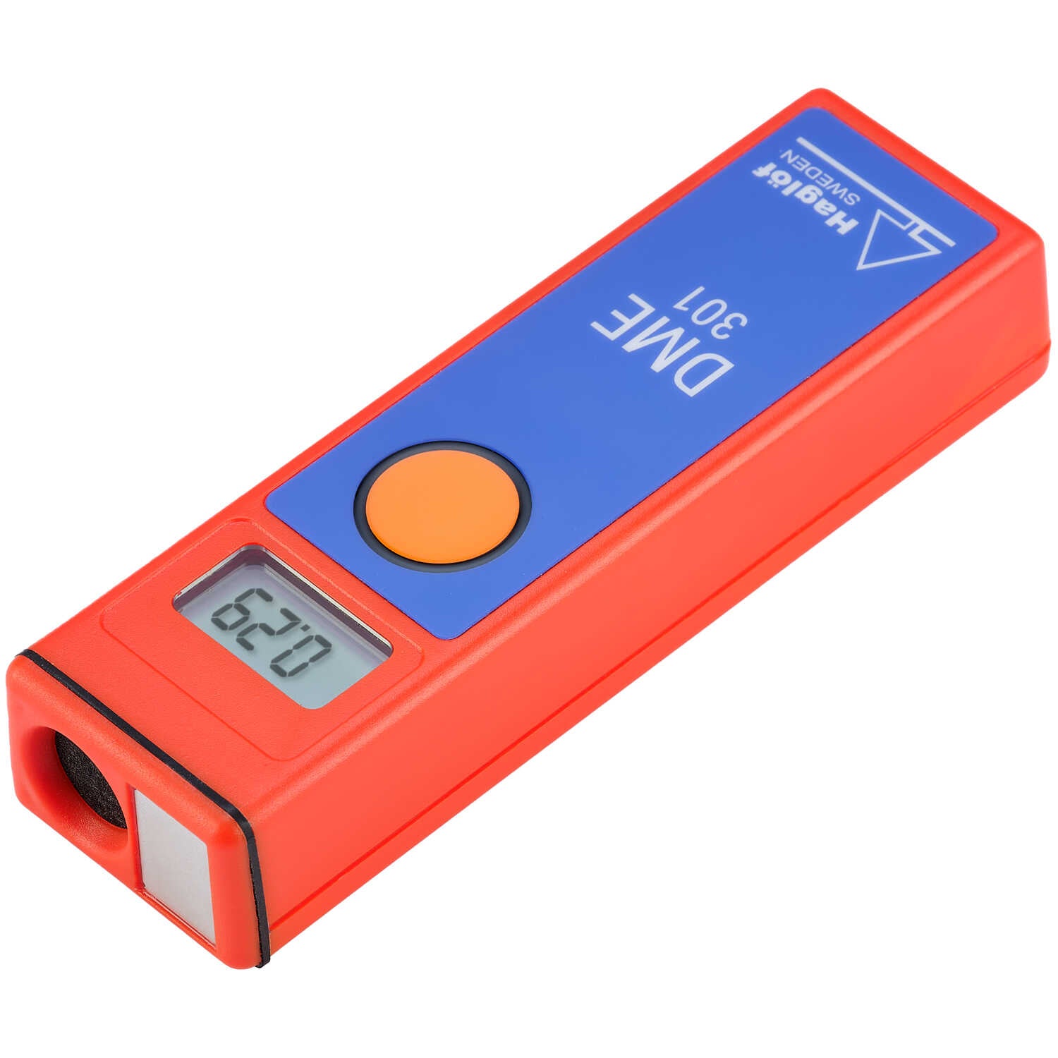
The DME 301 is the modern evolution of the reliable DME 201, widely used since the 1990s. This new version features advanced electronics, a graphical display, T4 transponder with LED indicators, and innovative functions such as BAF calculation and distance exceedance alerts. Thanks to its ultrasonic technology, the DME 301 provides fast and accurate readings even in densely vegetated environments. It can operate with a T4 transponder or alongside another DME 301 for a variety of applications including forest inventories, layout work, and road construction.
The T4 is the new and improved transponder replacing the T3 and all previous transponders. The T4 is equipped with six built-in LEDs that provide essential feedback:
The T4 is fully compatible with older measuring instruments, making it a perfect upgrade for all users. Introducing the T4 transponder—the future standard for all measuring instruments, including Vertex 5, Vertex Laser Geo, and DME...
| DME 301 | |
|---|---|
| Battery | 1 x 9V alkaline battery |
| Power consumption | 7 mA |
| Operating temperature | -15 °C to +45 °C / 5 °F to 113 °F |
| Ultrasonic frequency | 25 kHz |
| Range | Up to 30 m (98 ft); with 360° adapter: up to 20 m (60 ft) |
| Resolution | 0.01 m / 0.1 ft |
| Accuracy | ±1% or better |
| BAF factors | Variable from 0.0 to 999.9 |
| T4 Transponder | |
|---|---|
| Size | 70 mm diameter (2.8") |
| Weight | 85 g (3 oz) with battery |
| Battery | 1 x 1.5V AA battery |
| Power consumption | Max 9 mW |
| Indicators | 6 LEDs for status and noise detection |
| Compatibility | Compatible with Vertex 5, Vertex Laser Geo, DME, and earlier models |
| 360° Adapter | |
|---|---|
| Diameter | 58 mm (2.3") |
| Height | 45 mm (1.8") |
| Weight | 35 g (1.2 oz) |
| Monopod | |
|---|---|
| Transport length | Part 1: 335 mm (13.2"), Part 2: 320 mm (12.6") |
| Length in use | Min: 350 mm (13.8"), Max: 1390 mm (54.7") |
| Weight | 335 g (11.8 oz) |
Ver todos os detalhes do produto »
$ 2,746.75 USD
Precision Electronic Clinometer with Distance Calculation Experience enhanced accuracy with the EC II-D, featuring rapid...
Ver todos os detalhes do produto »
$ 513.50 USD
The EC II D-R is more than just a clinometer—it's an essential tool for forestry professionals seeking accuracy in measuring inclinations, heights, and calculating basal area or volume. Equipped with a factor gauge and integrated functions, this device allows for easy and direct execution of complex calculations, reducing errors and boosting field efficiency. From measuring tree height to computing basal area using different factors, the EC II D-R is engineered to deliver superior functionality and reliable results.
| Size | 20 x 63 x 44 mm |
| Weight | 50 g (including battery) |
| Operating Temperature | -15°C to 45°C |
| Battery | 1 x 1.5V AA alkaline (included) |
| Display | Backlit LCD |
| Height Range | 0 to 999 m (0.1 m resolution) |
| Angle Range | -55° to 85° (±0.2° accuracy) |
| Basal Area Factors (BAF) | 0.5, 1, 2, 4 m²/ha or 5, 10, 20, 40 ft²/acre |
Ver todos os detalhes do produto »