SHIPPING QUOTE FOR OVERSIZED ITEMS MUST BE REQUESTED | WhatsApp Global CLICK HERE

$ 100.00 USD $ 130.00 USD
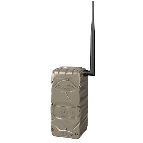
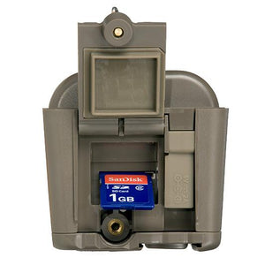
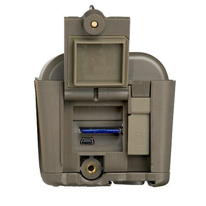
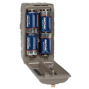
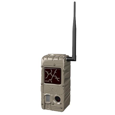
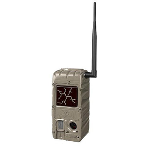
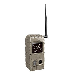
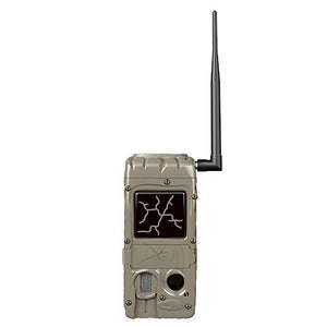
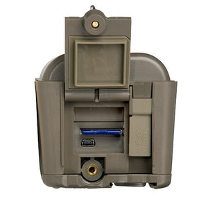
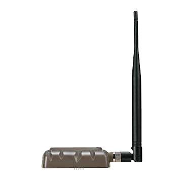
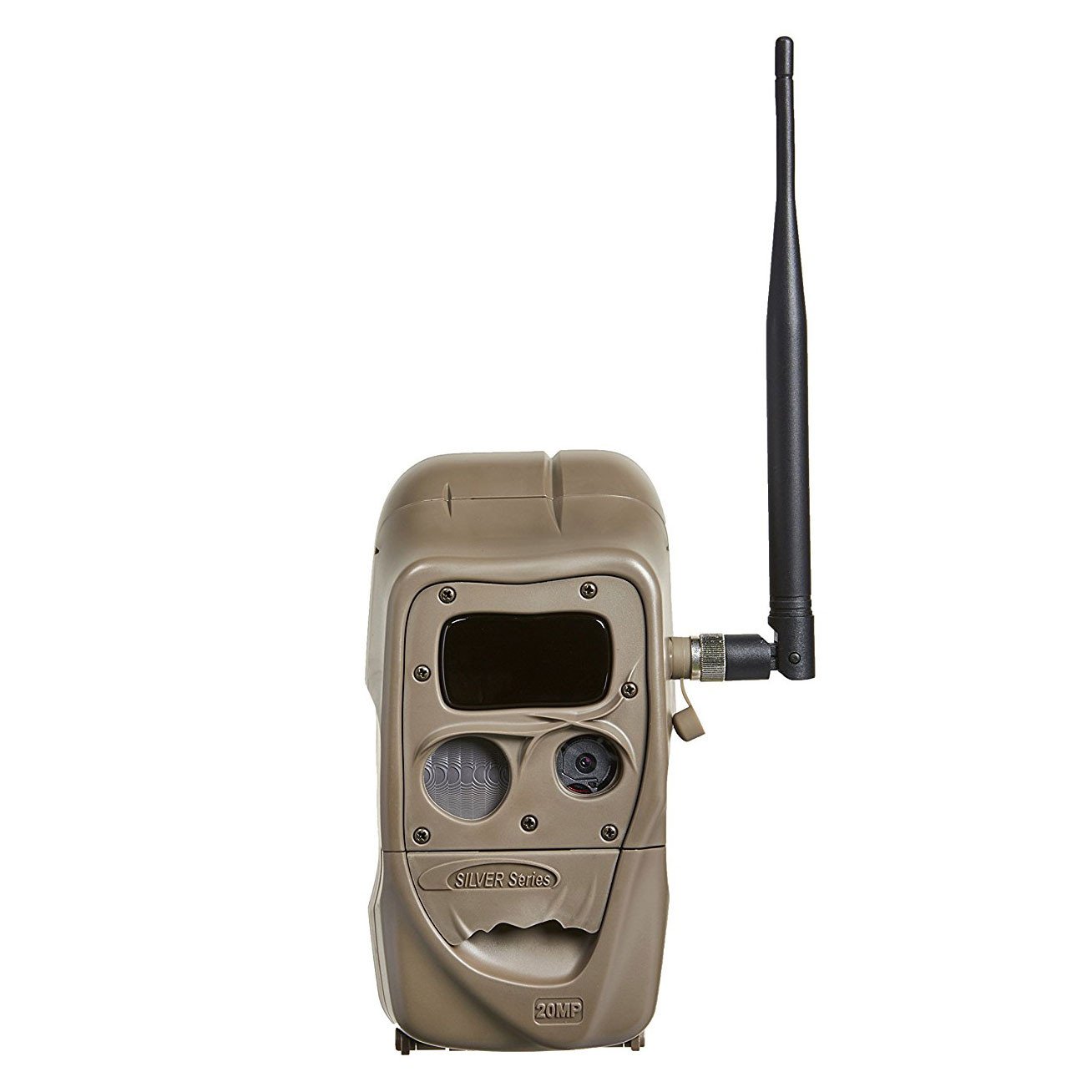
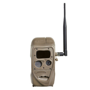
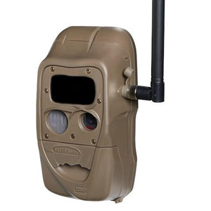
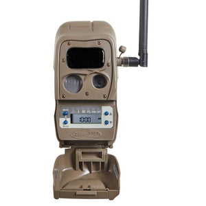
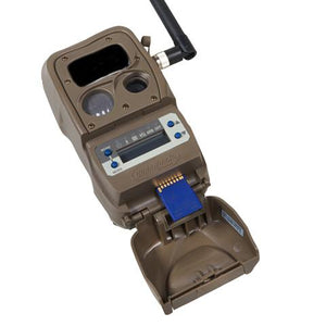
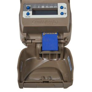
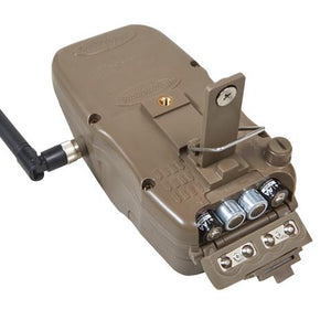
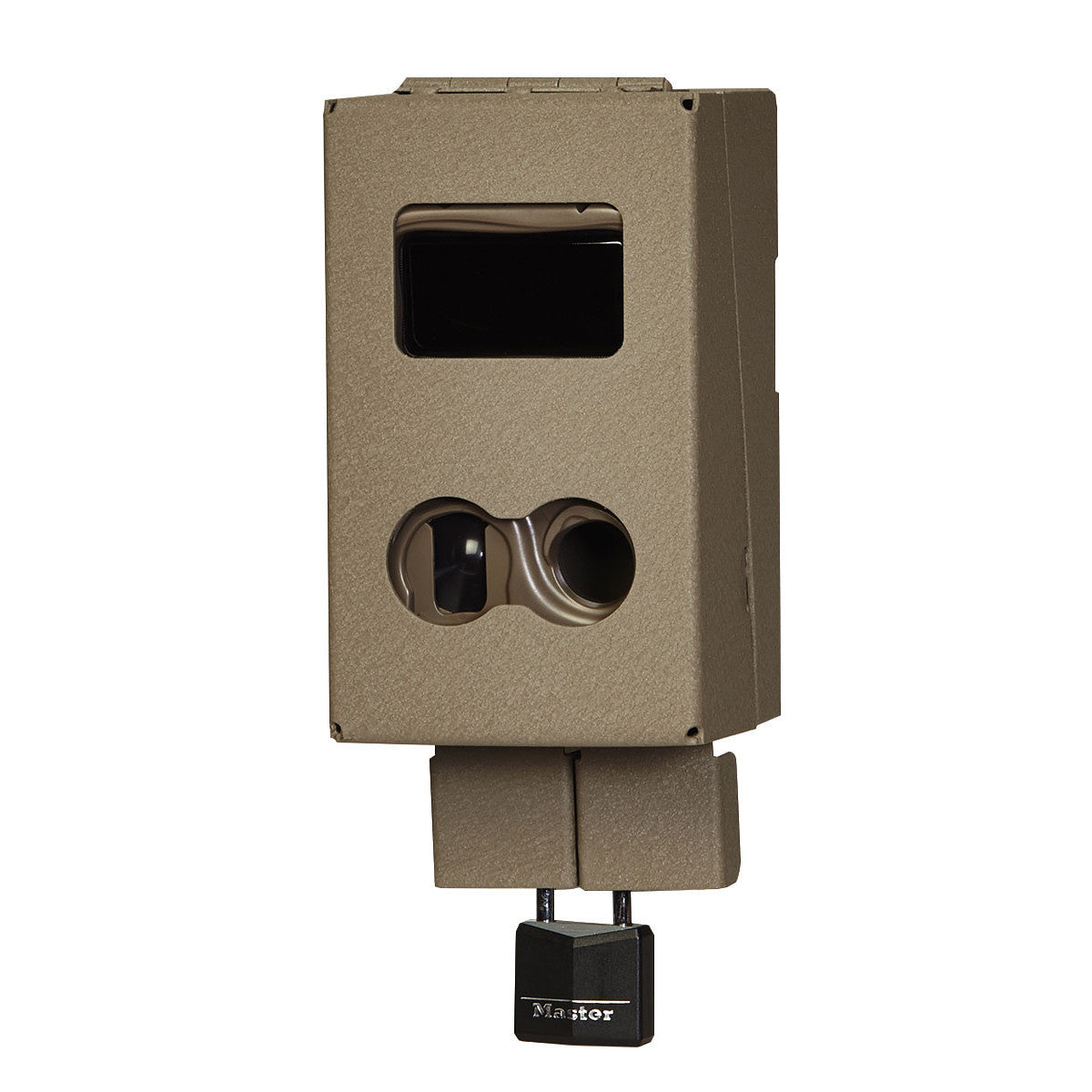
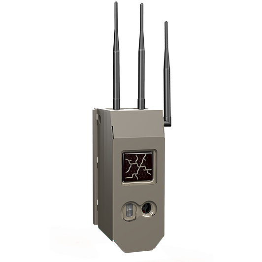
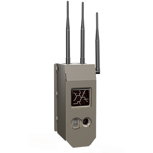
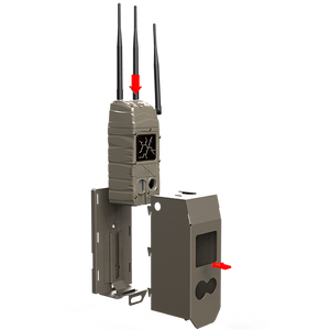
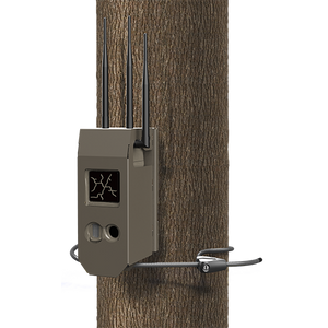
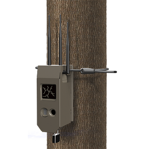
Discover the Power of Connectivity with CuddeLink L-Series Cell Home CuddeLink L-Series Cell Home takes...
$ 100.00 USD $ 130.00 USD

| General Information | |
|---|---|
| Technology | Patented CuddeLink Network Technology |
| Usage | Can be used as Remote or at HOME (non-cellular) |
| Compatibility | Compatible with all CuddeLink cameras (provided other cameras are on firmware v8.3) |
| Network | Links to a network of 24 cameras |
| Data Management | Allows user to avoid pulling multiple SD cards |
| Camera Features (IR) | |
| Sensor | 3rd generation sensor with 7 sensitivity settings |
| Resolution | High-definition sensor optimizing image clarity and brightness for LTE delivery and phone viewing |
| Shutter Speed | 1/4 second shutter speed |
| Delay | Patented automatic camera delay Delays ranging from 5 seconds to 5 minutes |
| Time Lapse Modes | Dual time lapse modes (Prime Time and Standard) |
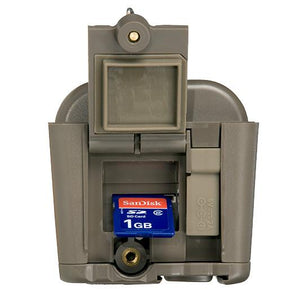
| Storage | Uses up to a 256GB SD card (*not included) |
| IR LEDs | Low glow IR LEDs (850nm) - 100 ft range |
| Display | Blue backlit display for easy viewing |
| Compatibility | Compatible with all power and mounting options |
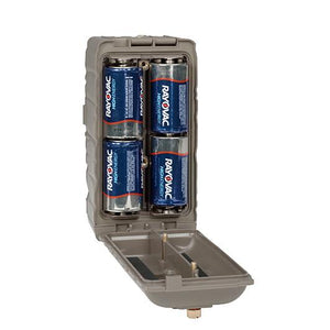
| Battery | Uses 4 D-cell batteries (*not included) |
| Warranty | |
| 2-year product warranty with online registration | |
Request Quote
$ 15.00 USD
Longer metal wrapped cables to allow placing a Cuddeback power accessory further from camera. Compatible...
$ 70.00 USD $ 110.00 USD
The Tracks LTE Camera combines Cuddeback’s advanced camera technology with robust LTE connectivity to deliver unparalleled performance in wildlife monitoring. Featuring dual paddle antennas for superior reception in areas with poor LTE coverage, this camera ensures you stay connected. The Tracks LTE Camera comes with dual SIM cards, allowing you to choose between Verizon or AT&T networks and switch carriers as needed. With a built-in user interface, 3rd generation animal sensor, Auto Camera Delay, and dual timelapse modes, it offers maximum flexibility and control. Remote management via Cuddeback's CAMP website or mobile app makes setup and monitoring easy from anywhere. Designed for long battery life with support for external power options, it is perfect for extended field use.
| Tracks LTE Camera Specifications | |
|---|---|
| Built-In User Interface: | For in-field setup directly on the camera. |
| Remote Setup: | Configuration via mobile app or web browser. |
| Dual Paddle Antennas: | For superior LTE reception, even in fringe areas. |
| Dual SIM Cards: | Includes Verizon and AT&T SIM cards; allows carrier switching at any time. |
| Trigger Speed: | ¼ second. |
| Timelapse Modes: | Dual modes (Prime Time and standard). |
| Animal Detector: | 3rd generation with 7 sensitivity levels. |
| Power Options: | Operates on 4 D batteries (not included); compatible with external battery and solar power options. |
| Storage: | Supports SD cards up to 256 GB (not included). |
| Image Reception: | Receive images via email, text, app, or web. |
| Infrared Illumination - Tracks IR: | 850nm IR LEDs for the longest night illumination with a range exceeding 100 feet. |
| Infrared Illumination - Tracks Black Flash: | 940nm IR LEDs for completely invisible illumination up to 75 feet. |
| Firmware Updates: | Automatic over-the-air updates via LTE. |
| Remote Control: | Adjust camera settings remotely via mobile app or web interface. |
| Data Management: | Multiple options for image reception and remote camera control. |
$ 200.00 USD
The Cuddeback Double Barrel 20MP - Model G-5048 is a high-quality trail camera designed to capture nighttime color images without motion blur. It uses the X-Change strobe flash system, allowing users to switch the type of flash according to their needs. Ideal for wildlife observation and photography in low-light conditions.
| Camera Specifications | |
|---|---|
| Model | G-5048 |
| Megapixels | 20 |
| Trigger Speed | 1/4 second |
| Strobe | 1-inch Xenon |
| Flash Type | Nighttime color images |
| Flash Range | 100 feet |
| Battery Type | 4 x D |
$ 82.50 USD
Each net is coated for durability and can be removed using a water-resistant zipper. The...
$ 79.95 USD $ 200.00 USD
The compact Cuddeback with full-size performance. AA batteries keep the camera compact and allows an illumination range of up to 40 feet. No glow IR cameras use infrared LEDs for night illumination. Night images are black & white and day images are color. Virtually no visible red glow even when looking at the IR LED. Great camera for all around use.
Download Trophy Room Image Management Software
Cámara de Rastreo Cuddeback 8MP Ambush Black Flash
fototrampa, cámara trampa, fototrampeo
$ 29.99 USD $ 35.00 USD
CuddeSafe is a heavy-duty metal enclosure made specifically to house your Cuddeback scouting camera. CuddeSafe...
$ 35.90 USD
CuddeSafe is a heavy-duty metal enclosure made specifically to protect your Cuddeback scouting camera from bears, theft, and vandals.
Protection from curious animals, such as bears and vandals and thieves, plus additional protection from the elements.
Caja de Seguridad CuddeSafe para Cámara de Rastreo Cuddeback Serie G, Caixa de segurança CuddeSafe para câmera de rastreamento
$ 35.00 USD
$ 35.00 USD
CuddeSafe is a heavy-duty metal enclosure made specifically to house your Cuddeback scouting camera. CuddeSafe...
$ 485.75 USD
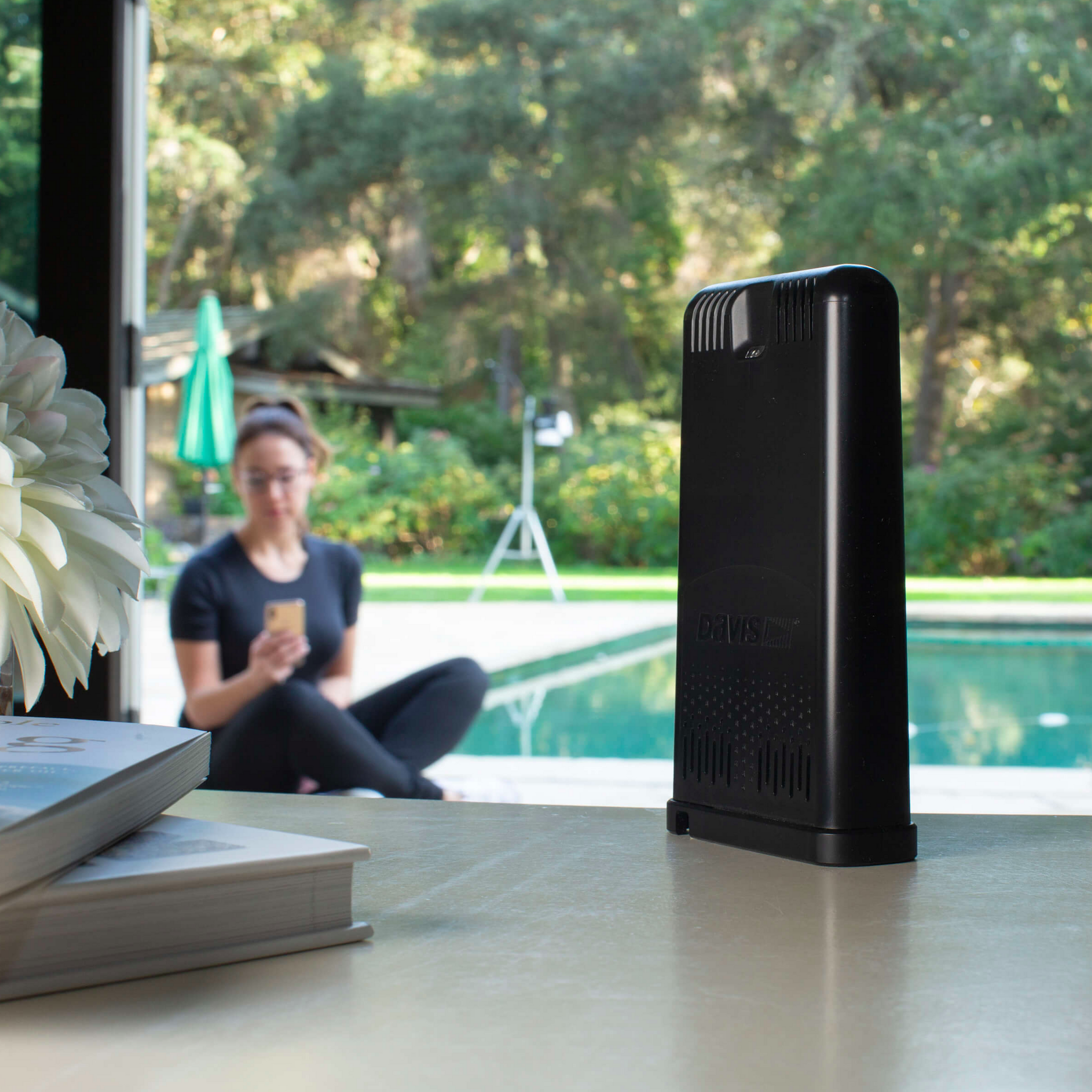
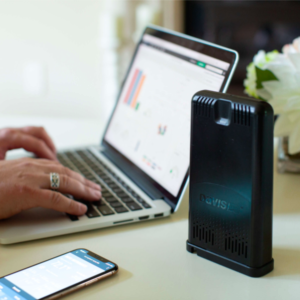
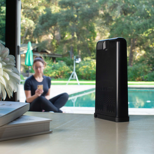
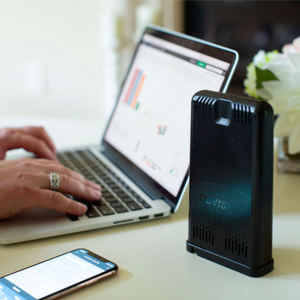
The brilliant, HD touchscreen allows you to easily navigate and analyze your hyperlocal weather data or view the latest conditions from anywhere in the room. The dynamic dashboard can be customized to see at-a-glance up to 21 parameters – from temperature to wind to rain. You can set hundreds of alarms to get notified when conditions that matter to you change, such as when temperatures begin approaching a critical point for outdoor work or when wind speeds reach a certain level. With a full database of historical data stored right on the console, the console offers easy access to graphs of the last 24 hours of data, last month, or the previous year.
The WeatherLink Console is a fully functional and powerful data display, storage, and analysis tool on its own – no Wi-Fi required. Or you can connect to Wi-Fi to join the WeatherLink community and upload and share data safely and securely. Use a free WeatherLink account to log in to all WeatherLink data viewing products and access all of your data on your phone or computer. Upgrade to Pro or Pro+ for more detailed analysis, charting, and mapping of data or to share your data with family, friends, the WeatherLink community, and beyond.
$ 485.75 USD
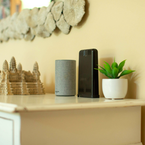
Stream live weather data over Wi-Fi to the WeatherLink Cloud: see updates on your smartphone...
$ 199.99 USD
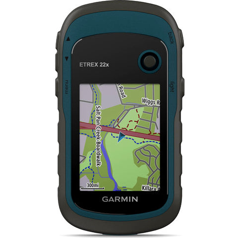
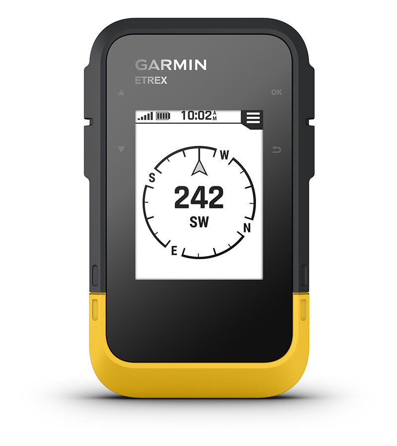
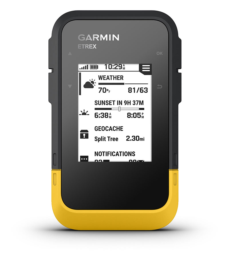
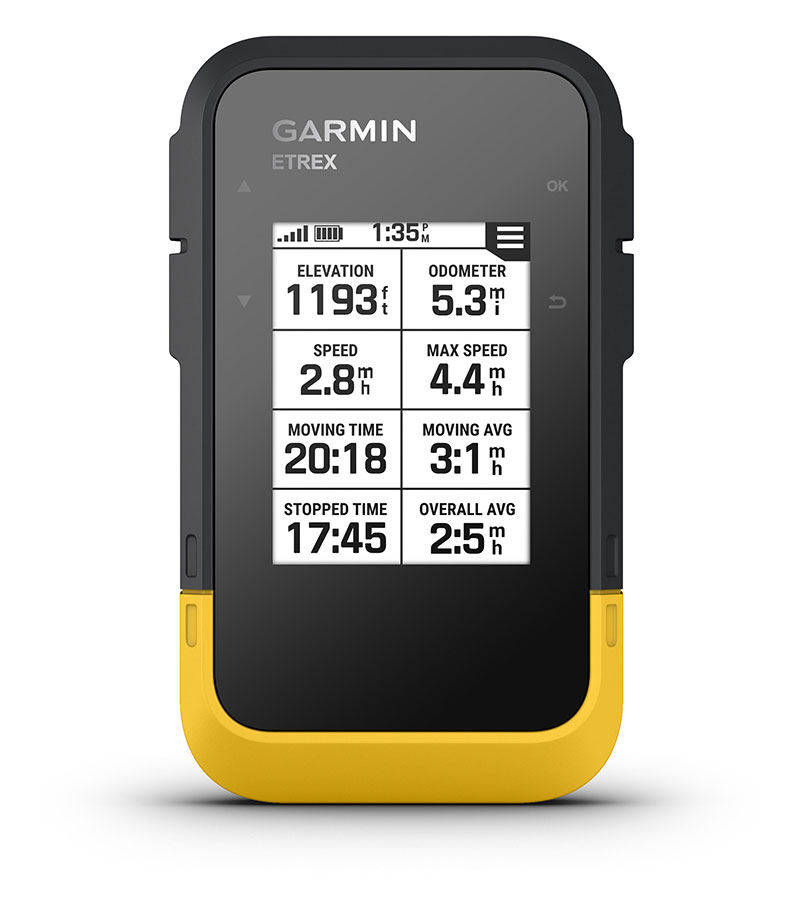
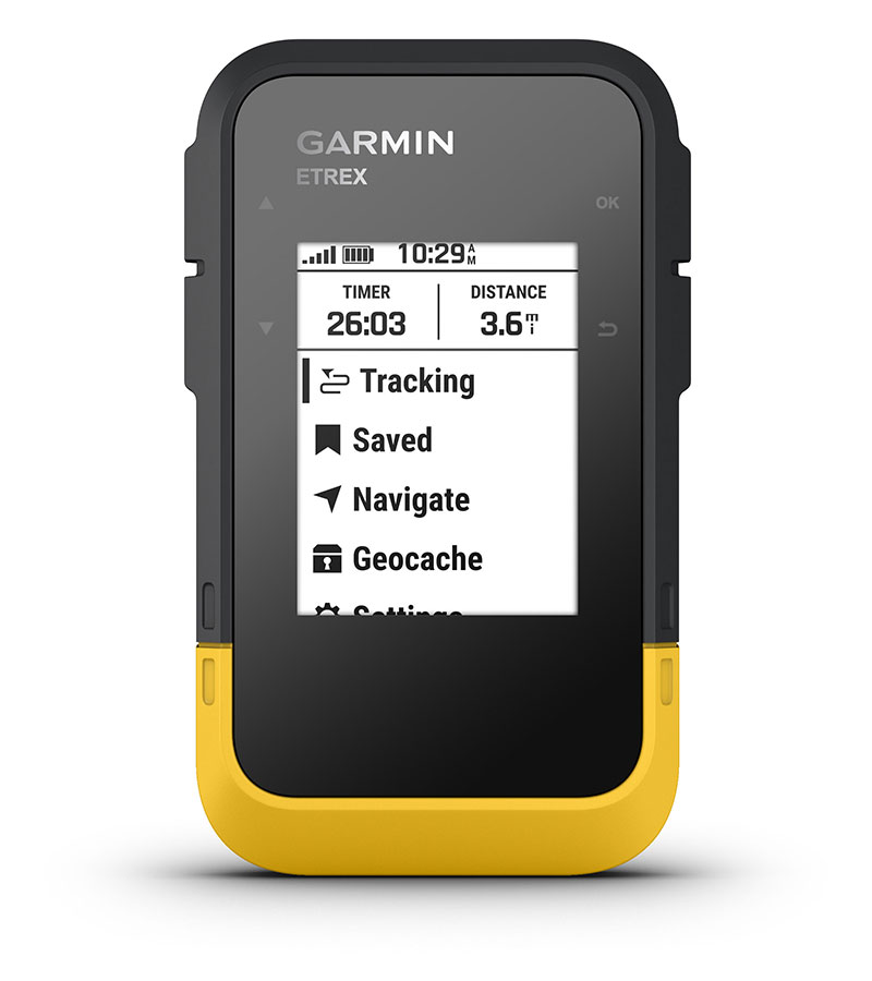
eTrex 22x and eTrex 32x offer the same ease-of-use, durability and affordability that the eTrex handheld GPS series is known for — along with preloaded TopoActive maps. These devices are perfect for ATVs, bicycles, boats or hiking.
eTrex 22x and 32x offer enhanced 2.2”, 65K color, sunlight-readable displays. Durable and water resistant, these handhelds are built to withstand the elements.

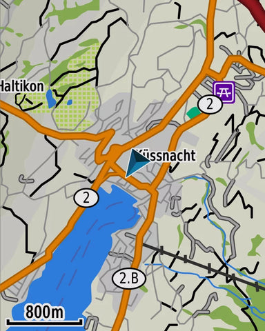
The eTrex 22x and 32x handheld devices come preloaded with road-routable TopoActive maps for outdoor activities that feature streets and trails so you can take the journey off the grid. Now you can know your surroundings — such as waterways, natural features as well as buildings, international boundaries and more. You can also find thousands of points of interests, including shops, restaurants, universities, car parks and accommodations.
The eTrex series uses both GPS and GLONASS satellite systems so the receiver has the ability to track in more challenging environments than GPS alone. eTrex 32x adds a 3-axis compass and barometric altimeter, making it easy for you to keep your bearings.


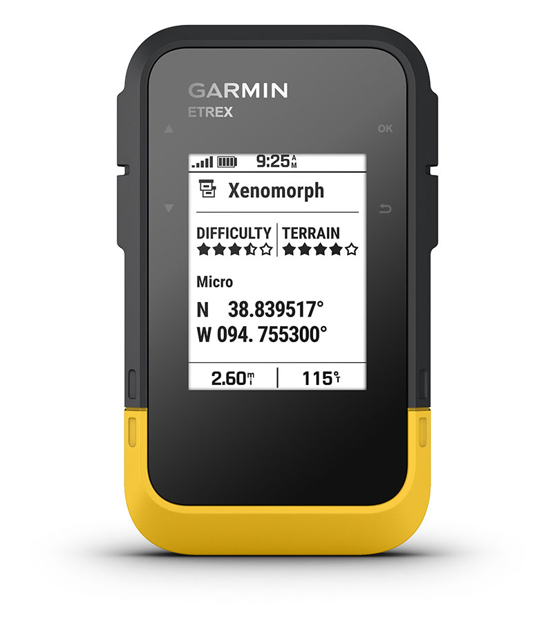
eTrex 22x and eTrex 32x support paperless geocaching. Upload GPX files straight to your device, and view key information such as location, terrain and hints from Geocaching.com
With an array of compatible mounts, eTrex is designed as a handheld — for use on ATVs or bicycles, in boats or on foot. Use the auto mount capability and City Navigator® NT maps for turn by turn driving directions for motorized vehicles, or use the rugged mount for your motorcycle or ATV. Wherever you think you might take eTrex, it has the mapping and mounts to get you there.
| Ref | 22x | 32x |
|---|---|---|
| Dimension | 2.1" x 4.0" x 1.3" | |
| Display Size | 1.4" x 1.7" 2.2" diag | |
| Display Resolution | 240 x 320 pixels | |
| Display Type | 2.2" transflective, 65K color TFT | |
| Weight | 5 oz with batteries | |
| Waterproof | IPX7 | |
| Battery Type | 2 AA batteries (not included); NiMH or Lithium recommended | |
| Battery Life | 25 hours | |
| Interface | mini USB | |
| Memory/History | 8 GB | |
| Maps And Memory | ||
| Preloaded Maps | yes (TopoActive; routable) | |
| Ability to add Maps | ![]() |
|
| Basemap | ![]() |
|
| Automatic Routing(TURN BY TURN ROUTING ON ROADS)for Outdoor Activities | ![]() |
|
| Map Segments | 3000 | |
| Include Detailes Hydrographic Features (COASTLINES, LAKE/RIVER SHORELINES, WETLANDS AND PERENNIAL AND SEASONAL STREAMS) | ![]() |
|
| Includes Searchable Points of Interests (PARKS, CAMPGROUNDS, SCENIC LOOKOUTS AND PICNIC SITES) | ![]() |
|
| Displays National, State and Local Parks, Forest, and Wilderness Areas | ![]() |
|
| External Memory Storage | yes (32 GB max microSD™ card) | |
| Waypoints/Favorites/Locations | 2000 | |
| Tracks | 200 | |
| Navigation Track Log | 10000 points, 200 saved tracks | |
| Navigation Routes | 200 routes, 250 points per route; 50 points auto routing | |
| Sensors | ||
| High-Sensitivity Receiber | ![]() |
|
| GPS | ![]() |
|
| GLONASS | ![]() |
|
| GPS COMPASS (WHILE MOVING) | ![]() |
|
| Barometric Altimeter | N/A | ![]() |
| Compass | N/A | Yes (tilt-compensated 3-axis) |
| Outdoor Recreation | ||
| Point-to-Point Navigation | ![]() |
|
| Area Calculation | ![]() |
|
| Hunt/Fish Calendar | ![]() |
|
| Sun and Moon Information | ![]() |
|
| Geocaching-Friendly | Yes (Paperless) | |
| Custom Maps Compatible | yes (100 custom map tiles) | |
| Picture Viewer | ![]() |
|
EO20233003
$ 268.75 USD
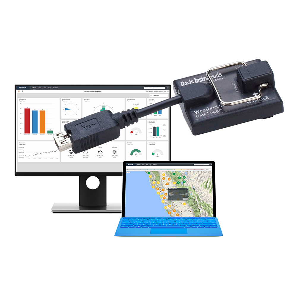
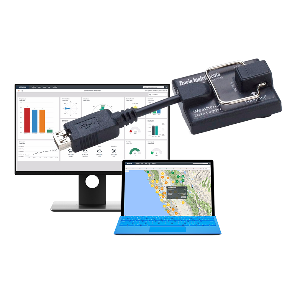
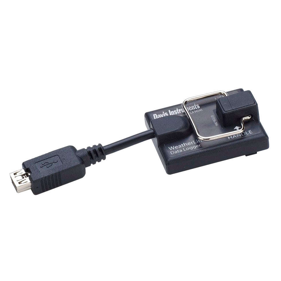
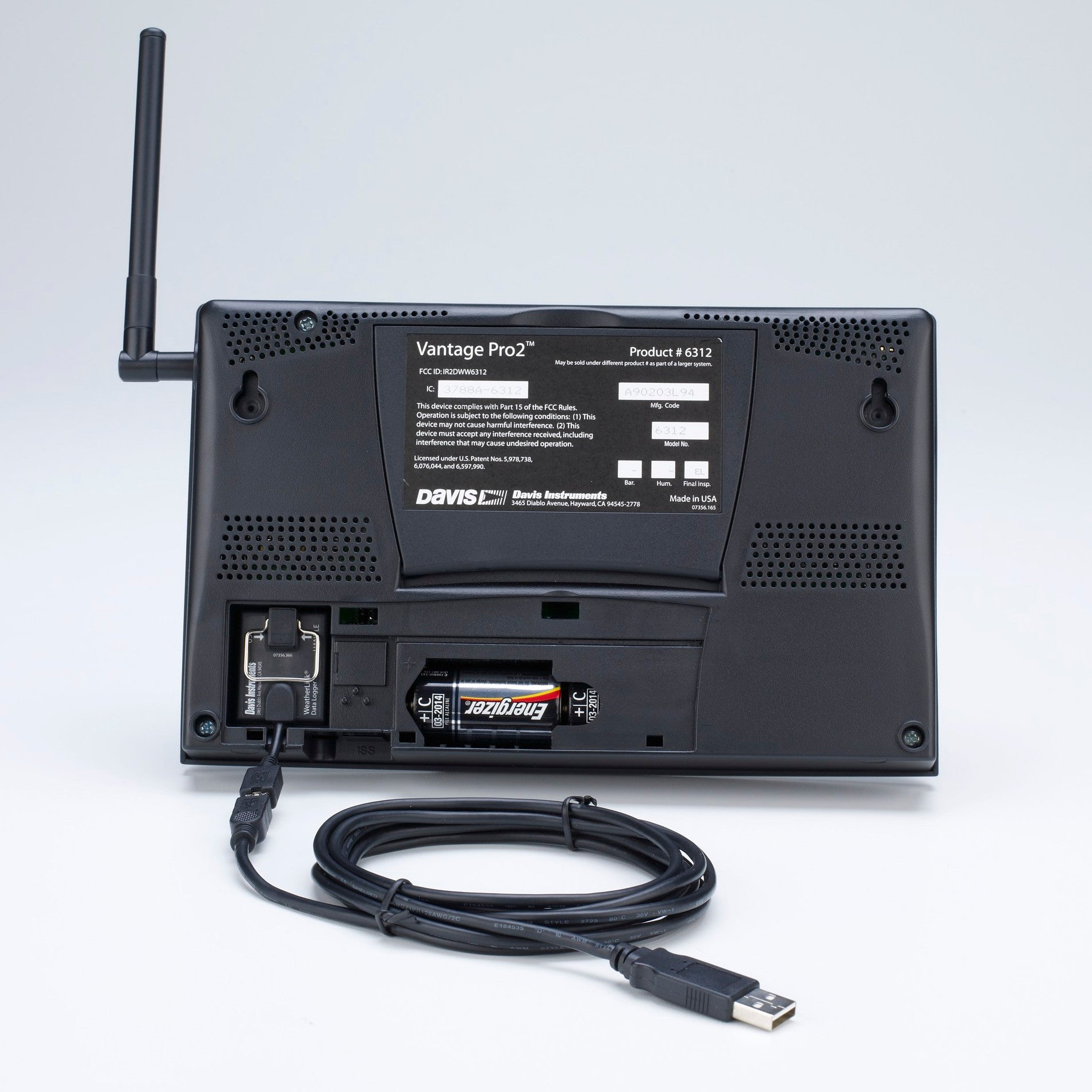
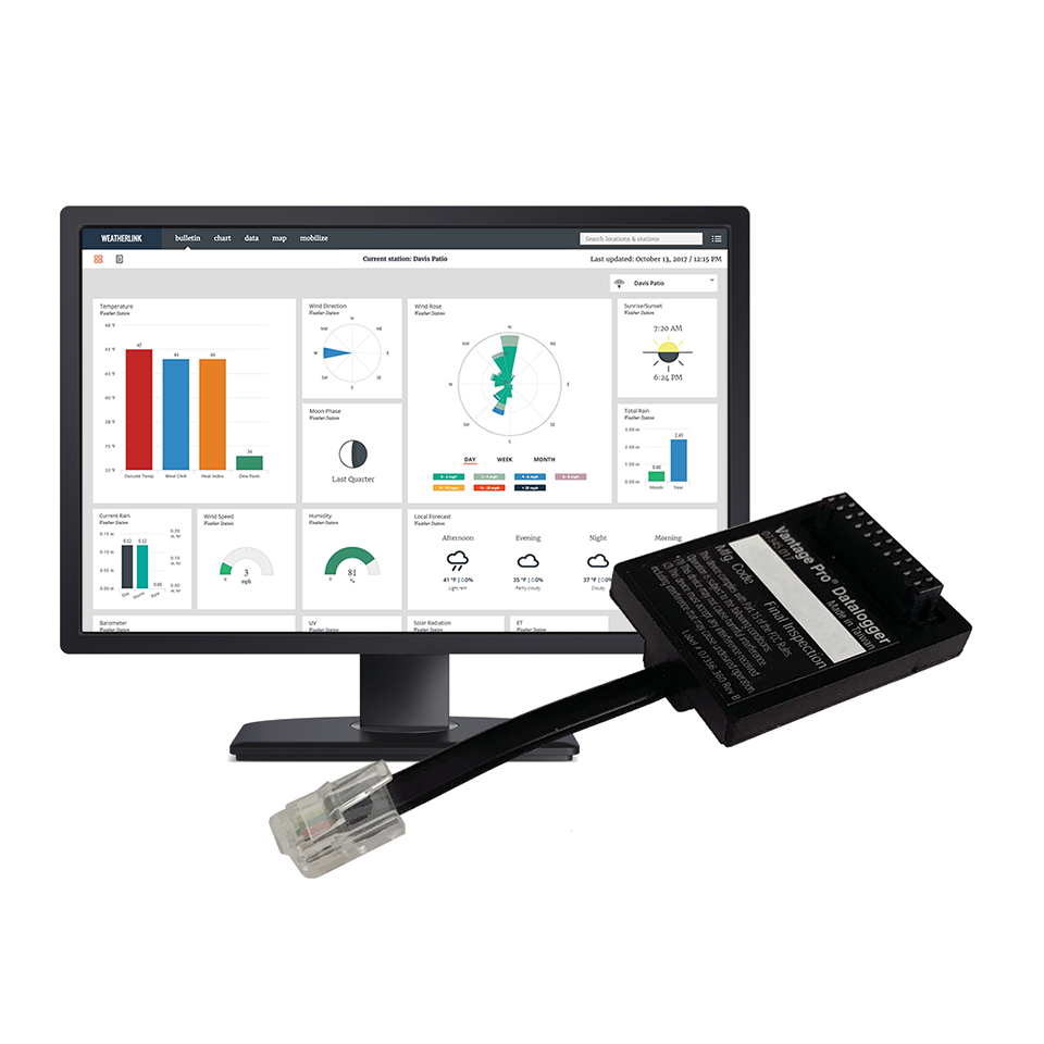
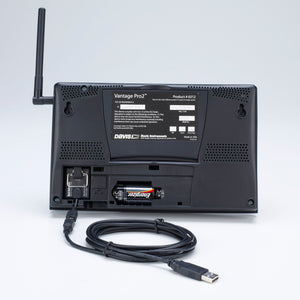
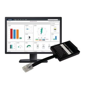
Add USB or Serial-Port Data Logger to your Vantage Vue/Vantage Pro2 console or Weather Envoy,...
$ 359.00 USD
GPSMAP serie 64 features a 2.6" sunlight-readable color screen that supports BirdsEye Satellite Imagery (subscription required) and Garmin Custom Maps. Rugged and waterproof, GPSMAP 64 uses a quad helix antenna for superior reception.
GPSMAP 64s and 64st handheld navigator feature a 3-axis tilt-compensated compass, a barometric altimeter and connect wirelessly to compatible handheld devices.
Get Your Bearings
GPSMAP 64s and 64st has a built-in 3-axis tilt-compensated electronic compass, which shows your heading even when you’re standing still, without holding it level. Its barometric altimeter tracks changes in pressure to pinpoint your precise altitude, and you can even use it to plot barometric pressure over time, which can help you keep an eye on changing weather conditions.
Share Wirelessly
Share your waypoints, tracks, routes and geocaches wirelessly with other compatible devices. Your friends can enjoy your favorite hike or cache without waiting for you to plug in to your computer — simply press “send” to transfer your information to another Garmin handheld.
GPSMAP 64st also connects to compatible Garmin devices, including compatible VIRB and accessory sensors, including tempe™, foot pod and heart rate monitor.
Explore the Terrain
GPSMAP serie 64 comes with a built-in worldwide basemap with shaded relief so you can navigate anywhere with ease. With photo navigation, you can download geotagged pictures from the Internet and navigate to them.
GPSMAP 64st comes preloaded with TOPO 100K, which includes coverage of the full U.S., including Alaska, Hawaii and Puerto Rico, and a worldwide basemap with shaded relief — all the tools for serious climbing or hiking. Map detail includes national, state and local parks and forests, along with terrain contours, elevation information, trails, rivers, lakes and points of interest.
Keep Your Fix
With its quad helix antenna and high-sensitivity, GPS and GLONASS, receiver, GPSMAP 64st locates your position quickly and precisely and maintains its location even in heavy cover and deep canyons. The advantage is clear — whether you’re in deep woods or just near tall buildings and trees, you can count on GPSMAP 64st to help you find your way when you need it the most.
Add Maps
Adding more maps to GPSMAP serie 64 is easy with our array of detailed topographic, marine and road maps. With 4 GB of onboard memory and microSD card slot, you can conveniently download TOPO 24K and 100K maps and hit the trail, plug in BlueChart® g2 preloaded cards for a great day on the water or City Navigator NT® map data for turn-by-turn routing on roads (see maps tab for compatibility). GPSMAP 64 also supports BirdsEye Satellite Imagery (subscription required) that lets you load satellite images onto your device and integrate them with your maps. In addition, the 64 is compatible with Custom Maps, a map format that allows you to transform paper and electronic maps easily into downloadable maps for your device, for free.
GPSMAP 64st comes with a built-in worldwide basemap with shaded relief, preloaded TOPO 100K and a 1-year subscription of BirdsEye Satellite Imagery for a photo-realistic view. Adding more maps is easy with our array of detailed topographic, marine and road maps. With 8 GB of onboard memory and microSD™ card slot, you can conveniently download TOPO 24K maps and hit the trail, plug in BlueChart® g2 preloaded cards for a great day on the water or City Navigator NT® map data for turn-by-turn routing on roads (see maps tab for compatibility). In addition, the 64st is compatible with Garmin Custom Maps, a map format that allows you to transform paper and electronic maps easily into downloadable maps for your device, for free.
Get Connected
You've been busy exploring and now you want to store and analyze your activities. With a simple connection to your computer and to the Internet, you can get a detailed analysis of your activities and send tracks to your outdoor device using Garmin Connect. This one-stop site offers an activity table and allows you to view your activities on a map using Google Earth. Explore other routes uploaded by millions of Garmin Connect users and share your experiences on Twitter and Facebook. Getting started is easy, so get out there, explore and share.
Find Fun
GPSMAP serie 64 supports paperless geocaching with 250,000 preloaded caches with hints and descriptions from Geocaching.com, and has a 16-hour battery life. By going paperless, you're not only helping the environment, but also improving efficiency. GPSMAP serie 64 stores and displays key information, including location, terrain, difficulty, hints and descriptions, which means there’s no more manually entering coordinates and paper printouts! Slim and lightweight, serie 64 is the perfect companion for all your outdoor pursuits.
Plan Your Next Trip
Take charge of your next adventure with BaseCamp, software that lets you view and organize maps, waypoints, routes, and tracks. This free trip-planning software even allows you to create Garmin Adventures that you can share with friends, family or fellow explorers. BaseCamp displays topographic map data in 2-D or 3-D on your computer screen, including contour lines and elevation profiles. It also can transfer an unlimited amount of satellite images to your device when paired with a BirdsEye Satellite Imagery subscription.
GPS de Mano Garmin GPSMAP Serie 64
$ 149.99 USD
Adventure easily with this simple-to-use GPS handheld with extra battery life, wireless connectivity and multi-GNSS support — so you can enjoy exploring more.
| Bright sunlight is no problem with the high-resolution 2.2” screen. | Head out more often with up to 168 hours of battery life. | Into geocaching? Get automatic updates from Geocaching Live to find your next cache. | Plan trips and more when you pair with the Garmin Explore™ smart-device app. | Need accurate tracking? You got it, even in challenging environments with multi-GNSS support. |
Keep your bearings with the digital compass so you’re always on course.
|
![]() |
MULTI-GNSS SUPPORTAccess multiple global navigation satellite systems (GPS, GLONASS, Galileo, BeiDou and QZSS) to track in more challenging environments than GPS alone. |
GEOCACHINGGet automatic cache updates from Geocaching Live, including descriptions, logs and hints. When connected to the Garmin Explore app, each find will upload to your Geocaching.com profile. |
![]() |
![]() |
DIGITAL COMPASSFollow your bearing on the digital compass, which provides an accurate heading even when stationary. |
ACTIVE WEATHERWhen connected to the Garmin Explore app, you can get real-time forecast information, so you’re aware of the changing conditions. |
![]() |
![]() |
GARMIN EXPLORE APPConnect with the Garmin Explore app for wireless software updates, cloud storage, trip planning, smart notifications and additional mapping. |
BATTERY LIFEGet long battery life of up to 168 hours in standard mode and up to 1,800 hours in expedition mode with 2 field-replaceable AA batteries (not included). |
![]() |
Note: Requires two (2) AA batteries
| General |
|
|---|---|
|
Dimension |
2.4" x 4.0" x 1.3" |
| Display Size | 1.3" x 1.7" 2.16" diag |
| Display Resolution | 240 x 320 pixels |
| Display Type | 2.2" transflective, monochrome |
| Weight | 5.5 oz with batteries |
| Waterproof | IPX7 |
| Battery Type | 2 AA batteries (not included) |
| Battery Life | 168 hours in standard mode; 1,800 hours in expedition mode |
| Interface | USB-C |
| Memory/History | 28MB |
| Maps and Memory | |
| Basemap | yes (cities only) |
| Waypoints/Favorites/Locations | 1,000 |
| Courses | 50 |
| TRACKS | ![]() |
| Activities | 200 |
| Navegation Routes | ![]() |
| Sensors | |
| High-Sensitivity Receiver | ![]() |
| GPS | ![]() |
| GLONASS | ![]() |
| GALILEO | ![]() |
| QZSS | ![]() |
| BEIDOU | ![]() |
| Compass | ![]() |
| GPS Compass (While Moving) | ![]() |
| Daily Smart Features | |
| Smart Notifications on Handheld | ![]() |
| Weather | ![]() |
| Outdoor Recreation | |
| Point-to-Point Navigation | ![]() |
| TRACBACK® | ![]() |
| Area Calculation | ![]() |
| Sun and Moon Information | ![]() |
| GEOCACHING-Friendly | ![]() |
| Outdoor Applications | |
| Compatible With GARMIN EXPLORE™ App | ![]() |
| Connections | |
| Connections Wireless Connectivity | yes (BLUETOOTH®) |
EO20233003
$ 820.50 USD
The rugged Montana 700 navigation device combines the flexibility of on-road or off-road navigation with global messaging and interactive SOS alerts using inReach1 satellite communication technology, plus an integrated 8 megapixel camera.
Text your loved ones, post on social media, or communicate with another inReach device in the same area (requires an active subscription to a satellite service).
In an emergency, activate an interactive SOS message to GEOS, a professional 24-hour global control and response center (requires an active subscription to a satellite service).
Instead of relying on mobile coverage, your messages, SOS alerts and tracking options are now transferred via the Iridium® satellite network with fully global coverage (active subscription to satellite service required).
The available inReach weather forecast service provides detailed updates directly to the Montana navigation device or paired devices, so you know what to expect along the way.
This waterproof and navigation device is tested to US military standards and features a 5 ”glove-friendly touchscreen that is 50% larger than previous Montana models.
Capture images of your exploits with Montana's 8 megapixel digital camera. Geotag photos with coordinates so you can return to your favorite places in the future.
Seamless transition between trail and road navigation with the preloaded City Navigator street map, which guides you as you drive with easy-to-follow turn-by-turn directions. (EUROPE).
Use direct-to-device downloads of BirdsEye satellite imagery (no annual subscription required) to see realistic views and create waypoints based on landmark locations.
Use ABC sensors on your next ride, including an altimeter for elevation data, a barometer to monitor weather changes, and a three-axis electronic compass.
Use mobile connectivity2 to access up-to-date Active Weather forecasts through the Garmin Connect ™ app.
Ideal for hunters and trainers, Montana syncs with Astro® or Alpha® series navigation devices (sold separately) to keep track of sporting dogs in the field.
| Specs | |
|---|---|
| Physical and Performance Characteristics | |
| Dimensiones | 9,1 x 18,30 x 3,27 cm |
| Screen Dimensions | 6,48 x 10,80 cm; 12,70 cm in diagonal |
| Screen Resolution | 480 x 800 px |
| Screen Type | Transflective WVGA, dual orientation |
| Weight | 410 g with included lithium-ion battery |
| Battery | rechargeable lithium-ion (included) |
| Battery Life |
|
| Water Resistance Classification | IPX7 |
| Interface | High-speed micro-USB and NMEA 0183 compatible |
| Record | 16GB (user space varies based on included maps) |
| Maps and Memory | |
| Pre-installed Maps | Yes (Europe TopoActive) |
| Automatic Route Creation | Yes (with optional maps with detailed road information) |
| Map Tracking | 15000 |
| Includes hydrographic features with a high level of detail (coastlines, river coastlines, swamps, perennial and seasonal streams) | |
| Includes searches for points of interest (parks, camping areas, scenic watchtowers and picnic areas) | |
| It shows national, regional and local parks, forests and natural landscapes. | |
| Storage and Loading Capacity | Yes (max 32GB microSD ™ card) |
| Route Points | 10000 |
| Tracks | 20,000 points, 250 saved gpx tracks and 300 saved exercise activities |
| Routes | 250, 250 points per route; 50 automatic route points |
| Sensors | |
| Compass | 250, 250 points per route; 50 automatic route points |
| Outdoor Leisure Functions | |
| Geocaching Mode | Yes (live geocaches) |
| Compatible with Custom Maps | Yes (500 custom map tiles) |
| Camera | Yes (8 megapixels with autofocus; automatic geotagging) |
| Outdoor Applications | |
| Dog Tracking | Yes (when linked to a compatible dog tracking system) |
| Connections | |
| Wireless Connectivity | Yes (Wi-Fi®, Bluetooth®, ANT + ®) |
(S 23/9/2021)
$ 685.75 USD
The device is designed for adventurers and explorers, providing constant connection with loved ones through two-way messaging and location tracking. It also offers advanced features such as preloaded topographic maps, satellite imagery, and ABC sensors, all in equipment built to withstand the harshest conditions.
| Dimensions | 2.5” x 6.4” x 1.4” (6.2 x 16.3 x 3.5 cm) |
|---|---|
| Screen Size | 1.5" wide x 2.5" high (3.8 x 6.3 cm); 3" diagonal (7.6 cm) |
| Screen Resolution | 240 x 400 pixels |
| Display Type | Transflective color TFT |
| Weight | 230 g (8.1 oz) with batteries |
| Waterproof | IPX7 |
| Battery Type | Internal rechargeable lithium-ion |
| Battery Life | Up to 165 hours with inReach® enabled with 10-minute tracking Up to 180 hours in GPS mode Up to 425 hours in Expedition mode with inReach enabled Up to 840 hours in Expedition mode |
| MIL-STD-810 | Yes (thermal, shock, water); bare unit only |
| Interface | USB-C |
| Memory/Storage | 16 GB (user space varies based on included mapping) |
| Preloaded Maps | Yes (TopoActive, routable) |
|---|---|
| Ability to Add Maps | Yes |
| Base Map | Yes |
| Auto Routing | Yes (turn-by-turn routing on roads for outdoor activities) |
| Map Segments | 15,000 |
| Satellite Imagery | Yes (direct to device) |
| Includes Hydrographic Features | Yes (coasts, lake/river shores, wetlands, and perennial/seasonal streams) |
| Includes Points of Interest | Yes (parks, campsites, scenic lookouts, and picnic sites) |
| Displays Parks, Forests, and Wilderness Areas | Yes (national, state, and local) |
| External Memory Storage | Yes (microSD™ card up to 32 GB) |
| Waypoints/Favorites/Locations | 10,000 |
| Courses | 250, 200 course points per course |
| Tracks | 250 |
| Navigation Track Log | 20,000 points, 250 saved gpx tracks, 300 saved fit activities |
| High-Sensitivity Receiver | Yes |
|---|---|
| GPS | Yes |
| Galileo | Yes |
| QZSS | Yes |
| Beidou | Yes |
| IRNSS | Yes |
| Barometric Altimeter | Yes |
| Compass | Yes (3-axis with tilt compensation) |
| GPS Compass (in motion) | Yes |
| Multi-Band Frequency Support | Yes |
| Active Weather | Yes |
|---|---|
| Connect IQ™ | Yes (downloadable watch faces, data fields, widgets, and apps) |
| Pairs with Garmin Connect™ Mobile | Yes |
| Smart Notifications | Yes (on the handheld device) |
| VIRB® Remote Control | Yes |
| LiveTrack | Yes |
|---|
| Point-to-Point Navigation | Yes |
|---|---|
| TracBack® | Yes |
| Area Calculation | Yes |
| Hunting/Fishing Calendar | Yes |
| Sun and Moon Information | Yes |
| Xero™ Locations | Yes |
| Geocaching Compatible | Yes (Live Geocaching) |
| Custom Maps Compatible | Yes (500 custom map tiles) |
| Image Viewer | Yes |
| LED Flashlight Beacon | Yes |
| Interactive SOS | Yes |
|---|---|
| inReach Weather | Yes |
| Send and Receive Text Messages to SMS and Email | Yes |
| Send and Receive Text Messages to Another inReach Device | Yes |
| Send and Receive Group Messages | Yes |
| Exchange Locations with Another inReach Device | Yes |
| MapShare Tracking Compatible | Yes |
| Virtual Keyboard for Custom Messaging | Yes |
| Send Waypoints to MapShare During Trip | Yes |
| Send Route Selection to MapShare During Trip | Yes |
| Compatible with Garmin Explore™ App | Yes |
|---|---|
| Compatible with Garmin Explore Website | Yes |
| Compatible with Garmin Messenger App | Yes |
| Smart Switching Between Wi-Fi, Cellular, and Satellite with Garmin Messenger App | Yes |
| Wireless Connectivity | Yes (Wi-Fi®, BLUETOOTH®, ANT+®) |
|---|
$ 535.00 USD
garmin
$ 499.99 USD
Thanks to a redesigned antenna for better satellite reception, the Oregon 750 GPS and GLONASS handheld puts even more of the great outdoors at your fingertips. Whether you’re hiking, hunting, climbing, kayaking, trail riding or whatever, this rugged navigator is ready for anything. It features multilink wireless connectivity (Wi-Fi, Bluetooth and ANT+), Active Weather support with animated radar overlays, a 1-year BirdsEye Satellite Imagery subscription and a built-in 3-axis compass with barometric altimeter.
More Connectivity, Less Complexity
The expanded wireless capabilities of Oregon 750 make it easier than ever to download software, receive smart notifications¹ and upload adventures to Garmin Connect. You can even share LiveTrack location data or geocache discoveries, unit-to-unit, with other compatible Garmin handheld devices. Smart notifications via Bluetooth connectivity with a compatible smartphone let you receive emails, texts and alerts right on your device. So you can see what’s going on while you’re getting away from it all. Comes standard with a dual battery system that lets you use traditional AA batteries or a rechargeable NiMH power pack.
Find Fun with Geocaching.com
The wireless Wi-Fi and Bluetooth links on your Oregon 750 makes it easier than ever to enjoy a superior geocaching experience. You can set your device to automatically stay up to date with all the latest caches from Geocaching.com. No more manual entry of coordinates or printing out cache details on paper.
Take Geotagged Pictures
Capture locations and memories with the 8 megapixel digital camera. Each photo is automatically geotagged, allowing you to easily navigate back to that exact spot in the future. You can upload and share your favorite photos with friends via Garmin Adventures™, part of the Garmin online community.
Navigate Your Way
The Oregon 750 handheld provides comprehensive navigation and tracking to guide you on and off the beaten path, using GPS and GLONASS plus ABC (altimeter, barometer and compass) sensor capabilities. The built-in altimeter provides elevation data to accurately monitor ascent and descent, while the barometer can be used to predict weather changes by showing short-term trends in air pressure. The 3-axis electronic compass keeps your bearing, whether you’re moving or not. There’s also a TracBack® feature on Oregon 750 to help you navigate back to your starting point the same way you came. You can also mark locations, such as your campsite, vehicle or other points of interest, to which you'd like return navigation.
Enjoy the View on a Vivid Display
The Oregon 750 handheld features a bright, sunlight-readable 3-inch color touchscreen display with dual orientation for landscape or portrait views. It easily supports multiple mapping options such as BlueChart® g2 HD for water navigation or City Navigator® NT for turn-by-turn driving directions. Durable and water-rated to IPX7, the Oregon series is built to keep delivering vital mapping and tracking data, no matter what the elements throw at you. Plus, you can even customize your Oregon’s display with free downloads of apps, widgets and data fields from the Garmin Connect IQ™ online store².
Plan Your Next Trip
Take charge of your next adventure with BaseCamp™, software that lets you view and organize maps, waypoints, routes and tracks. This free trip-planning software even allows you to create Garmin Adventures that you can share with friends, family or fellow explorers online. BaseCamp displays on your computer screen any topographic map data stored on the device, including contour lines and elevation profiles. It also can transfer an unlimited amount of satellite images to your device when paired with a BirdsEye Satellite Imagery subscription.
¹See Garmin.com/BLE for compatibility ²Apps, widgets and data fields will be introduced when they become available; not all products may be available all the time. Please check the website for current inventory of Connect IQ products.
The Bluetooth® word mark and logos are registered trademarks owned by Bluetooth SIG, Inc. Wi-Fi® is a registered trademark of the Wi-Fi Alliance.
GPS de Mano Garmin GPSMAP Serie 64
$ 475.00 USD
- NEW GPS and GLONASS: better and faster satellite positioning.
- 4" display with dual orientation optimized for outdoors: for easy reading in any condition.
- NEW Pre-Installed Content: 250,000 geo-caches from Geocaching.com and 1 free year of BirdsEye1 satellite imagery. Ref. 680t includes recreational topographic route map with United States coverage.
- NEW Includes a new Track Manager that offers a better user experience and more control.
- NEW 8 megapixel camera for high resolution geo-tagged photos.
- Full navigation on any site with more versatile features, display and support.
- Barometric altimeter and three-axis compass.
Designed for use on trails, on roads or in the water, Garmin's Montana 680 device will guide you wherever you go. With an improved large 4" (10.16 Cm) touch screen, dual orientation and GPS and GLONASS positioning to control your position faster and more accurately, even in the most difficult environments. With the new Track Manager, it's easy to see where you are at all times and comfortably control your track recording.The Montana 680 includes a 3-axis electronic compass with barometric altimeter and a free 1-year subscription to Bird's Eye satellite imagery.The Montana 680 is Rugged, waterproof, includes an 8-megapixel camera and is designed to withstand the elements2.
The Montana 680 features a 4" dual-orientation touch screen optimized for outdoor use that offers the best readability in any light condition. The easy-to-use touch screen user interface will allow you to enjoy nature more and spend less time searching information.Montana's display is loved by outdoor enthusiasts for its optimal readability thanks to large data fields and numerous mapping functions.Rugged and waterproof, the Montana 680 is designed to withstand inclement weather Shocks, dust, dirt, humidity or water will no longer be a problem for this resistant navigator2.
Capture locations and memories with the Montana 680's 8-megapixel digital camera. Each photo is automatically geotagged with the location where it was taken, allowing you to navigate back to that exact spot in the future. Take and view photos in a landscape or portrait orientation. Track your photos and check their locations on a map with BaseCamp™. Pop in a microSD™ card for more storage space or to view photos from other devices.
With the new high-sensitivity GPS and GLONASS receiver, the Montana 680 locates your position quickly and accurately, and maintains its location even in thick forests and deep valleys. The advantage is clear, you can count on the Montana 680 device to help you find your way when you need it most.
With a wide range of compatible mounts, the Montana is designed for use on bikes, 4x4s, boats, and as a handheld device or for convenient everyday car navigation. Use the optional car mount with City Navigator maps for voice turn-by-turn directions, or try the optional rugged mount for your motorcycle or ATV.
The Montana 680 includes a 1-year BirdsEye satellite imagery subscription with incredible aerial imagery to enhance your navigation. If you want more detailed information, you can easily add more maps to the Montana1 device. Load TOPO maps and hit the road in no time, pop in preloaded BlueChart® g2 cards for a great day on the water, or load City Navigator map data for turn-by-turn directions. Or transform paper maps into files you can download for your Montana device with Custom Maps.
Navigate with ease
The new Montana 680 device includes a Track Manager application that allows you to record, view and analyze your tracks in a very comfortable and intuitive way. The handheld has key features for outdoor activities like a 3-axis tilt-compensated compass that shows your direction even when you're standing still and held tilted. It also includes a barometric altimeter that tracks changes in air pressure to determine your altitude and even graphs barometric pressure over time, which can help you keep an eye on changing weather conditions.
The Montana 680 comes preloaded with over 250,000 assorted geocaches from geocaching.com and supports "paperless" geocaching. This allows the Montana 680 to save and display key cache information such as location, terrain, difficulty, hints and descriptions, so you no longer have to manually enter coordinates or carry paper printouts. When you want to add more caches, you just have to load the GPX file on your device and continue with the search.
With the Montana 680 device you can share your waypoints, tracks, routes and geocaches wirelessly with other compatible Garmin GPS users. Just press "Send" to transfer your information to other units.
The Montana 680 device includes Garmin's dual battery system that guarantees maximum independence. It will allow you to use the option that suits you best: rechargeable lithium-ion batteries or traditional AA alkaline batteries.
Take command of your next adventure with our free BaseCamp™, software that lets you view and organize maps, waypoints, routes, and tracks. This free trip planning software even lets you create Garmin Adventures that you can share with friends, family, or fellow explorers. BaseCamp displays topographic map data in 2D or 3D on your computer screen, including elevation profiles and bathymetric lines. Plus, you can transfer an almost unlimited amount of satellite imagery to your device from the included BirdsEye satellite imagery subscription.
| Unit Dimensions (Width/Height/Depth) | 7,48 x 14,42 x 3,64 cm |
| Weight | 289 g (10,2 oz) with a lithium-ion battery (included); 333 g (11,7 oz) with three AA batteries (not included) |
| Waterproof | IPX7 |
| Drums | Rechargeable lithium-ion battery (included) or 3 AA batteries (not included); NiMH or lithium recommended |
| Touch screen | ![]() |
| screen type | Bright, sunlight-readable, dual-orientation, 65,000-colour transflective TFT touchscreen |
| Screen size (Width/Height) | 5,06 x 8,93 cm; 4" in diagonal (10,2 cm) |
| Screen resolution (Width/Height) | 272 x 480 pixels |
| Cell/battery autonomy | Up to 16 hours (lithium-ion); up to 22 hours (AA batteries) |
| memory/history | 2,7 GB |
| High sensitivity receiver | ![]() |
| computer interface | Compatible with Hi-Speed USB and NMEA 0183 |
| Basemap | ![]() |
| pre-installed maps | 1 year subscription to BirdsEye Satellite Imagery ready to download once you have registered your device. Ref 680t 100K maps preloaded with TOPO U.S. |
| Ability to add maps | ![]() |
| Supports data cards | microSD™ card (not included) |
| Customizable points of interest (possibility to add additional points of interest) | ![]() |
| Waypoints | 4000 |
| Routes | 200 |
| Tracks | 10.000 points, 200 saved tracks |
| barometric altimeter | ![]() |
| Compass | Yes (Three Axis Tilt Compensated) |
| Calculation of areas | ![]() |
| Automatic route creation (turn by turn on the road) |
(with optional maps with detailed road information) |
| geocaching mode |
(paperless) |
| Compatible with custom maps | ![]() |
| Hunting and fishing calendar | ![]() |
| astronomical information | ![]() |
| Camera |
(8 megapixels with autofocus and geotagging) |
| Pictures viewer | ![]() |
| Compatible with Garmin Connect™ (online community where you can analyze, classify and share data) | ![]() |
| Additional characteristics | - High sensitivity GPS receiver for GPS and GLONASS signals - 250000 pre-installed geocaches - New and improved track manager |
$ 349.99 USD
| Enhanced GNSS support | Preloaded Topographic Maps | Multiband Frequency Support |
|---|---|---|
![]() |
![]() |
![]() |
| Multi-band technology and extended GNSS support (GPS, GLONASS, Galileo, QZSS and IRNSS) provide optimum accuracy in rugged terrain, urban canyons and dense forests. | The preloaded TopoActive maps of the USA and Canada show you terrain contours, topographic elevations, summits, parks, coasts, rivers, lakes and geographical points. | Receive and use multiple frequencies sent by navigation satellites, allowing you to improve position accuracy, specifically in areas where GNSS signals are reflected, weak or normally do not penetrate. Achieve superior accuracy using state-of-the-art technology previously only available to the military. |
| Physical and Performance Characteristicso | ||
|---|---|---|
| Ref | 65 | 65s |
| Dimensiones de la Unidad (Ancho/Alto/Profundidad) | 2.4'' x 6.2'' x 14.1'' | |
| Dimensiones Pantalla (Ancho/Alto) | 14.1'' x 21.6'' x 25.9'' (Diagonal) | |
| Screen Resolution (Wide/High) | 160 x 240 pixels | |
| Display Type | 65000 color transflective TFT | |
| Weight | 217 g (With batteries) | |
| Batteries | 2 Batteries AA (not included); NiMH or lithium is recommended | |
| Battery Autonomy | 16 hours | |
| Water Resistance Classification | IPX7 | |
| Memory/History | 16 GB (the user space varies depending on the included maps) | |
| Equipment Interface | mini USB Hi-Speed and NMEA 0183 | |
| Maps and Memory | ||
| Preinstalled Maps | Yes (TopoActive; with routing function)) | |
| Ability to add maps | ![]() |
|
| Base Map | ![]() |
|
| Automatic Route Creation | ![]() |
|
| Map Segments | 3000 | |
| BirdsEye | 250 BirdsEye image files | |
|
Includes Hydrographic Features with a high level of detail (Shorelines, Shorelines of Lakes and Rivers, Marshes and Perennial and Seasonal Streams). |
![]() |
|
|
Includes Points of Interest (Parks, Camping Areas, Viewpoints and Picnic Areas). |
![]() |
|
|
National, Regional and Local Parks. Forests and Wilderness Areas |
![]() |
|
| Storage and Payload Capacity | Yes, microSD card™;32 GB as max. (not included) | |
| Waypoints | 5000 | |
| Routes | 200, 250 points per route; 50 points from automatic routes | |
| Navigation Tracking Log | 10 000 points, 200 saved tracks | |
| Tracks | 200 | |
| Sensors | 65 | 65s |
| High Sensitivity Receiver | ![]() |
![]() |
| GPS |
|
![]() |
| GLONASS |
|
|
| GALILEO |
|
|
| QZSS |
|
|
| GPS Compass | ![]() |
|
| Compatibilidad con Frecuencia Multibanda |
|
|
| Barometric Altimeter |
|
|
| Compass |
|
|
| Intelligent Daily Functions | ||
| Notifications on Handheld GPS | ![]() |
|
| Remote Control for VIRB® | ![]() |
|
| Compatible with Garmin Connect™ Mobile | ![]() |
|
| Outdoor Leisure Functions | ||
| Geocaching mode | Yes (Paperless) | |
| Hunting and Fishing Calendar | ![]() |
|
| Point to Point Navigation | ![]() |
|
| Cálculo de Áreas | ![]() |
|
| Información Astronómica | ![]() |
|
| Visor de Imágenes | ![]() |
|
| Custom Map Compatibility; | Yes (500 customized map tiles) | |
| Outdoor Applications | ||
| Compatible with Garmin Explore™ for WayPoints, Tracks, Routes and Activities | ![]() |
|
| Compatible with Garmin Explore website™ | ![]() |
|
| Connections | ||
| Wireless Connectivity |
Yes, Bluetooth, ANT+GPS |
|
(ZC20220808)
$ 370.50 USD
The Bushnell Equinox Z2 series offers high-performance digital night vision monoculars, ideal for nature observation, security, and outdoor activities. With infrared-sensitive CMOS sensors and micro LCD screens, they deliver clear images both day and night. Each model includes a built-in IR illuminator, 1080p video recording, and Wi-Fi connectivity to easily share your content.
Equipped with a powerful built-in infrared illuminator, the Bushnell Equinox Z2 night vision monocular allows clear viewing in low-light conditions and even total darkness. The infrared-sensitive complementary metal-oxide semiconductor (CMOS) sensor provides edge-to-edge resolution and exceptional image quality, along with fully multi-coated optics.
Not only can you view your subject at night with the Equinox Z2 night vision monocular, but you can also record its image as a still photo or video clip. Simply insert a micro SD card (not included) to capture high-quality videos (up to 1080p) and images, then easily upload files to your smartphone, tablet, or computer for quick sharing. You can also stream live video via Wi-Fi.
| Specification | Equinox Z2 3x30 | Equinox Z2 4.5x40 | Equinox Z2 6x50 |
|---|---|---|---|
| Optical Magnification | 3x | 4.5x | 6x |
| Digital Zoom | Up to 9x | Up to 13.5x | Up to 18x |
| Objective Lens Diameter | 30 mm | 40 mm | 50 mm |
| Night Vision Range | 152 m | 229 m | 275 m |
| Field of View at 1000 m | 117 m | 105 m | 74 m |
| Video Recording | 1080p HD | ||
| Wi-Fi Connectivity | Yes | ||
| App Compatibility | Yes | ||
| Battery Type | 4 x AA | ||
| Memory Card Compatibility | Micro SD up to 64 GB | ||
| Water Resistance | IPX4 | ||
| Weight | 765 g | 624 g | 765 g |
Request Quote
BADGECII (Iridium) is an advanced Platform Messaging Transceiver (PMT) designed for satellite data transmission via the Iridium system. Equipped with high-precision GPS and multiple sensors, it enables real-time collection of environmental and behavioral data. Its innovative INTELINK® technology allows not only remote data download and device recovery, but also raw acceleration data collection and on-site behavior-tagged modeling. It is ideal for ecological and conservation studies requiring animal monitoring in remote and variable conditions.
| Specification | BADGECII (Iridium) |
|---|---|
| Deployment | Collar |
| Power Source | Solar panel + internal battery |
| Battery | 2×210 mAh (rechargeable) + 1900 mAh (primary) |
| Battery Protection | Against overcharge and low voltage |
| Operating Temperature | -25 °C to 60 °C |
| GPS - Accuracy | CEP (50%) 2.5 m |
| GPS - Band | 1616 MHz to 1626.5 MHz |
| Transmission Speed | 2400 bps |
| Integrated Sensors | Light, pressure, temperature, 3-axis accelerometer |
| Data Storage | 17,800 environmental records + 107,100 behavioral records |
| Firmware Update | Via INTELINK® / ECOTOPIA App |
| Collection Modes | Regular intervals or sleep mode |
| ACC Collection | 25 Hz for 3 s every 10 min (default) |
| Smart BOOST | Automatic optimization based on activity and power |
$ 599.99 USD
Discover the Garmin GPSMAP 86 Series: a family of handheld devices designed for those who live on the water and demand reliability, connectivity, and precise mapping. Each variant combines durability (it floats and is water-resistant), advanced sensors, and the ability to integrate with onboard systems to display vessel data — all on a sunlight-readable 3” display. Choose the variant that fits your needs, from BlueChart® g3 mapping to global inReach® communication.
| Specification | GPSMAP 86s | GPSMAP 86sc | GPSMAP 86i | GPSMAP 86sci |
|---|---|---|---|---|
| Short Description | Handheld preloaded with Worldwide Basemap; onboard system integration. | Marine handheld preloaded with BlueChart® g3 (U.S.) and autopilot/Fusion control. | Marine handheld with inReach® capabilities; worldwide basemap. | Marine handheld with BlueChart® g3 (U.S.) + inReach® capabilities. |
| Preloaded Maps | Worldwide basemap | BlueChart® g3 (U.S.) | Worldwide basemap | BlueChart® g3 (U.S.) |
| Satellite Communication / inReach® | No (wireless features supported) | No (supports notifications and onboard control) | Yes, inReach® (satellite messaging, interactive SOS) | Yes, inReach® + BlueChart® g3 |
| Battery Life (depending on mode) | Up to 40 hours in standard mode (depending on use) | Up to 40 hours in standard mode (depending on use) | Up to 35 hours (10-min tracking); up to 200 hours (30-min power save) | Up to 35 hours (10-min tracking); up to 200 hours (30-min power save) |
| Internal Memory | 16 GB (user space varies by included maps) | |||
| Expansion (microSD) | Yes (microSD™ up to 32 GB) | |||
| Display | Transflective 65K color TFT — 3" diagonal (240 x 400 px) | |||
| Dimensions | 6.75 x 17.8 x 4.4 cm (2.65" x 7" x 1.7") | |||
| Weight | 272 g (9.59 oz) | |||
| Water Resistance | IPX7 (floats) | |||
| MIL-STD Certification | Yes (thermal, shock, and water resistance — MIL-STD-810) | |||
| Sensors | GPS, GLONASS, Galileo, barometric altimeter, 3-axis compass | GPS, GLONASS, Galileo, barometric altimeter, 3-axis compass | GPS, Galileo, barometric altimeter, 3-axis compass | GPS, Galileo, barometric altimeter, 3-axis compass |
| Waypoints / Routes / Tracks | Waypoints: 10,000 · Routes: 250 · Tracks: 250 · Track log: 20,000 points | |||
| Connectivity | Wi-Fi®, Bluetooth®, ANT+®, and NMEA 0183 compatibility (boat data and Garmin app sync) | |||
| Key Notes | Preloaded worldwide basemap; optional BlueChart® g3 available. | BlueChart® g3 preloaded (U.S.); includes autopilot and Fusion control. | Built-in inReach® for global messaging and safety. | BlueChart® g3 + inReach® combo (messaging + interactive SOS). |
$ 89.90 USD
The TALKABOUT T270 walkie-talkie is the ideal solution for anyone seeking reliable communication and style in any environment. Whether on a family camping trip, hiking remote trails, or at festivals, this device lets you stay in touch without relying on cell service or paying call fees. Its functional design includes an easy pairing button that simplifies setting up group calls, along with USB charging for superior convenience. With access to NOAA weather channels and a range of up to 25 miles (40 km), the T270 ensures safety and information are always within reach during your outdoor explorations.
Fully featured, tough, and stylish, the TALKABOUT T270 walkie-talkie is the best way to stay connected during your outdoor adventures. At home, at a campsite, at a party, or simply on a hike, the TALKABOUT T270 keeps you connected. It comes with an easy pairing button and USB charging for unprecedented convenience. No license is required, and it includes key features such as an LCD screen, 22 channels, and a range of up to 25 miles (40 km)* with no call charges.
*Real-world range may be less than the maximum range.
| Model | TALKABOUT T270 |
| Frequency Band | FRS 462-467 MHz (UHF Band) |
| Maximum Range | Up to 40 km (25 miles) |
| Channels | 22 channels and 121 privacy codes |
| Weather Channels | 11 channels (7 NOAA with alert) |
| Battery Life (NiMH 800 mAh) | Up to 14 hours |
| Battery Life (AA Alkaline) | Up to 35 hours |
| Charging Interface | Micro USB |
| Weight (without battery) | 0.1 kg (100 g / 0.22 lb) |
| Dimensions | 5.36 x 3.10 x 16.48 cm (2.11" x 1.22" x 6.49") |
| Scan/Monitor | Yes |
| Dual Watch | Yes |
| Time-out Timer | Yes |
| Auto Squelch | Yes |
| Keypad Lock | Yes |
| Battery Level Indicator | Yes |
| Headphone Jack | 2.5 mm |
| Compatibility | Compatible with all FRS/GMRS radios |
None: Ready to use!
Request Quote
GPSMAP serie 64 features a 2.6" sunlight-readable color screen that supports BirdsEye Satellite Imagery (subscription required) and Garmin Custom Maps. Rugged and waterproof, GPSMAP 64 uses a quad helix antenna for superior reception.
GPSMAP 64s and 64st handheld navigator feature a 3-axis tilt-compensated compass, a barometric altimeter and connect wirelessly to compatible handheld devices.
Get Your Bearings
GPSMAP 64s and 64st has a built-in 3-axis tilt-compensated electronic compass, which shows your heading even when you’re standing still, without holding it level. Its barometric altimeter tracks changes in pressure to pinpoint your precise altitude, and you can even use it to plot barometric pressure over time, which can help you keep an eye on changing weather conditions.
Share Wirelessly
Share your waypoints, tracks, routes and geocaches wirelessly with other compatible devices. Your friends can enjoy your favorite hike or cache without waiting for you to plug in to your computer — simply press “send” to transfer your information to another Garmin handheld.
GPSMAP 64st also connects to compatible Garmin devices, including compatible VIRB and accessory sensors, including tempe™, foot pod and heart rate monitor.
Explore the Terrain
GPSMAP serie 64 comes with a built-in worldwide basemap with shaded relief so you can navigate anywhere with ease. With photo navigation, you can download geotagged pictures from the Internet and navigate to them.
GPSMAP 64st comes preloaded with TOPO 100K, which includes coverage of the full U.S., including Alaska, Hawaii and Puerto Rico, and a worldwide basemap with shaded relief — all the tools for serious climbing or hiking. Map detail includes national, state and local parks and forests, along with terrain contours, elevation information, trails, rivers, lakes and points of interest.
Keep Your Fix
With its quad helix antenna and high-sensitivity, GPS and GLONASS, receiver, GPSMAP 64st locates your position quickly and precisely and maintains its location even in heavy cover and deep canyons. The advantage is clear — whether you’re in deep woods or just near tall buildings and trees, you can count on GPSMAP 64st to help you find your way when you need it the most.
Add Maps
Adding more maps to GPSMAP serie 64 is easy with our array of detailed topographic, marine and road maps. With 4 GB of onboard memory and microSD card slot, you can conveniently download TOPO 24K and 100K maps and hit the trail, plug in BlueChart® g2 preloaded cards for a great day on the water or City Navigator NT® map data for turn-by-turn routing on roads (see maps tab for compatibility). GPSMAP 64 also supports BirdsEye Satellite Imagery (subscription required) that lets you load satellite images onto your device and integrate them with your maps. In addition, the 64 is compatible with Custom Maps, a map format that allows you to transform paper and electronic maps easily into downloadable maps for your device, for free.
GPSMAP 64st comes with a built-in worldwide basemap with shaded relief, preloaded TOPO 100K and a 1-year subscription of BirdsEye Satellite Imagery for a photo-realistic view. Adding more maps is easy with our array of detailed topographic, marine and road maps. With 8 GB of onboard memory and microSD™ card slot, you can conveniently download TOPO 24K maps and hit the trail, plug in BlueChart® g2 preloaded cards for a great day on the water or City Navigator NT® map data for turn-by-turn routing on roads (see maps tab for compatibility). In addition, the 64st is compatible with Garmin Custom Maps, a map format that allows you to transform paper and electronic maps easily into downloadable maps for your device, for free.
Get Connected
You've been busy exploring and now you want to store and analyze your activities. With a simple connection to your computer and to the Internet, you can get a detailed analysis of your activities and send tracks to your outdoor device using Garmin Connect. This one-stop site offers an activity table and allows you to view your activities on a map using Google Earth. Explore other routes uploaded by millions of Garmin Connect users and share your experiences on Twitter and Facebook. Getting started is easy, so get out there, explore and share.
Find Fun
GPSMAP serie 64 supports paperless geocaching with 250,000 preloaded caches with hints and descriptions from Geocaching.com, and has a 16-hour battery life. By going paperless, you're not only helping the environment, but also improving efficiency. GPSMAP serie 64 stores and displays key information, including location, terrain, difficulty, hints and descriptions, which means there’s no more manually entering coordinates and paper printouts! Slim and lightweight, serie 64 is the perfect companion for all your outdoor pursuits.
Plan Your Next Trip
Take charge of your next adventure with BaseCamp, software that lets you view and organize maps, waypoints, routes, and tracks. This free trip-planning software even allows you to create Garmin Adventures that you can share with friends, family or fellow explorers. BaseCamp displays topographic map data in 2-D or 3-D on your computer screen, including contour lines and elevation profiles. It also can transfer an unlimited amount of satellite images to your device when paired with a BirdsEye Satellite Imagery subscription.
GPS de Mano Garmin GPSMAP Serie 64
$ 109.95 USD
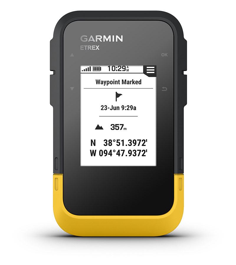
Only Garmin could make the eTrex better. The new serie eTrex retains the core functionality, rugged construction, affordability and long battery life that made eTrex the most dependable GPS device available. We improved the user interface and added a worldwide basemap, paperless geocaching and added support for spine mounting accessories. You’ll recognize the name. You’ll recognize the quality. But the serie eTrex is an entirely new device – a device that only Garmin could offer.
See the Way
eTrex 10 has an enhanced 2.2 in monochrome display that’s easy to read in any lighting situation. Its easy-to-use interface means you’ll spend more time enjoying the outdoors and less time searching for information. eTrex 20, eTrex 20x, eTrex 30 and eTrex 30x has an enhanced 2.2 in 65K colour, brilliant, sunlight-readable display. Durable and waterproof, feature the legendary toughness that’s built to withstand the elements – be it dust, dirt, humidity or water, none of which are a match for these legendary navigators.
Find Fun
The serie eTrex features paperless geocaching by supporting GPX files for downloading geocaches and details straight to your unit. Visit OpenCaching.com to start your geocaching adventure. By going paperless, you're not only helping the environment but also making your geocaching more fun. The serie eTrex stores and displays all the information you need, including location, terrain, difficulty, hints and descriptions, which means no more manually entering coordinates and paper print outs. Simply upload the geocache to your unit and start hunting for caches.
Keep Your Fix
With its high-sensitivity, EGNOS-enabled GPS receiver and HotFix satellite prediction, the serie eTrex locates your position quickly and precisely and maintains its GPS location even in heavy cover and deep canyons. The advantage is clear — whether you’re in deep woods or just near tall buildings and trees, you can count on the eTrex to help you find your way when you need it the most.
Go Global
The new eTrex series is the first-ever consumer-grade receivers that can track both GPS and GLONASS satellites simultaneously. GLONASS is a system developed by the Russian Federation that will be fully operational in 2012. When using GLONASS satellites, the time it takes for the receiver to “lock on” to a position is (on average) approximately 20 percent faster than using GPS. And when using both GPS and GLONASS, the receiver has the ability to lock on to 24 more satellites than using GPS alone.
Add Maps
With its microSD card slot and 1.7 GB of internal memory, eTrex 20 and eTrex 30 and 3.7 GB for eTrex 20x and eTrex 30x lets you load our range of Ordnance Survey maps such as Garmin GB Discoverer and hit the trail, plug in BlueChart g2preloaded cards for a great day on the water or City Navigator NT map data for turn-by-turn routing on roads (see maps tab for compatible maps).The eTrex 20, eTrex 20x, eTrex 30 and eTrex 30x also supports BirdsEye select map download service, that lets you download premium raster maps to your device and integrate them with your existing maps.
Go Anywhere
With an array of compatible mounts, eTrex 20, eTrex 20x, eTrex 30 and eTrex 30x can be used on your bicycle, boat, in your car or motorbike and off-road vehicle. You even get turn-by-turn directions with the auto mount and City Navigator NT maps. Wherever you think you might take eTrex, it has the mapping and mounts to get you there.
Share Wirelessly
The eTrex 30 and eTrex 30x lets you share your waypoints, tracks, routes and geocaches wirelessly with other compatible Garmin GPS devices. So now your friends also can enjoy your favorite hike or cache – simply press “send” to transfer your information to similar units, and let the games begin.
GPS de Mano Garmin Serie eTrex
Request Quote
† ADVERTENCIA de la Proposición 65 de California
The CelluCORE™ 20 Low Glow Cellular Trail Camera from Bushnell is the ideal solution for hunters, landowners, and wildlife observers looking for an affordable yet feature-rich cellular trail camera. Delivering 20MP images and HD video, the CelluCORE 20 ensures you never miss a moment — and it sends content straight to your mobile device using a cellular connection. Its low-glow infrared flash provides up to 80 feet of nighttime range without alerting animals. Built tough for rugged outdoor use, this camera offers long battery life, solar compatibility, and hybrid photo-video capture. Whether you're tracking game or enhancing property security, the CelluCORE 20 is built to perform season after season.
† ADVERTENCIA de la Proposición 65 de California: Cáncer y daños reproductivos. Para más información, visita www.P65Warnings.ca.gov/chemicals y aquí.
| Feature | Details |
|---|---|
| Resolution | 20 Megapixels |
| Video Resolution | HD Video (up to 30 seconds) |
| Flash Type | Low Glow Infrared / 80 ft Range |
| Hybrid Capture | Yes |
| Audio Recording | No |
| PIR Sensor | Low / Medium / High / Auto |
| Stamps | Date / Time / Temperature / Moon Phase |
| Display | None |
| Battery Type | 12 x AA (not included) |
| Battery Life | Up to 6 Months |
| Power Options | Battery or Solar Compatible |
| Storage | Up to 32GB SD Card (not included) |
| Wireless Connectivity | Yes (Cellular) |
| GPS Geotag | No |
$ 70.50 USD
The Motorola Talkabout MH230R is the must-have communication tool for each and every outdoor enthusiast. With a powerful range of up to 23 miles*, this radio is perfect for researchers, family and friends to stay in touch whether you’re tackling a back country trail, or trying to communicate in a field project. The MH230 doesn’t stop at just exceptional range. This lightweight unit comes packed full of essential features.
* How far can I expect my radios to communicate? The communication range quoted is calculated under optimum conditions, with an unobstructed line of sight. Actual range will vary depending on terrain and conditions, and is often less than the maximum possible. Your actual range will be limited by several factors including, but not limited to, terrain, weather conditions, electromagnetic interference and obstructions.
Radio Dos-Vías Recargable Motorola Talkabout MH230R 37 Km x 2 u.
Request Quote
Optional ItemsExternal sensors must be purchased separately. Requires a HOBOlink data plan, which must be renewed annually. Learn more about HOBOlink.
A compact, rugged, easy-to-deploy, low-cost cellular solution for long-term, reliable field monitoring. With two power options available (a solar panel for extended deployments or user-replaceable batteries for flexible mounting in covered or protected locations), this monitoring station includes inputs for up to five of Onset's research-grade plug-and-play sensors. (Sensors must be purchased separately.)
Configurable station-side alarms trigger immediate notifications of critical conditions, and Onset's HOBOlink cloud platform makes it easy to view, access, and share data. This station can also be ordered with an additional water level sensor input with integrated flow conversion.
EO2023803
Request Quote
Optimize your target acquisition and baseline anchoring configurations within dense tree canopies using the Petzl AIRLINE technical throwline. Engineered to meet the demanding field criteria of arborists and remote rigging specialists, this premium line offers a superior compromise between dynamic flexibility and structural stiffness. It facilitates incredibly precise casting trajectories while effectively mitigating the risk of nests, tangles, or premature knot formation as the line unfurls from its storage system.
The primary mechanical advantage of this high-performance cord relies on the excellent bonded construction between its outer sheath and core elements. This technical integration preserves a perfectly round cross-section under tension, guaranteeing a hydrodynamic, low-friction glide through rough crotches and abrasive tree bark. Furthermore, the exterior sheath is woven entirely from Dyneema® fibers, a state-of-the-art material that delivers exceptional resistance to mechanical abrasion and cutting, drastically lengthening the service life of your gear layout.
Thanks to its ultra-lightweight linear mass — weighing a mere 2.1 grams per meter — the Petzl AIRLINE removes the necessity of using excessively heavy throw bags, thereby minimizing operator physical fatigue during extensive field setups. Its specialized bright yellow pigmentation ensures excellent visual tracking and visibility against dark foliage or under low-light conditions. It is available in 60-meter and 300-meter spools to perfectly scale with your specific field expedition or project dimensions.
| Length | 60 m | 300 m |
| Color | High-Visibility Yellow | |
| Weight | 2.1 g per meter | |
| Sheath Material | Dyneema® (High-Density Polyethylene) | |
Request Quote
The Crevasse Rescue Kit Contains Everything Needed to Set Up a Haul System or Rope Ascent in the Event of a Fall into a Crevasse. This Kit is Essential for Glacier Travel, Whether on Skis or on Foot, Focusing on Lightweight Performance and Operational Efficiency under Critical Conditions. Its Professional Design Allows Intuitive Handling, Ensuring that Safety Remains the Highest Priority in Demanding Natural Environments.
| Model | Crevasse Rescue Kit K025AB00 |
| Total Weight | 355 g |
| Rope Compatibility | 8 to 11 mm |
| Safety Certifications | CE, UIAA |
$ 112.90 USD
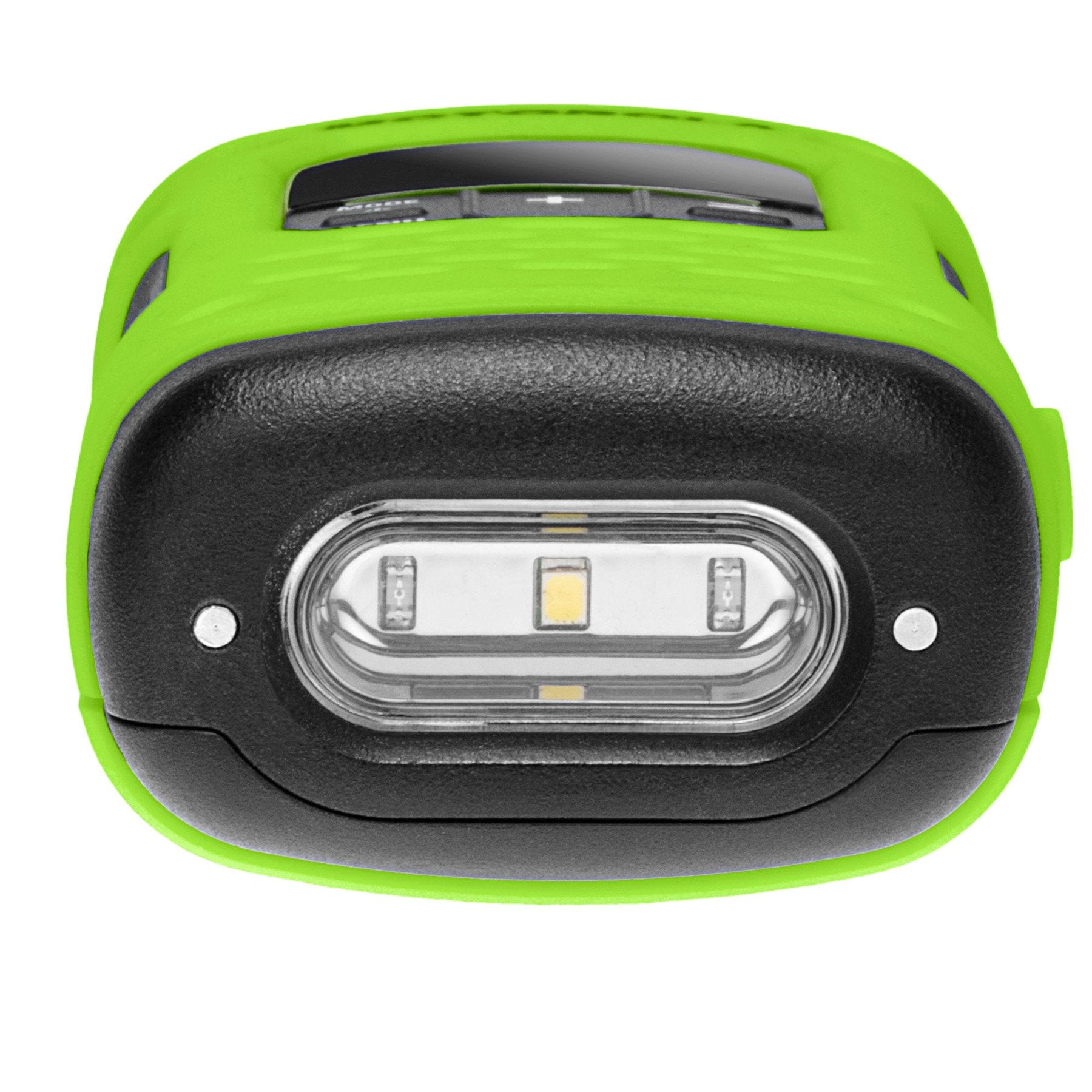
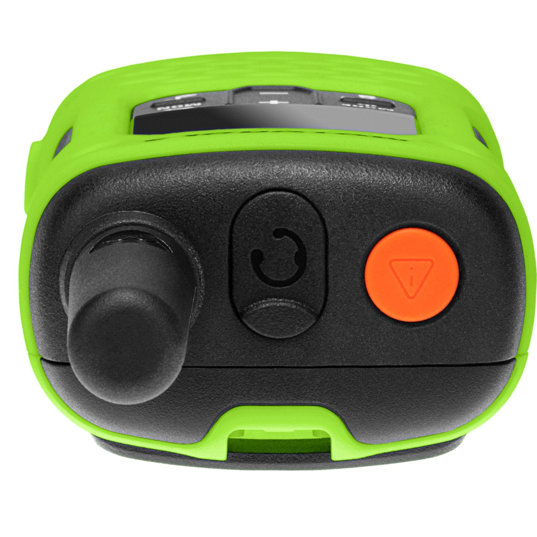
Trust the T600 H2O water-resistant two-way radio to keep you connected both on land and at sea. With its IP67 rating, the T600 H2O withstands continuous immersion in up to 1 meter of water for 30 minutes and repels heavy rain.
Through meticulous engineering, the radio floats and remains visible on the surface of the water. And with the hydro-activated flashlight, it is even easier to find.
This radio includes an emergency alarm feature that allows you to enjoy your escape into nature with the confidence that others can be alerted to any danger you may encounter. When the alarm button is activated, the radio transmits an alarm siren followed by a transmission of spoken or incidental sounds. This allows you to send the signal to other radios and warn them of any imminent danger.
You can also use the whistle on the belt clip to alert others that you need help. In addition, it features an integrated LED flashlight so you can feel confident during nighttime adventures, unexpected emergencies, and power outages.
Select the white LED setting on the integrated flashlight to illuminate your path during nighttime activities, unexpected emergencies, or power outages. If your adventure takes place in the dark, for example, while stargazing and you need to see maps, charts, or other papers, switch to the red LED setting. This allows you to read what you need while preserving your night vision.
Use the VibraCall™ feature when a ringtone may be intrusive.
There are two ways to power your radio: use the included NiMH rechargeable batteries for up to 9 hours of battery life, or use 3 AA batteries for up to 23 hours of battery life. To recharge the NiMH batteries, choose one of three methods: connect them to your vehicle adapter or your computer. Or connect your charging adapter with the Y-cable to a power outlet. This cable comes equipped with dual connectors so you can charge two radios at the same time.
Enjoy hours of uninterrupted outdoor activities by selecting a high-capacity battery (high-capacity battery sold separately).
With iVOX/VOX acting as a speaker and enabling hands-free communication, you can keep moving without stopping to take a call.
Choose what callers hear before you start speaking by selecting one of 20 call tones.
The push-to-talk (PTT) power boost feature allows you to extend the transmission range by increasing the transmitter's output power. It also saves battery life when a power boost is not necessary.
You can communicate with other FRS radios of any brand simply by being on the same channel and privacy code.
Most of the energy wasted when using a mobile device occurs during charging. This radio consumes less power when idle.
How far will my radios communicate? The stated communication range is calculated under optimal conditions, with an unobstructed line of sight. Actual range may vary depending on terrain and conditions and is often less than the maximum possible range. Your actual range will be limited by several factors, including terrain, weather conditions, obstructions, and electromagnetic interference.
| Brand | Motorola Solutions |
| Model Number | T600 H2O |
| Color | Green |
| Number of Channels | 22 channels, each with 121 privacy codes |
| Special Feature | Long range, water-resistant |
| Frequency Range | 450 to 470 MHz |
| Tuner Type | UHF |
| Maximum Talk Range | Up to 35 miles (56 km) in mountain-to-valley terrain; 6 miles in open water; 2 miles in neighborhoods |
| Voltage | 3.6 volts |
| Water Resistance Level | Waterproof, IP67 |
| Number of Batteries | 3 AA batteries (included), or rechargeable NiMH batteries (800 mAh, included) |
| Average Battery Life | 9 hours (NiMH); up to 23 hours with 3 AA batteries |
| Compatible Devices | FRS/GMRS two-way radios; can be paired with other Motorola Talkabout radios |
| Connectivity Protocol | GMRS, MURS |
| Charging Interface | USB-C |
| UPC | 748091024603 |
| ASIN | B0C7HKB7WB |
| Manufacturer | Motorola Solutions |
None: Ready to use!
Request Quote
The DJI Dock 3 Docking Station is an advanced automated charging and landing platform designed to facilitate remote missions without constant human intervention. Compatible with DJI Matrice 4D and 4TD drones, the Dock 3 enables autonomous deployment from fixed or mobile locations thanks to its innovative vehicle-mounting capability. With full integration with DJI FlightHub 2, it allows for cloud-based mission scheduling and management, making it an essential tool for industrial operations, infrastructure inspection, and public safety.
Installing the D-RTK 3 relay on rooftops can significantly improve signal quality, allowing the Dock 3 to be deployed next to high-rise buildings or substation walls.
Deploying the D-RTK 3 relay on a nearby communication tower can significantly improve signal quality during Dock operations.
The DJI Dock 3 can be flexibly deployed, redefining the operations paradigm. For fixed deployments, signal quality can be improved by installing the next-generation D-RTK 3 relay in elevated locations, allowing flexible dock site selection. With the new DJI Enterprise app, deployment can be completed with just a smartphone. Additionally, for the first time, a DJI Dock supports vehicle-mounted deployment, enabling more efficient dispatch during urgent operations and long-distance inspections.
Two docks can be deployed on a single vehicle simultaneously, achieving significant efficiency gains. DJI Dock 3 employs a special handover pattern to avoid drone collisions and ensure operational safety, allowing the two docks to alternate tasks in an orderly manner.
| Category | Specification |
|---|---|
| Product name | DJI Dock 3 |
| Total weight | 55 kg (without aircraft) |
| Dimensions | Cover open: 1760 × 745 × 485 mm Cover closed: 640 × 745 × 770 mm |
| Input voltage | 100-240 V (AC), 50-60 Hz |
| Input power | Maximum 800 W |
| Operating temperature range | From −30 to 50 °C |
| Protection rating | IP56 |
| Maximum landing wind speed | 12 m/s |
| Maximum operating altitude | 4500 m |
| Charging time | 27 minutes (from 15% to 95% at 25 °C) |
| Transmission frequencies | 2.400-2.4835 GHz, 5.150-5.250 GHz, 5.725-5.850 GHz |
| Antennas | 9 integrated antennas, 2T4R, enables smart switching |
| Air conditioning system | Compressor AC, operating voltage: 48 V DC |
| Auxiliary battery | Capacity: 12 Ah Output voltage: 12 V Type: Lead-acid battery Lifespan: >4 hours |
| Network access | Ethernet: 10/100/1000 Mb/s adaptive port 4G: Requires DJI Cellular Adapter 2 (sold separately) |
| Integrated sensors | Wind speed Precipitation Ambient temperature Water immersion Cabin temperature Cabin humidity |
| Security cameras | External: 1920×1080 resolution, 151° FOV, auxiliary white light Internal: 1920×1080 resolution, 151° FOV, auxiliary white light |
| Lightning protection | AC power port: 20 kA (complies with EN 61643-11 Type 2 and IEC 61643-1 Class II) Ethernet port: 10 kA (complies with EN/IEC 61643-21 Category C) |
Request Quote
The inReach® Messenger Plus is an advanced satellite communicator capable of sending and receiving text messages, photos, and voice notes even in areas without cellular service. With a rugged design, long-lasting battery, and features like group messaging, live tracking, interactive SOS, and TracBack®, this device is the ideal companion for scientific expeditions, outdoor adventures, and remote field missions. Compatible with the Garmin Messenger™ and Garmin Explore™ apps, it provides a complete, reliable, and continuous communication experience from anywhere in the world.
| Specification | inReach® Messenger Plus |
|---|---|
| Display | 1.08" diagonal, monochrome MIP, 160 x 68 pixels |
| Lens Material | Chemically strengthened glass |
| Water Resistance | IPX7 |
| Battery Type | Internal rechargeable lithium-ion |
| Battery Life | Up to 600 h (low 10-min mode), 25 days at 10-min tracking |
| Messaging | Text, voice (30 sec), photos, groups, 1600 characters |
| Connectivity | Bluetooth®, USB-C, Wi-Fi, Iridium Satellite |
| GPS and Navigation | GPS, Galileo, QZSS, BeiDou, TracBack®, compass |
| Compatible Apps | Garmin Messenger™, Garmin Explore™ |
| SOS Transmission | Interactive via Garmin Response℠ 24/7 |
| Reverse Charging | Can charge other devices via USB-C |
Request Quote
The RockBLOCK 9603 is a compact, bidirectional satellite communication module specially designed for developers and system integrators. Equipped with an Iridium 9603N modem, this device enables sending and receiving short messages from anywhere on the planet with a clear view of the sky. Thanks to its built-in antenna and support for USB power or direct header connection, the RockBLOCK 9603 is ideal for environmental monitoring, unmanned vehicle control, remote data transmission, and more.
| Specification | RockBLOCK 9603 |
|---|---|
| Operating temperature | -45 °C to 85 °C |
| Relative humidity | ≤ 75% |
| Required voltage | 3.4 - 5.4 V |
| Power consumption | Up to 450 mA (active mode) |
| Sleep mode | Minimum 100 mA; suspendable |
| Transmission frequency | 1 message every ~40 seconds |
| Message size | Tx: 340 bytes / Rx: 270 bytes |
| Waterproof rating | Not waterproof |
| Connector | Molex 51021 (serial, power, and signal) |
Request Quote
The Bushnell Equinox X650 is a digital night vision monocular with 5x zoom and an integrated infrared illuminator, designed for low-light observation in environmental monitoring activities and field documentation. It allows real-time viewing both day and night, offering video recording via micro SD card and tripod mounting compatibility for greater stability.
| Brand | Bushnell |
| Model | Equinox X650 |
| Type | Digital monocular |
| Material | Durable plastic |
| Magnification | 5x |
| Lens diameter | 32 mm |
| Field of view | 4.6° |
| Night vision | Yes |
| Daytime viewing | Color |
| Recording | Micro SD |
| IR illuminator | Integrated |
| Mounting | Tripod compatible |
EO2023603
Request Quote
The Telonics TGAVS Solar GPS/Argos Transmitters are designed for avian studies requiring precise GPS positioning and data transmission via the Argos satellite system. Thanks to their solar power supply, these devices offer longer service life compared to transmitters powered by primary batteries. Each unit is fully user-programmable using the Telonics Product Programmer (TPP) software, enabling optimization of data collection and transmission, sensor activation, and management of transmission schedules using satellite pass predictions.
| Specification | TGAVS-811-5 | TGAVS-830-5 |
|---|---|---|
| Dimensions (L x W x H) | 1.6 x 0.7 x 0.35 in 4.1 x 1.7 x 0.9 cm |
2.2 x 1.0 x 0.6 in 5.6 x 2.5 x 1.5 cm |
| Weight | 11 g | 30 g |
| GPS | Included (position collection) | |
| Transmission | Argos Satellite System | |
| Power Supply | Solar energy | |
| Optional VHF | Yes, available for ground or aerial tracking | |
| Satellite Pass Prediction | Yes, integrated | |
| Available Sensors | Mortality, Activity, Temperature, Low Voltage | |
| Programming | With TPP software (Telonics Product Programmer) | |
| Data Processing | With Telonics Data Converter (TDC) | |
$ 229.50 USD
The CDC Miniature Light Trap Model 512 was originally developed by the U.S. Centers for Disease Control and Prevention (CDC) to provide researchers and wildlife biologists with a highly reliable and portable sampling device. Widely utilized across the globe for taxonomic identification and arbovirus surveillance, this battery-operated trap stands as a core tool for vector control programs. Its optimized field design allows for seamless operation under dense canopy or remote research sites. When paired with the optional Photosensor (LCS-2) and Air Gate System, maintenance requirements are minimized, allowing for automated multi-night collection cycles with a single trip to the field site.
Battery is not included with this product. Sold separately.
| Model | 512 |
| Type | Miniature Light Trap |
| Power Source | Battery (not included) |
| Target Insects | Mosquitoes and Sandflies |
| Automation | Compatible with Photosensor and Air Gate System (optional) |
$ 56.25 USD
A simple design of surprising accuracy, commonly used for counting larger plankton. It is recommended for its ease of use and for obtaining reproducible data. It is designed for you to use with standard or inverted compound microscopes at low magnifications (up to 200x), which makes it unsuitable for examining nannoplankton. Additionally, you can purchase replacement cover glasses in packs of twelve.
| Specification | Detail |
|---|---|
| Frame Material | Brass, mounted on a 1" x 3" glass slide |
| Cell Size | 50 mm x 20 mm x 1 mm |
| Cell Volume | 1.0 ml |
| Gridded Model (1801-G20) | Includes 1x1 mm grid etched on the slide (1 microliter per square) |
$ 596.90 USD
Compatible with the Spartan camera management app: stream photos, videos, and update your settings remotely with just a tap. Whether you are monitoring land, cabins, or animals, the Spartan GoLive keeps you connected with industry-leading technology.
| Dimensions | 17.7 x 24.6 x 10.6 cm. |
|---|---|
| Screen | 2.0" IPS LCD |
| PIR Detection Range | Up to 80 feet (24 meters) |
| Field of View | 56° |
| GPS | Yes - Through the app |
| SD Card Image Resolution | 4MP - 8MP |
| Image Transmission | Thumbnails: 640 x 480 (Normal) or 1280 x 960 (Large) HD Size Options (on request): 2688 x 1520 (4MP) 3840 x 2160 (8MP) |
| Mounting | Tripod mount sockets (bottom and back), mounting strap, security cable lock |
| Night Illumination | Off |
| Operating Humidity | 5% - 90% |
| Photo Burst | 1, 2, 3 (Sends all photos in burst) |
| PIR Sensitivity Options | High, Normal, Low, Off |
| Power Supply | Internal: Built-in lithium cell / External: 12 x AA (1.2v-1.5v each) / 12V DC / 12V Lead-acid |
| SD Card Capacity | SD Card Capacity |
| Video Transmission | Yes (Premium required) |
| Temperature | -4 to 140 Fahrenheit (-20 to 60 Celsius) |
| Time Lapse Interval | 30 seconds - 24 hours |
| Trigger | Motion (PIR), Timer (Time Lapse), Scheduled Events (Premium required) |
| Trigger Interval | 0 seconds - 60 minutes |
| Trigger Time | 0.4/0.5 seconds |
| Video Resolution | WVGA (800 x 480), 720p (1280 x 720), 1080p (1920 x 1080) |
| Video Frame Aspect | 30 fps |
| Video Aspect Ratio | 16:9 |
| Video Transmission Duration | 5 sec, 10 sec, 15 sec, 20 sec, 25 sec, 30 sec |
| Sound Recording in Video | Available |