SHIPPING QUOTE FOR OVERSIZED ITEMS MUST BE REQUESTED | WhatsApp Global CLICK HERE
$ 213.75 USD – Sold Out
This device have been updated to the EC II - D and EC II -...
$ 35.75 USD
Hardened rubber cap is forged with extractor so it won’t work loose. Replacement parts are...
$ 210.90 USD
Haglöf Sweden is the world's largest producer of increment borers. Our increment borers come in...
$ 2,761.90 USD
The Laser Geo 2.2 Hypsometer offers precise 3D measurements thanks to its advanced technology combining laser, GPS, compass, and ultrasonic sensors. Ideal for professionals needing long-range measurements with easy data transfer to GIS applications. Its rugged design and long-lasting battery make this instrument an essential tool for fieldwork in any condition.
The 3D Vector function allows you to measure remote targets such as horizontal distances and angles between two points far ahead in the terrain, such as canopy width or river width.
3-point, 2-point, 1-point, or direct measuring – choose your preferred method using the easy-to-follow menu system. A nonmagnification dot sight helps identify individual targets such as treetops and power lines.
Use the built-in GPS to walk and log an area, or stand in the middle of the area and use the integrated GPS, compass, and laser to measure border points. View results directly in Google Earth or other geographic applications.
MAP wood chip piles.
The MAP TRAIL feature lets you gather target coordinates using laser methods, pitch, and azimuth data. Useful for mapping routes or planning forest cableway systems where GPS isn’t precise. The built-in compass continuously shows direction, helping you hit a target accurately.
| Specifications | |
|---|---|
| Dimensions | 93x63x72 mm / 3.7×2.5×2.8” |
| Weight | 243 g / 8.6 oz |
| Battery and Consumption |
|
| Communication | IR, USB 2.0/SSD, Bluetooth BR/EDR, Bluetooth LE V4.2 (LE), Spp (serial profile), PIN code 1234. |
| Temperature | -20° to +45° C / -4°F to 113°F |
| Height | 0-999 m/ft. Height resolution: 0.1 m/ft. |
| Angle | -90° to +90°. Unit: 360⁰ degrees, 400⁰ degrees, and %. Resolution: 0.1⁰. Accuracy: 0.1⁰ typical. |
| Laser |
|
| Area |
|
| GPS |
33-channel high-sensitivity receiver. Supports GPS, Glonass, Galileo, QZSS. Built-in real-time correction with SBAS (EGNOS, WAAS, MSAS, GAGAN). Accuracy up to 2.5 m / 8.19 ft in open terrain. Satellite position prediction up to 3 days. |
| Compass | Azimuth compass 0-360˚, resolution 0.1˚, accuracy < 1.5 RSME˚. |
| Classification | MIL-STD-810E. Frame material: glass-filled polycarbonate, IP67, NEMA6, Laser Class 1, 7 mm (FDA, CFR21) Class 1m (IEC 60825-1:2001). |
| View | Yellow dot target 1x magnification (HUD) Heads-up-display. |
| Display | External graphical LCD 100x60 pixels. Internal display (HUD) Heads-up-display. |
| Data Format | Nmea or ASCII. IR, Bluetooth. |
| File Format | CSV and KML (Google Earth). |
| Memory | 2000 datasets, non-volatile. |
| Other Information | Adapter and monopod stick, 4 parts (33-140 cm). Aluminum carrying/storage case. See the user manual for more details. |
| Transponder T3 | Transponder T4 | |
|---|---|---|
| Size | Diameter 70 mm | Diameter 70 mm/2.8” |
| Weight | 85 g | 85 g/5 oz (Incl. Battery) |
| Battery | 1 AA 1.5V alkaline battery required for T3 | |
| Power Consumption | 9 mW | |
$ 2,145.00 USD
The Haglöf Laser GEO Hypsometer features a unique combination of high-precision laser, ultrasound, and integrated GPS, compass, and tilt sensors for accurate 3D measurements. Results are displayed on an integrated data screen and an external graphic display.


The Laser Geo instrument is a high-precision laser rangefinder with built-in GPS, compass, Bluetooth, and USB 2.0 for communication. Extreme precision, extreme utility!
| Specifications | |
|---|---|
| Dimensions | 93x63x72 mm |
| Weight | 243 g |
| Battery and Power Consumption |
|
| Communication | IR, Bluetooth® BLE 4.0 class 2, Spp (serial profile), pin code 1234, USB 2.0 / SSD drive. |
| Temperature | -20 ° to + 45 ° C |
| ULTRASOUND (Vertex Laser Geo) |
|
| Height | 0-999 m Height resolution: 0.1 m |
| Angle | -90 ° - 90 °. Unit: 360⁰, 400⁰ Degrees and %. Resolution: 0.1⁰. Accuracy: 0.1⁰ typical. |
| Laser |
|
| Area |
|
| GPS |
33-channel high-sensitivity receiver. Supports GPS, Glonass, Galileo, QZSS. Built-in real-time correction with SBAS (EGNOS, WAAS, MSAS, GAGAN) Accuracy up to 2.5 m / 8.19 ft in open terrain. Satellite position prediction up to 3 days. Multiglobal satellite navigation system based on GPS (USA) / GLONASS (Russia) / Galileo (EU) / QZSS (JAPAN) SBAS Augmentation systems based on satellites: WAAS (USA) EGNOS (EU) GAGAN (India) MSAS (Japan). Built-in auto-generated orbit prediction (TTFF faster up to 3 days), built-in interference cancellation. Accuracy: automatic position 2.5 m CEP (circular probable error) (50% static 24h, -130dBm. Speed 0.1 m / s (50% at 30 m / s. |
| Compass | Azimuth compass 0-360˚, resolution 0.1˚, accuracy <1.5 RSME˚. |
| Classification | MIL-STD-810E. Polycarbonate glass-filled housing frame material, IP67, NEMA6, laser class 1, 7 mm (FDA, CFR21) Class 1m (IEC 60825-1: 2001). |
| View | Yellow point target 1x magnification. |
| Display | 100x60 pixel external LCD graphical display. Internal heads-up display. |
| Data Format | Nmea or Ascii. IR, Bluetooth. |
| File Format | CSV and KML (Google Earth). |
| Memory | 2000 non-volatile data sets. |
| Other Information | Adapter and monopod stick, 4 pieces (33-140cm). Aluminum transport/storage case. Please refer to the user manual for more details. |
$ 1,888.00 USD
The MD II caliper is a rugged and field-ready Bluetooth® caliper designed for efficient diameter...
$ 2,485.00 USD
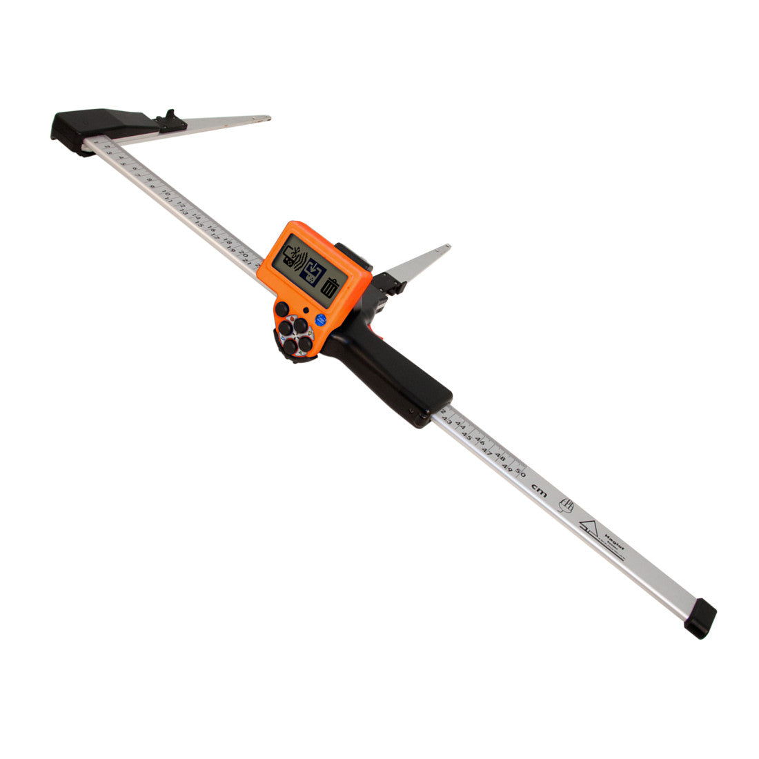
The MD II+ 4.0 caliper from Haglöf Sweden AB is designed to enhance your forestry tasks with advanced technology for measuring tree diameters, heights, and logging details. Equipped with a high-speed 120 MHz floating-point processor and 8 GB of flash memory, this rugged Bluetooth-enabled caliper brings unparalleled efficiency to your fieldwork.
Whether you are conducting detailed tree inventories or scaling logs, the MD II+ 4.0 provides the accuracy and reliability you need to get the job done right. This tool not only measures but also records and transmits data effortlessly, ensuring that your forestry management tasks are performed with precision and ease.
The MD II+ caliper has a large internal memory that can store thousands of measurement results. The memory works similar to a USB memory stick. Stored data is saved in XML file format that can be downloaded to your computer. The communication program MD II+ Com app for Android phones and tablets can be downloaded from Google Play and used to transfer field data. For a fuller communication solution that can present assortments, list of standing trees and more, we offer the MD II+ Com PC communication program.
MD II+ Com is an application for Android tablets and SmartPhones that can be used to read wireless data from the caliper via Bluetooth®. Data is stored as a list in XML files on the Android device. Instead of having to go back to the office, you can share the files via e-mail, Google Drive, Dropbox and more.
Use the MD II+ caliper with the Android app. Share data with your office straight from the field!
Forcípulas, forcipulas, Forcipulas, Forcipula, Forcípula, forcipula, forcípula
| Feature | Detail |
|---|---|
| Memory Capacity | More than 100,000 registers |
| Processor | Low Power Arm Cortex CPU 120MHz includes floating point unit |
| Temperature | Min -20° Max 60°C / Min -4° Max 140° F |
| Battery | Rechargeable Li-ion (1 in terminal +1 in SmartScale), USB-interface charge. Estimated operating time: One week per charge |
| Keys/Buttons |
|
| Measuring System | Non-contact. Accuracy: ±1mm or 0.039 inch |
| Measuring Range | From 500mm/18” to 1000mm/36” (standard) |
| Weight | Caliper and terminal: <1kg/2.20 lbs (standard 500mm/18”). MD II Terminal only: 150g/6oz |
| Display | Graphic, 128 x 64 pixels backlit, graphic interface |
| Communication | USB 2.0 MSD; Bluetooth® v4.2 dual mode (SPP, HID KEYBOARD, BLE); IR receiver |
| Bluetooth® | v4.2 dual mode (SPP, HID KEYBOARD, BLE) |
| Signal | Built-in loudspeaker |
| Classification | IP67 Moist/dust resistant, CE, FCC, IC certified |
| Model | Length |
|---|---|
| Mantax Digitech II+ 320 mm | 320 mm |
| Mantax Digitech II+ 500 mm | 500 mm |
| Mantax Digitech II+ 600 mm | 600 mm |
| Mantax Digitech II+ 650 mm | 650 mm |
| Mantax Digitech II+ 800 mm | 800 mm |
| Mantax Digitech II+ 950 mm | 950 mm |
| Mantax Digitech II+ 1000 mm | 1000 mm |
| Mantax Digitech II+ 18 inches | 18 inches |
| Mantax Digitech II+ 24 inches | 24 inches |
| Mantax Digitech II+ 30 inches | 30 inches |
| Mantax Digitech II+ 36 inches | 36 inches |
| Mantax Digitech II+ 40 inches | 40 inches |
Request Quote
Make your own data collection software for DP II and Digitech Professional Develop custom programs...
$ 161.50 USD
Handle sold separately or Complete Increment Borer available Haglöf Sweden is the world's largest producer of...
$ 495.00 USD
Transponder T4 The T4 is the new and improved transponder that replaces the T3 and...
$ 2,155.00 USD
Vertex is many foresters’ preferred choice of instrument to perform precision height, angle and distance measurements in the forest. The Vertex 5 can be used in dense vegetation and undergrowth.
The new Vertex 5, an ultrasound instrument system is a true 'work horse' that will hand you accurate and reliable measurement results in most forest terrains and conditions. This is also the best Haglöf selling instrument and the professional foresters' preference for accurate height, distance and horizontal distance measuring.
- Ultrasound distance measuring - great accuracy and proven reliability in the forest.
- Works in dense vegetation.
- Audible beep signal for measuring results.
- Low battery consumption.
- Reference users worldwide.
- BAF function.
- Bluetooth® and IR transmitter.
The Vertex 5 is delivered with a lanyard and in an aluminum safety and transport case.
Vertex 5 360° package/set incl. Vertex 5 instrument, transponder T3, plot staff and adapter. Vertex 5 60° package/set incl. Vertex 5 measuring instrument, transponder T3. Vertex 5 measuring instrument only also available.
With the well proven ultrasound measurement method and a high-visibility cross hair sight, the Vertex 5 offers accurate distance readings also in thick undergrowth.
The ultrasound method works great in sample plot surveys, for distances up to approx. 30m/98ft, in dense forests and where there are difficulties to target. Sample Plots with Ultrasound.

Fast and accurate two-point measurement with the Vertex 5 system.
Fasten the T3 transponder to the tree at any height, walk a distance of your choice and measure as many heights on each object as you wish, with the four last measured heights shown in the display.
Measure slope in the terrain and have it presented to you in degrees, grads and percentage.

In sample plot inventory work it is important to use the correct radius measurement.The ultrasound method is very suitable for this application.
Working with factor gauge or prisms can be difficult when some trees cover others in the forest. Poor sighting can prevent a correct diameter measuring.
With the Vertex 5 built in BAF function, the minimum tree diameter for trees to be included in the plot can be featured.
0.5, 1 to 9 (m2/ha) or 5, 10, 15..to 50 (ft2/acre). Vertex 5 can be used in dense vegetation and undergrowth.
Communicate with IR or Bluetooth. Transfer values to the MD II or DP II calipers, or other handheld units with HAGLOF data format.
Vertex 5
| Size | 80 x 54 x 31 mm / 3.14 x 2.12 x 1.22" |
| Weight | 173g (incl. battery) |
| Battery | 1 x 1.5v AA alkaline Current 20mA with Bluetooth 150mA |
| Temperature | -20°C to 45°C / -4°F to - 113°F |
| Wireless Interface | IR Bluetooth 4.0 (BLE), IR |
| Memory | Storage 5000 data sets |
| Signal | Built-in Loud Speaker |
| Ultra sonic frequency | 25 kHz |
| Height | 0-999 m |
| Resolution height | 0.1m / 0.1ft |
| Angles | ‐90° to +90° deg./ ‐100° to +100° grads |
| Resolution Angle | 0.1° |
| Distance with aimed transponder | Approx. 30m / 98ft |
| Distance with 360° Adapter | Approx. 20m / 60ft |
| Resolution Distance | 0.01m / 0.1ft |
| Accuracy Distance | 1% |
T3 Transponder
T4 Transponder
| Size | Diameter 70mm / 2.8" | |
| Weight | 85g / 5oz (Incl. battery) | 85g / 5oz (Incl. battery) |
| Battery | 1,5V AA alkaline | 1,5V AA alkaline |
| Power consumption | 9mW | |
| Current | 1.0 mA | - |
Vertex 5 Only
- Hypsometer (1)
Kit Vertex 5 60°
- Hypsometer (1)
- Transponder (1)
Kit Vertex 5 360°
- Hypsometer (1)
- Transponder (1)
- Adapter (1)
- Monopod staff (1)
Request Quote – Sold Out
The best-selling Haglöf instrument system for tree heights in the forest!
The Vertex IV ultrasound instrument system is a true 'work horse' that will hand you accurate and reliable measurement results in most forest terrains and conditions. This is also the best Haglöf selling instrument and the professional foresters' preference for accurate height, distance and horizontal distance measuring. Download the product sheet (1.7 MB).
- Ultrasound distance measuring - great accuracy and proven reliability in the forest.
- Works in dense vegetation.
- Audible beep signal for measuring results.
- Low battery consumption.
- Reference users worldwide.
- BAF function.
- Bluetooth® and IR transmitter.
The Vertex IV is delivered with a lanyard and in an aluminum safety and transport case.
Vertex IV 360° package/set incl. Vertex IV instrument, transponder T3, plot staff and adapter. Vertex IV 60° package/set incl. Vertex IV measuring instrument, transponder T3. Vertex IV measuring instrument only also available.
With the well proven ultrasound measurement method and a high-visibility cross hair sight, the Vertex IV offers accurate distance readings also in thick undergrowth.
The ultrasound method works great in sample plot surveys, for distances up to approx. 30m/98ft, in dense forests and where there are difficulties to target. Sample Plots with Ultrasound.
Fast and accurate two-point measurement with the Vertex IV system.
Fasten the T3 transponder to the tree at any height, walk a distance of your choice and measure as many heights on each object as you wish, with the four last measured heights shown in the display.
Measure slope in the terrain and have it presented to you in degrees, grads and percentage.
In sample plot inventory work it is important to use the correct radius measurement.The ultrasound method is very suitable for this application.
Working with factor gauge or prisms can be difficult when some trees cover others in the forest. Poor sighting can prevent a correct diameter measuring.
With the Vertex IV built in BAF function, the minimum tree diameter for trees to be included in the plot can be featured.
Communicate with IR or Bluetooth. Transfer values to the MD II or DP II calipers, or other handheld units with HAGLOF data format.
Vertex IV
| Size | 80 x 50 x 30mm / 3.2 x 2 x 1.2" |
| Weight | 180g (incl. battery) |
| Battery | 1 x 1,5v AA alkaline |
| Temperature | -15°C to 45°C / 5°F to - 113°F |
| Ultra sonic frequency | 25kHz |
| Height | 0-999m |
| Resolution height | 0,1m / 0.1ft |
| Angles | -55° to 85° |
| Resolution Angle | 0,1° |
| Distance with aimed transponder | Approx. 30m / 98ft |
| Distance with 360° adapter | Approx. 20m / 60ft |
| Resolution distance | 0.01m / 0.1ft |
| Accuracy distance | 1% |
| Bluetooth | Model –BT SPP Slave serial profile |
T3 Transponder
| Size | Diameter 70mm / 2.8" |
| Weight | 85g / 5oz (Incl. battery) |
| Battery | 1,5VAA alkaline |
| Current | 1.0mA |
Vertex IV Only
- Hypsometer (1)
Kit Vertex IV 60°
- Hypsometer (1)
- Transponder (1)
Kit Vertex IV 360°
- Hypsometer (1)
- Transponder (1)
- Adapter (1)
- Monopod staff (1)
Hipsómetro y Localizador de Rangos, Hipsómetros, Hypsometer
$ 3,198.50 USD
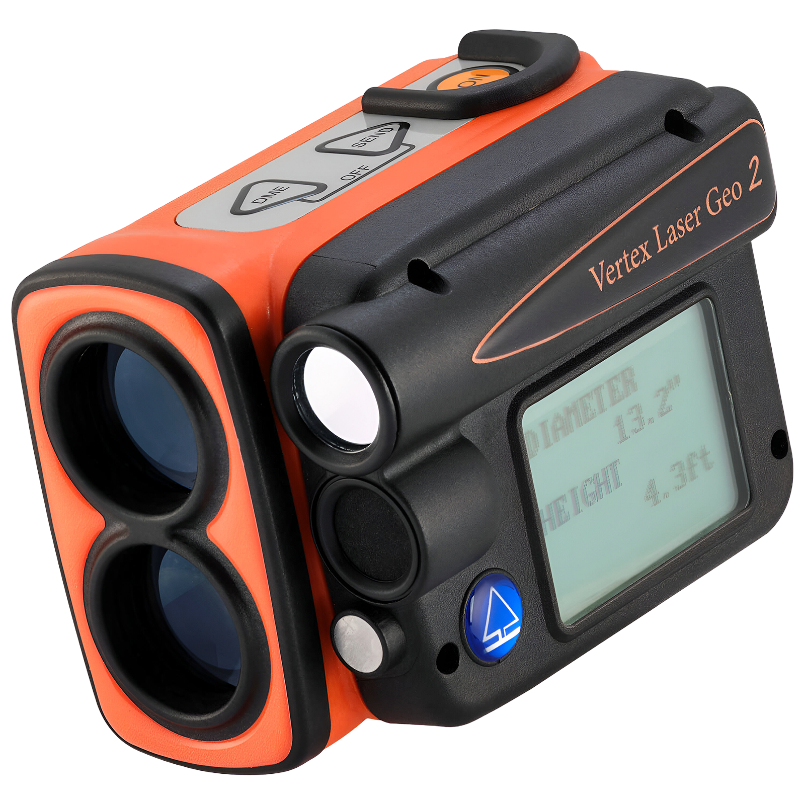
The Haglöf Vertex Laser Geo 2 combines long-range laser technology and ultrasound to provide accurate height, distance, and diameter measurements, even in dense or challenging conditions. With 3-axis tilt sensors, compass, built-in GPS, and connectivity options such as USB, Bluetooth, and infrared, it's an all-in-one tool for field professionals. Its programmable platform allows you to customize features and apps to meet specific needs.
Two vertical lines or
a single horizontal line.


The 3D Vector feature allows you to measure remote targets, such as horizontal distances and angles between two far points in the terrain, like canopy width or river width. Additionally, with the Vertex Laser Geo 2, you have the option to use ultrasound to measure distances in areas with dense vegetation and underbrush.


The MAP TRAIL feature allows you to logically collect destination coordinates using laser method, tilt, and azimuth data. It is useful for mapping trails or roads where GPS is inaccurate, or for planning a forest cableway system. The built-in compass continuously shows direction, guiding you to reach a target accurately.


The T4 is the latest and improved version of the Transponder, succeeding the T3 and all earlier models. Equipped with six built-in LEDs, the T4 provides crucial information at a glance:
The T4 is fully compatible with older measuring instruments, ensuring an effortless upgrade for users. Introducing the T4 Transponder, setting the new standard for all measuring tools, including Vertex 5, Vertex Laser Geo 2, Vertex Laser Geo, and DME...
| Power | |
|---|---|
| Battery | 3.7V rechargeable Li-Ion, approx. 2000 measurements |
| Power consumption | Max. 0.9W |
| Charging time | Max. 3.5 h |
| Communication and Storage | |
| Interfaces | USB 2.0 / SSD, IR, Bluetooth V4.2 LE and Classic |
| Memory | 2000 non-volatile records |
| Formats | CSV, KML (Google Earth), NMEA or ASCII |
| Measurement | |
| Laser range | 46 cm – 700 m |
| Laser accuracy | ±4 cm typical |
| Ultrasonic range | 30 m (20 m with 360° adapter) |
| Ultrasonic accuracy | 1% or better typical |
| Angle | -90° to +90°, accuracy 0.1°, resolution 0.1° |
| Height | 0–999 m/ft, resolution 0.1 |
| Remote diameter | Up to 47" at 10 m, accuracy 1.2 cm |
| GPS and Sensors | |
| GNSS Receiver | GPS, Glonass, Galileo, QZSS with SBAS |
| GPS Accuracy | Up to 2.5 m CEP |
| Compass | 0–360°, accuracy <1.5° RMS |
| Inclinometer | 3-axis, typical accuracy 0.1° |
| Displays and View | |
| Head-Up Display (HUD) | Integrated, 1x magnification |
| Graphic display | LCD 100x60 px |
| Construction and Environment | |
| Durability | IP67, NEMA6, MIL-STD-810E |
| Material | Fiberglass-reinforced polycarbonate |
| Operating temperature | -20 °C to +45 °C |
$ 2,710.00 USD
New models with EXTREME functionality- programmable with built in GPS & Compass Haglöf Sweden introduces...
$ 128.95 USD
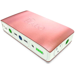
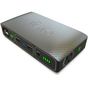
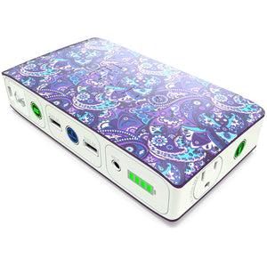
The HALO Bolt 58830 is more than just a portable charger: it’s an essential ally for travel, emergencies, and power outages. With its powerful 58,830 mWh battery, you can charge smartphones, tablets, and laptops, but also jump-start your car or motorcycle in seconds. Compact, stylish, and easy to use, it features an LED light, built-in safety protection, and multiple outputs so you never run out of power when you need it most. Perfect for drivers, travelers, and families looking for safety and backup at all times.
Charge more than just your vehicle with the two USB-A ports. Recharge your iPad on a long trip to keep the kids entertained. Or recharge your AirPods and completely power them up. Either way, the HALO Bolt keeps all your devices charged.
The HALO Bolt can jump-start a full-size car or SUV. Whether you left your headlights on or you’re just being a good Samaritan, the HALO Bolt gets you back on the road fast.
| Specification | Model/Variant |
|---|---|
| Brand | HALO |
| Model | Bolt ACDC 58830 |
| Battery Capacity | 58,830 mWh (196.9 Wh) |
| Inputs / Outputs | AC 120V / 2x USB 5V-2.4A / AC Output 115V (65W) |
| Car Jump Start | 12V / 500A |
| Dimensions | 7.17” x 3.82” x 1.6” |
| Weight | 1.66 lbs (0.75 kg) |
| Certification | UL / ETL |
| Additional Features | LED light, safety protection, charge indicator |
$ 599.00 USD
$ 599.00 USD
The Original Hancock Live Beaver Trap Lightweight and foldable live trap for beavers, designed to...
$ 35.00 USD
This upgraded design hummingbird feeder, is equipped with 8 perch stations for hummingbirds to rest...
$ 35.00 USD
This upgraded design hummingbird feeder, is equipped with 8 perch stations for hummingbirds to rest...
$ 29.95 USD
The LaElvish Garden Hand-Blown Glass Hummingbird Feeder is a unique piece of functional art, handmade by artisans using traditional techniques. Ideal for outdoor use, its vibrant design not only attracts hummingbirds but also enhances any space as exquisite garden décor. With a 32-ounce capacity, four comfortable perches, and a leak-proof structure, this feeder is made from recycled glass and safe materials, offering an unmatched visual and practical experience for nature lovers.
| Specification | Details |
|---|---|
| Capacity | 32 ounces |
| Material | Hand-blown glass |
| Target species | Hummingbirds |
| Feeding ports | 4 copper ports with no sharp edges |
| Perches | 4 sturdy perches |
| Ant moat | Built-in |
| Refilling | Wide-mouth opening |
| Special features | Leak-proof, garden decoration, sun-resistant colors |
| Additional materials | Recycled glass, lead-free |
$ 99.50 USD
Meta - analysis is a powerful statistical methodology for synthesizing research evidence across independent studies....
$ 94.75 USD
This special volume serves as the perfect conclusion to this innovative 16-volume series, covering all...
$ 195.25 USD
Volume 16 marks the conclusion of the Handbook of the Birds of the World series,...
$ 195.25 USD
The Handbook of the Birds of the World (HBW) is an ambitious and comprehensive project,...
$ 192.50 USD
$ 192.50 USD
Volume 15 of the Handbook of the Birds of the World series covers eight families...
$ 195.25 USD
Volume 8, Broadbills to Tapaculos marks the beginning of the volumes dedicated to passerine birds,...
$ 223.75 USD
Volume 9 covers nine families of Passeriformes, including the last suboscines and the first oscines....
$ 194.50 USD
Volume 10, Cuckoo-shrikes to Thrushes, is the largest volume in the series, with 895 pages...
$ 192.50 USD
Volume 11, Old World Flycatchers to Old World Warblers, covers 8 diverse families, mainly from...
$ 170.00 USD
Volume 12, Picathartes to Tits and Chickadees, continues the comprehensive coverage of bird families in...
$ 189.25 USD
Volume 13, Penduline-tits to Shrikes, explores 16 diverse bird families, focusing on climbers, nectar feeders,...
$ 195.25 USD
Volume 14 of the Handbook of the Birds of the World series covers 17 families...
$ 195.25 USD
The Handbook of the Birds of the World, Volume 2, continues the ambitious project of...
$ 186.00 USD
The Handbook of the Birds of the World, Volume 3 covers an impressive total of...
$ 121.75 USD
Awarded the prestigious Outstanding Academic Title, 2000 by ‘CHOICE: Current Reviews for Academic Libraries’. Choice...
$ 161.75 USD
Volume 6, Mousebirds to Hornbills, covers 12 families of birds, taking readers from the unique...
$ 313.90 USD
This is the final volume dedicated to non-passerine birds, covering six fascinating bird families. It...
$ 176.75 USD
Volume 4 of the Handbook of the Birds of the World explores six major bird...
$ 198.00 USD
The species descriptions provide complete and up-to-date information at a time when new and increasingly...
$ 193.50 USD
Volume 1: Carnivores is the first volume of the series Handbook of the Mammals of...
$ 198.00 USD
Rats, mice, and their relatives in the order Rodentia make up nearly half of the...
$ 184.90 USD
Marine mammals include some of the most fascinating animals on Earth. The large and majestic...
$ 194.00 USD
*Volume 5* of the *Handbook of Mammals of the World* offers complete coverage of two...
$ 198.00 USD
Rats, mice, and their relatives in the order Rodentia make up nearly half of the...
$ 191.75 USD
Among rodents, there are species that have colonized almost all available habitats on Earth and...
$ 208.25 USD
*Volume 5* of the *Handbook of Mammals of the World* provides a comprehensive coverage of...
$ 208.75 USD
We saved the best for last! Volume 9 completes the Handbook of Mammals of the...