SHIPPING QUOTE FOR OVERSIZED ITEMS MUST BE REQUESTED | WhatsApp Global CLICK HERE
Request Quote
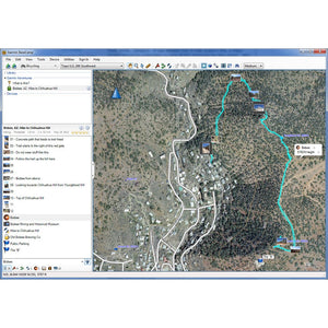
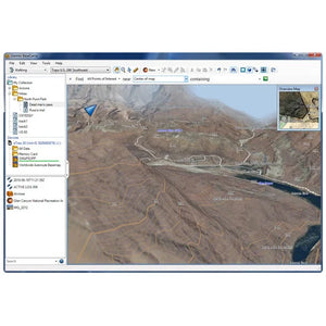
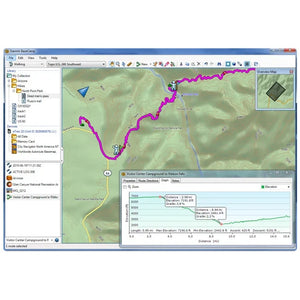
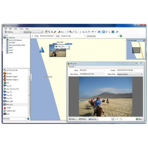
Make the most of your next outdoor activity, or relive the trips you’ve taken. BaseCamp...
Request Quote
Get durable all-around protection for your handheld device with this black nylon carrying case. Wide...
Request Quote
The device is designed for adventurers and explorers, providing constant connection with loved ones through two-way messaging and location tracking. It also offers advanced features such as preloaded topographic maps, satellite imagery, and ABC sensors, all in equipment built to withstand the harshest conditions.
Dimensions | 2.5” x 6.4” x 1.4” (6.2 x 16.3 x 3.5 cm) |
---|---|
Screen Size | 1.5" wide x 2.5" high (3.8 x 6.3 cm); 3" diagonal (7.6 cm) |
Screen Resolution | 240 x 400 pixels |
Display Type | Transflective color TFT |
Weight | 230 g (8.1 oz) with batteries |
Waterproof | IPX7 |
Battery Type | Internal rechargeable lithium-ion |
Battery Life | Up to 165 hours with inReach® enabled with 10-minute tracking Up to 180 hours in GPS mode Up to 425 hours in Expedition mode with inReach enabled Up to 840 hours in Expedition mode |
MIL-STD-810 | Yes (thermal, shock, water); bare unit only |
Interface | USB-C |
Memory/Storage | 16 GB (user space varies based on included mapping) |
Preloaded Maps | Yes (TopoActive, routable) |
---|---|
Ability to Add Maps | Yes |
Base Map | Yes |
Auto Routing | Yes (turn-by-turn routing on roads for outdoor activities) |
Map Segments | 15,000 |
Satellite Imagery | Yes (direct to device) |
Includes Hydrographic Features | Yes (coasts, lake/river shores, wetlands, and perennial/seasonal streams) |
Includes Points of Interest | Yes (parks, campsites, scenic lookouts, and picnic sites) |
Displays Parks, Forests, and Wilderness Areas | Yes (national, state, and local) |
External Memory Storage | Yes (microSD™ card up to 32 GB) |
Waypoints/Favorites/Locations | 10,000 |
Courses | 250, 200 course points per course |
Tracks | 250 |
Navigation Track Log | 20,000 points, 250 saved gpx tracks, 300 saved fit activities |
High-Sensitivity Receiver | Yes |
---|---|
GPS | Yes |
Galileo | Yes |
QZSS | Yes |
Beidou | Yes |
IRNSS | Yes |
Barometric Altimeter | Yes |
Compass | Yes (3-axis with tilt compensation) |
GPS Compass (in motion) | Yes |
Multi-Band Frequency Support | Yes |
Active Weather | Yes |
---|---|
Connect IQ™ | Yes (downloadable watch faces, data fields, widgets, and apps) |
Pairs with Garmin Connect™ Mobile | Yes |
Smart Notifications | Yes (on the handheld device) |
VIRB® Remote Control | Yes |
LiveTrack | Yes |
---|
Point-to-Point Navigation | Yes |
---|---|
TracBack® | Yes |
Area Calculation | Yes |
Hunting/Fishing Calendar | Yes |
Sun and Moon Information | Yes |
Xero™ Locations | Yes |
Geocaching Compatible | Yes (Live Geocaching) |
Custom Maps Compatible | Yes (500 custom map tiles) |
Image Viewer | Yes |
LED Flashlight Beacon | Yes |
Interactive SOS | Yes |
---|---|
inReach Weather | Yes |
Send and Receive Text Messages to SMS and Email | Yes |
Send and Receive Text Messages to Another inReach Device | Yes |
Send and Receive Group Messages | Yes |
Exchange Locations with Another inReach Device | Yes |
MapShare Tracking Compatible | Yes |
Virtual Keyboard for Custom Messaging | Yes |
Send Waypoints to MapShare During Trip | Yes |
Send Route Selection to MapShare During Trip | Yes |
Compatible with Garmin Explore™ App | Yes |
---|---|
Compatible with Garmin Explore Website | Yes |
Compatible with Garmin Messenger App | Yes |
Smart Switching Between Wi-Fi, Cellular, and Satellite with Garmin Messenger App | Yes |
Wireless Connectivity | Yes (Wi-Fi®, BLUETOOTH®, ANT+®) |
---|
$ 142.00 USD
1080p Tiny Dash Cam with a 140-degree Field of View Notice: Some jurisdictions regulate or...
$ 199.99 USD
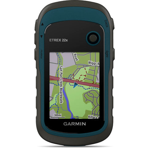
eTrex 22x and eTrex 32x offer the same ease-of-use, durability and affordability that the eTrex handheld GPS series is known for — along with preloaded TopoActive maps. These devices are perfect for ATVs, bicycles, boats or hiking.
eTrex 22x and 32x offer enhanced 2.2”, 65K color, sunlight-readable displays. Durable and water resistant, these handhelds are built to withstand the elements.
The eTrex 22x and 32x handheld devices come preloaded with road-routable TopoActive maps for outdoor activities that feature streets and trails so you can take the journey off the grid. Now you can know your surroundings — such as waterways, natural features as well as buildings, international boundaries and more. You can also find thousands of points of interests, including shops, restaurants, universities, car parks and accommodations.
The eTrex series uses both GPS and GLONASS satellite systems so the receiver has the ability to track in more challenging environments than GPS alone. eTrex 32x adds a 3-axis compass and barometric altimeter, making it easy for you to keep your bearings.
eTrex 22x and eTrex 32x support paperless geocaching. Upload GPX files straight to your device, and view key information such as location, terrain and hints from Geocaching.com
With an array of compatible mounts, eTrex is designed as a handheld — for use on ATVs or bicycles, in boats or on foot. Use the auto mount capability and City Navigator® NT maps for turn by turn driving directions for motorized vehicles, or use the rugged mount for your motorcycle or ATV. Wherever you think you might take eTrex, it has the mapping and mounts to get you there.
Ref | 22x | 32x |
---|---|---|
Dimension | 2.1" x 4.0" x 1.3" | |
Display Size | 1.4" x 1.7" 2.2" diag | |
Display Resolution | 240 x 320 pixels | |
Display Type | 2.2" transflective, 65K color TFT | |
Weight | 5 oz with batteries | |
Waterproof | IPX7 | |
Battery Type | 2 AA batteries (not included); NiMH or Lithium recommended | |
Battery Life | 25 hours | |
Interface | mini USB | |
Memory/History | 8 GB | |
Maps And Memory | ||
Preloaded Maps | yes (TopoActive; routable) | |
Ability to add Maps | ![]() |
|
Basemap | ![]() |
|
Automatic Routing(TURN BY TURN ROUTING ON ROADS)for Outdoor Activities | ![]() |
|
Map Segments | 3000 | |
Include Detailes Hydrographic Features (COASTLINES, LAKE/RIVER SHORELINES, WETLANDS AND PERENNIAL AND SEASONAL STREAMS) | ![]() |
|
Includes Searchable Points of Interests (PARKS, CAMPGROUNDS, SCENIC LOOKOUTS AND PICNIC SITES) | ![]() |
|
Displays National, State and Local Parks, Forest, and Wilderness Areas | ![]() |
|
External Memory Storage | yes (32 GB max microSD™ card) | |
Waypoints/Favorites/Locations | 2000 | |
Tracks | 200 | |
Navigation Track Log | 10000 points, 200 saved tracks | |
Navigation Routes | 200 routes, 250 points per route; 50 points auto routing | |
Sensors | ||
High-Sensitivity Receiber | ![]() |
|
GPS | ![]() |
|
GLONASS | ![]() |
|
GPS COMPASS (WHILE MOVING) | ![]() |
|
Barometric Altimeter | N/A | ![]() |
Compass | N/A | Yes (tilt-compensated 3-axis) |
Outdoor Recreation | ||
Point-to-Point Navigation | ![]() |
|
Area Calculation | ![]() |
|
Hunt/Fish Calendar | ![]() |
|
Sun and Moon Information | ![]() |
|
Geocaching-Friendly | Yes (Paperless) | |
Custom Maps Compatible | yes (100 custom map tiles) | |
Picture Viewer | ![]() |
EO20233003
$ 249.95 USD – Sold Out
We offer the new eTrex 22x and 32x
Request Quote
GPSMAP serie 62 features a 2.6" sunlight-readable 65K color screen that supports BirdsEye Satellite imagery (subscription required) and Custom Maps. Rugged and waterproof, GPSMAP serie 62 features a quad helix antenna for unparalleled reception and sleek new design. Support for Custom Maps and BirdsEye Satellite imagery (subscription required).
GPSMAP serie 62s, 62sc, 62st and 62stc handheld navigator feature a 3-axis tilt-compensated compass, a barometric altimeter, a 5 megapixel autofocus camera with photo navigation, and connect wirelessly to compatible handheld devices.
Explore
GPSMAP serie 62 comes with built-in worldwide basemap with shaded relief, so you can navigate anywhere with ease. With photo navigation, you can download geotagged pictures from the Internet and navigate to them.
Get Your Bearings
GPSMAP 62s, 62sc, 62st and 62stc has a built-in 3-axis tilt-compensated electronic compass, which shows your heading even when you’re standing still, without holding it level. Its barometric altimeter tracks changes in pressure to pinpoint your precise altitude, and you can even use it to plot barometric pressure over time, which can help you keep an eye on changing weather conditions.
Share Wirelessly
With GPSMAP 62s, 62sc, 62st and 62stc you can share your waypoints, tracks, routes and geocaches wirelessly with other compatible devices. Your friends can enjoy your favorite hike or cache — simply press “send” to transfer your information.
Explore the Terrain
GPSMAP 62st and 62stc come preloaded with TOPO 100K, which includes coverage of the full U.S., including Alaska, Hawaii and Puerto Rico, and a worldwide basemap with shaded relief — all the tools for serious climbing or hiking. Map detail includes national, state and local parks and forests, along with terrain contours, elevation information, trails, rivers, lakes and points of interest.
Document Your Journey
With GPSMAP 62sc and 62stc built-in 5 megapixel autofocus camera, you'll be able to capture the highlights of your outings. Each photo is automatically geotagged with the location of where it was taken, allowing you — or those you share your photos with — to easily navigate back to that spot in the future.
Keep Your Fix
With its quad helix antenna and high-sensitivity, WAAS-enabled GPS receiver and HotFix® satellite prediction, GPSMAP 62 locates your position quickly and precisely and maintains its GPS location even in heavy cover and deep canyons. The advantage is clear — whether you’re in deep woods or just near tall buildings and trees, you can count on GPSMAP 62 to help you find your way when you need it the most. BirdsEye satellite image.
Add Maps
Adding more maps is easy with our array of detailed topographic, marine and road maps. With 1.7 GB (62 and 62s) 3.5 GB (62sc, 62st and 62stc) of onboard memory, you can conveniently download 24K and 100K TOPO maps and hit the trail or City Navigator NT map data for turn-by-turn routing on roads (see maps tab for compatible maps). GPSMAP serie 62 also supports BirdsEye Satellite Imagery (subscription required), that lets you download satellite images to your device and integrate them with your maps. In addition, the 62 is compatible with Custom Maps, free software that transforms paper and electronic maps into downloadable maps for your device.
Get Connected
You've been busy exploring and now you want to store and analyze your activities. With a simple connection to your computer and to the Internet, you can get a detailed analysis of your activities and send tracks to your outdoor device using Garmin Connect. This one-stop site offers an activity table and allows you to view your activities on a map using Google Earth. Explore other routes uploaded by millions of Garmin Connect users and share your experiences on Twitter and Facebook. Getting started is easy, so get out there, explore and share.
Find Fun
GPSMAP serie 62 supports geocaching GPX files for downloading geocaches and details straight to your unit. By going paperless, you're not only helping the environment but also improving efficiency. GPSMAP 62 stores and displays key information, including location, terrain, difficulty, hints and descriptions, which means no more manually entering coordinates and paper printouts! Simply upload the GPX file to your unit and start hunting for caches. Slim and lightweight, 62 is the perfect companion for all your outdoor pursuits.
Plan Your Next Trip
Take charge of your next adventure with BaseCamp, software that lets you view and organize maps, waypoints, routes, and tracks. This free trip-planning software even allows you to create Garmin Adventures that you can share with friends, family or fellow explorers. BaseCamp displays topographic map data in 2-D or 3-D on your computer screen, including contour lines and elevation profiles. It also can transfer an unlimited amount of satellite images to your device when paired with a BirdsEye Satellite Imagery subscription.
GPS de Mano Garmin GPSMAP Serie 62
Request Quote
GPSMAP serie 64 features a 2.6" sunlight-readable color screen that supports BirdsEye Satellite Imagery (subscription required) and Garmin Custom Maps. Rugged and waterproof, GPSMAP 64 uses a quad helix antenna for superior reception.
GPSMAP 64s and 64st handheld navigator feature a 3-axis tilt-compensated compass, a barometric altimeter and connect wirelessly to compatible handheld devices.
Get Your Bearings
GPSMAP 64s and 64st has a built-in 3-axis tilt-compensated electronic compass, which shows your heading even when you’re standing still, without holding it level. Its barometric altimeter tracks changes in pressure to pinpoint your precise altitude, and you can even use it to plot barometric pressure over time, which can help you keep an eye on changing weather conditions.
Share Wirelessly
Share your waypoints, tracks, routes and geocaches wirelessly with other compatible devices. Your friends can enjoy your favorite hike or cache without waiting for you to plug in to your computer — simply press “send” to transfer your information to another Garmin handheld.
GPSMAP 64st also connects to compatible Garmin devices, including compatible VIRB and accessory sensors, including tempe™, foot pod and heart rate monitor.
Explore the Terrain
GPSMAP serie 64 comes with a built-in worldwide basemap with shaded relief so you can navigate anywhere with ease. With photo navigation, you can download geotagged pictures from the Internet and navigate to them.
GPSMAP 64st comes preloaded with TOPO 100K, which includes coverage of the full U.S., including Alaska, Hawaii and Puerto Rico, and a worldwide basemap with shaded relief — all the tools for serious climbing or hiking. Map detail includes national, state and local parks and forests, along with terrain contours, elevation information, trails, rivers, lakes and points of interest.
Keep Your Fix
With its quad helix antenna and high-sensitivity, GPS and GLONASS, receiver, GPSMAP 64st locates your position quickly and precisely and maintains its location even in heavy cover and deep canyons. The advantage is clear — whether you’re in deep woods or just near tall buildings and trees, you can count on GPSMAP 64st to help you find your way when you need it the most.
Add Maps
Adding more maps to GPSMAP serie 64 is easy with our array of detailed topographic, marine and road maps. With 4 GB of onboard memory and microSD card slot, you can conveniently download TOPO 24K and 100K maps and hit the trail, plug in BlueChart® g2 preloaded cards for a great day on the water or City Navigator NT® map data for turn-by-turn routing on roads (see maps tab for compatibility). GPSMAP 64 also supports BirdsEye Satellite Imagery (subscription required) that lets you load satellite images onto your device and integrate them with your maps. In addition, the 64 is compatible with Custom Maps, a map format that allows you to transform paper and electronic maps easily into downloadable maps for your device, for free.
GPSMAP 64st comes with a built-in worldwide basemap with shaded relief, preloaded TOPO 100K and a 1-year subscription of BirdsEye Satellite Imagery for a photo-realistic view. Adding more maps is easy with our array of detailed topographic, marine and road maps. With 8 GB of onboard memory and microSD™ card slot, you can conveniently download TOPO 24K maps and hit the trail, plug in BlueChart® g2 preloaded cards for a great day on the water or City Navigator NT® map data for turn-by-turn routing on roads (see maps tab for compatibility). In addition, the 64st is compatible with Garmin Custom Maps, a map format that allows you to transform paper and electronic maps easily into downloadable maps for your device, for free.
Get Connected
You've been busy exploring and now you want to store and analyze your activities. With a simple connection to your computer and to the Internet, you can get a detailed analysis of your activities and send tracks to your outdoor device using Garmin Connect. This one-stop site offers an activity table and allows you to view your activities on a map using Google Earth. Explore other routes uploaded by millions of Garmin Connect users and share your experiences on Twitter and Facebook. Getting started is easy, so get out there, explore and share.
Find Fun
GPSMAP serie 64 supports paperless geocaching with 250,000 preloaded caches with hints and descriptions from Geocaching.com, and has a 16-hour battery life. By going paperless, you're not only helping the environment, but also improving efficiency. GPSMAP serie 64 stores and displays key information, including location, terrain, difficulty, hints and descriptions, which means there’s no more manually entering coordinates and paper printouts! Slim and lightweight, serie 64 is the perfect companion for all your outdoor pursuits.
Plan Your Next Trip
Take charge of your next adventure with BaseCamp, software that lets you view and organize maps, waypoints, routes, and tracks. This free trip-planning software even allows you to create Garmin Adventures that you can share with friends, family or fellow explorers. BaseCamp displays topographic map data in 2-D or 3-D on your computer screen, including contour lines and elevation profiles. It also can transfer an unlimited amount of satellite images to your device when paired with a BirdsEye Satellite Imagery subscription.
GPS de Mano Garmin GPSMAP Serie 64
$ 359.00 USD
GPSMAP serie 64 features a 2.6" sunlight-readable color screen that supports BirdsEye Satellite Imagery (subscription required) and Garmin Custom Maps. Rugged and waterproof, GPSMAP 64 uses a quad helix antenna for superior reception.
GPSMAP 64s and 64st handheld navigator feature a 3-axis tilt-compensated compass, a barometric altimeter and connect wirelessly to compatible handheld devices.
Get Your Bearings
GPSMAP 64s and 64st has a built-in 3-axis tilt-compensated electronic compass, which shows your heading even when you’re standing still, without holding it level. Its barometric altimeter tracks changes in pressure to pinpoint your precise altitude, and you can even use it to plot barometric pressure over time, which can help you keep an eye on changing weather conditions.
Share Wirelessly
Share your waypoints, tracks, routes and geocaches wirelessly with other compatible devices. Your friends can enjoy your favorite hike or cache without waiting for you to plug in to your computer — simply press “send” to transfer your information to another Garmin handheld.
GPSMAP 64st also connects to compatible Garmin devices, including compatible VIRB and accessory sensors, including tempe™, foot pod and heart rate monitor.
Explore the Terrain
GPSMAP serie 64 comes with a built-in worldwide basemap with shaded relief so you can navigate anywhere with ease. With photo navigation, you can download geotagged pictures from the Internet and navigate to them.
GPSMAP 64st comes preloaded with TOPO 100K, which includes coverage of the full U.S., including Alaska, Hawaii and Puerto Rico, and a worldwide basemap with shaded relief — all the tools for serious climbing or hiking. Map detail includes national, state and local parks and forests, along with terrain contours, elevation information, trails, rivers, lakes and points of interest.
Keep Your Fix
With its quad helix antenna and high-sensitivity, GPS and GLONASS, receiver, GPSMAP 64st locates your position quickly and precisely and maintains its location even in heavy cover and deep canyons. The advantage is clear — whether you’re in deep woods or just near tall buildings and trees, you can count on GPSMAP 64st to help you find your way when you need it the most.
Add Maps
Adding more maps to GPSMAP serie 64 is easy with our array of detailed topographic, marine and road maps. With 4 GB of onboard memory and microSD card slot, you can conveniently download TOPO 24K and 100K maps and hit the trail, plug in BlueChart® g2 preloaded cards for a great day on the water or City Navigator NT® map data for turn-by-turn routing on roads (see maps tab for compatibility). GPSMAP 64 also supports BirdsEye Satellite Imagery (subscription required) that lets you load satellite images onto your device and integrate them with your maps. In addition, the 64 is compatible with Custom Maps, a map format that allows you to transform paper and electronic maps easily into downloadable maps for your device, for free.
GPSMAP 64st comes with a built-in worldwide basemap with shaded relief, preloaded TOPO 100K and a 1-year subscription of BirdsEye Satellite Imagery for a photo-realistic view. Adding more maps is easy with our array of detailed topographic, marine and road maps. With 8 GB of onboard memory and microSD™ card slot, you can conveniently download TOPO 24K maps and hit the trail, plug in BlueChart® g2 preloaded cards for a great day on the water or City Navigator NT® map data for turn-by-turn routing on roads (see maps tab for compatibility). In addition, the 64st is compatible with Garmin Custom Maps, a map format that allows you to transform paper and electronic maps easily into downloadable maps for your device, for free.
Get Connected
You've been busy exploring and now you want to store and analyze your activities. With a simple connection to your computer and to the Internet, you can get a detailed analysis of your activities and send tracks to your outdoor device using Garmin Connect. This one-stop site offers an activity table and allows you to view your activities on a map using Google Earth. Explore other routes uploaded by millions of Garmin Connect users and share your experiences on Twitter and Facebook. Getting started is easy, so get out there, explore and share.
Find Fun
GPSMAP serie 64 supports paperless geocaching with 250,000 preloaded caches with hints and descriptions from Geocaching.com, and has a 16-hour battery life. By going paperless, you're not only helping the environment, but also improving efficiency. GPSMAP serie 64 stores and displays key information, including location, terrain, difficulty, hints and descriptions, which means there’s no more manually entering coordinates and paper printouts! Slim and lightweight, serie 64 is the perfect companion for all your outdoor pursuits.
Plan Your Next Trip
Take charge of your next adventure with BaseCamp, software that lets you view and organize maps, waypoints, routes, and tracks. This free trip-planning software even allows you to create Garmin Adventures that you can share with friends, family or fellow explorers. BaseCamp displays topographic map data in 2-D or 3-D on your computer screen, including contour lines and elevation profiles. It also can transfer an unlimited amount of satellite images to your device when paired with a BirdsEye Satellite Imagery subscription.
GPS de Mano Garmin GPSMAP Serie 64
$ 535.00 USD
garmin
$ 475.00 USD
- NEW GPS and GLONASS: better and faster satellite positioning.
- 4" display with dual orientation optimized for outdoors: for easy reading in any condition.
- NEW Pre-Installed Content: 250,000 geo-caches from Geocaching.com and 1 free year of BirdsEye1 satellite imagery. Ref. 680t includes recreational topographic route map with United States coverage.
- NEW Includes a new Track Manager that offers a better user experience and more control.
- NEW 8 megapixel camera for high resolution geo-tagged photos.
- Full navigation on any site with more versatile features, display and support.
- Barometric altimeter and three-axis compass.
Designed for use on trails, on roads or in the water, Garmin's Montana 680 device will guide you wherever you go. With an improved large 4" (10.16 Cm) touch screen, dual orientation and GPS and GLONASS positioning to control your position faster and more accurately, even in the most difficult environments. With the new Track Manager, it's easy to see where you are at all times and comfortably control your track recording.The Montana 680 includes a 3-axis electronic compass with barometric altimeter and a free 1-year subscription to Bird's Eye satellite imagery.The Montana 680 is Rugged, waterproof, includes an 8-megapixel camera and is designed to withstand the elements2.
The Montana 680 features a 4" dual-orientation touch screen optimized for outdoor use that offers the best readability in any light condition. The easy-to-use touch screen user interface will allow you to enjoy nature more and spend less time searching information.Montana's display is loved by outdoor enthusiasts for its optimal readability thanks to large data fields and numerous mapping functions.Rugged and waterproof, the Montana 680 is designed to withstand inclement weather Shocks, dust, dirt, humidity or water will no longer be a problem for this resistant navigator2.
Capture locations and memories with the Montana 680's 8-megapixel digital camera. Each photo is automatically geotagged with the location where it was taken, allowing you to navigate back to that exact spot in the future. Take and view photos in a landscape or portrait orientation. Track your photos and check their locations on a map with BaseCamp™. Pop in a microSD™ card for more storage space or to view photos from other devices.
With the new high-sensitivity GPS and GLONASS receiver, the Montana 680 locates your position quickly and accurately, and maintains its location even in thick forests and deep valleys. The advantage is clear, you can count on the Montana 680 device to help you find your way when you need it most.
With a wide range of compatible mounts, the Montana is designed for use on bikes, 4x4s, boats, and as a handheld device or for convenient everyday car navigation. Use the optional car mount with City Navigator maps for voice turn-by-turn directions, or try the optional rugged mount for your motorcycle or ATV.
The Montana 680 includes a 1-year BirdsEye satellite imagery subscription with incredible aerial imagery to enhance your navigation. If you want more detailed information, you can easily add more maps to the Montana1 device. Load TOPO maps and hit the road in no time, pop in preloaded BlueChart® g2 cards for a great day on the water, or load City Navigator map data for turn-by-turn directions. Or transform paper maps into files you can download for your Montana device with Custom Maps.
Navigate with ease
The new Montana 680 device includes a Track Manager application that allows you to record, view and analyze your tracks in a very comfortable and intuitive way. The handheld has key features for outdoor activities like a 3-axis tilt-compensated compass that shows your direction even when you're standing still and held tilted. It also includes a barometric altimeter that tracks changes in air pressure to determine your altitude and even graphs barometric pressure over time, which can help you keep an eye on changing weather conditions.
The Montana 680 comes preloaded with over 250,000 assorted geocaches from geocaching.com and supports "paperless" geocaching. This allows the Montana 680 to save and display key cache information such as location, terrain, difficulty, hints and descriptions, so you no longer have to manually enter coordinates or carry paper printouts. When you want to add more caches, you just have to load the GPX file on your device and continue with the search.
With the Montana 680 device you can share your waypoints, tracks, routes and geocaches wirelessly with other compatible Garmin GPS users. Just press "Send" to transfer your information to other units.
The Montana 680 device includes Garmin's dual battery system that guarantees maximum independence. It will allow you to use the option that suits you best: rechargeable lithium-ion batteries or traditional AA alkaline batteries.
Take command of your next adventure with our free BaseCamp™, software that lets you view and organize maps, waypoints, routes, and tracks. This free trip planning software even lets you create Garmin Adventures that you can share with friends, family, or fellow explorers. BaseCamp displays topographic map data in 2D or 3D on your computer screen, including elevation profiles and bathymetric lines. Plus, you can transfer an almost unlimited amount of satellite imagery to your device from the included BirdsEye satellite imagery subscription.
Unit Dimensions (Width/Height/Depth) | 7,48 x 14,42 x 3,64 cm |
Weight | 289 g (10,2 oz) with a lithium-ion battery (included); 333 g (11,7 oz) with three AA batteries (not included) |
Waterproof | IPX7 |
Drums | Rechargeable lithium-ion battery (included) or 3 AA batteries (not included); NiMH or lithium recommended |
Touch screen | ![]() |
screen type | Bright, sunlight-readable, dual-orientation, 65,000-colour transflective TFT touchscreen |
Screen size (Width/Height) | 5,06 x 8,93 cm; 4" in diagonal (10,2 cm) |
Screen resolution (Width/Height) | 272 x 480 pixels |
Cell/battery autonomy | Up to 16 hours (lithium-ion); up to 22 hours (AA batteries) |
memory/history | 2,7 GB |
High sensitivity receiver | ![]() |
computer interface | Compatible with Hi-Speed USB and NMEA 0183 |
Basemap | ![]() |
pre-installed maps | 1 year subscription to BirdsEye Satellite Imagery ready to download once you have registered your device. Ref 680t 100K maps preloaded with TOPO U.S. |
Ability to add maps | ![]() |
Supports data cards | microSD™ card (not included) |
Customizable points of interest (possibility to add additional points of interest) | ![]() |
Waypoints | 4000 |
Routes | 200 |
Tracks | 10.000 points, 200 saved tracks |
barometric altimeter | ![]() |
Compass | Yes (Three Axis Tilt Compensated) |
Calculation of areas | ![]() |
Automatic route creation (turn by turn on the road) |
![]() |
geocaching mode |
![]() |
Compatible with custom maps | ![]() |
Hunting and fishing calendar | ![]() |
astronomical information | ![]() |
Camera |
![]() |
Pictures viewer | ![]() |
Compatible with Garmin Connect™ (online community where you can analyze, classify and share data) | ![]() |
Additional characteristics | - High sensitivity GPS receiver for GPS and GLONASS signals - 250000 pre-installed geocaches - New and improved track manager |
$ 799.95 USD
The rugged Montana 750i navigation device combines the flexibility of on-road or off-road navigation with global messaging and interactive SOS alerts using inReach1 satellite communication technology, plus an integrated 8 megapixel camera.
Text your loved ones, post on social media, or communicate with another inReach device in the same area (requires an active subscription to a satellite service).
In an emergency, activate an interactive SOS message to GEOS, a professional 24-hour global control and response center (requires an active subscription to a satellite service).
Instead of relying on mobile coverage, your messages, SOS alerts and tracking options are now transferred via the Iridium® satellite network with fully global coverage (active subscription to satellite service required).
The available inReach weather forecast service provides detailed updates directly to the Montana navigation device or paired devices, so you know what to expect along the way.
This waterproof and navigation device is tested to US military standards and features a 5 ”glove-friendly touchscreen that is 50% larger than previous Montana models.
Capture images of your exploits with Montana's 8 megapixel digital camera. Geotag photos with coordinates so you can return to your favorite places in the future.
Seamless transition between trail and road navigation with the preloaded City Navigator street map, which guides you as you drive with easy-to-follow turn-by-turn directions. (EUROPE).
Use direct-to-device downloads of BirdsEye satellite imagery (no annual subscription required) to see realistic views and create waypoints based on landmark locations.
Use ABC sensors on your next ride, including an altimeter for elevation data, a barometer to monitor weather changes, and a three-axis electronic compass.
Use mobile connectivity2 to access up-to-date Active Weather forecasts through the Garmin Connect ™ app.
Ideal for hunters and trainers, Montana syncs with Astro® or Alpha® series navigation devices (sold separately) to keep track of sporting dogs in the field.
Specs | |
---|---|
Physical and Performance Characteristics | |
Dimensiones | 9,1 x 18,30 x 3,27 cm |
Screen Dimensions | 6,48 x 10,80 cm; 12,70 cm in diagonal |
Screen Resolution | 480 x 800 px |
Screen Type | Transflective WVGA, dual orientation |
Weight | 410 g with included lithium-ion battery |
Battery | rechargeable lithium-ion (included) |
Battery Life |
|
Water Resistance Classification | IPX7 |
Interface | High-speed micro-USB and NMEA 0183 compatible |
Record | 16GB (user space varies based on included maps) |
Maps and Memory | |
Pre-installed Maps | Yes (Europe TopoActive) |
Automatic Route Creation | Yes (with optional maps with detailed road information) |
Map Tracking | 15000 |
Includes hydrographic features with a high level of detail (coastlines, river coastlines, swamps, perennial and seasonal streams) | |
Includes searches for points of interest (parks, camping areas, scenic watchtowers and picnic areas) | |
It shows national, regional and local parks, forests and natural landscapes. | |
Storage and Loading Capacity | Yes (max 32GB microSD ™ card) |
Route Points | 10000 |
Tracks | 20,000 points, 250 saved gpx tracks and 300 saved exercise activities |
Routes | 250, 250 points per route; 50 automatic route points |
Sensors | |
Compass | 250, 250 points per route; 50 automatic route points |
Outdoor Leisure Functions | |
Geocaching Mode | Yes (live geocaches) |
Compatible with Custom Maps | Yes (500 custom map tiles) |
Camera | Yes (8 megapixels with autofocus; automatic geotagging) |
Outdoor Applications | |
Dog Tracking | Yes (when linked to a compatible dog tracking system) |
Connections | |
Wireless Connectivity | Yes (Wi-Fi®, Bluetooth®, ANT + ®) |
(S 23/9/2021)
$ 109.95 USD
Only Garmin could make the eTrex better. The new serie eTrex retains the core functionality, rugged construction, affordability and long battery life that made eTrex the most dependable GPS device available. We improved the user interface and added a worldwide basemap, paperless geocaching and added support for spine mounting accessories. You’ll recognize the name. You’ll recognize the quality. But the serie eTrex is an entirely new device – a device that only Garmin could offer.
See the Way
eTrex 10 has an enhanced 2.2 in monochrome display that’s easy to read in any lighting situation. Its easy-to-use interface means you’ll spend more time enjoying the outdoors and less time searching for information. eTrex 20, eTrex 20x, eTrex 30 and eTrex 30x has an enhanced 2.2 in 65K colour, brilliant, sunlight-readable display. Durable and waterproof, feature the legendary toughness that’s built to withstand the elements – be it dust, dirt, humidity or water, none of which are a match for these legendary navigators.
Find Fun
The serie eTrex features paperless geocaching by supporting GPX files for downloading geocaches and details straight to your unit. Visit OpenCaching.com to start your geocaching adventure. By going paperless, you're not only helping the environment but also making your geocaching more fun. The serie eTrex stores and displays all the information you need, including location, terrain, difficulty, hints and descriptions, which means no more manually entering coordinates and paper print outs. Simply upload the geocache to your unit and start hunting for caches.
Keep Your Fix
With its high-sensitivity, EGNOS-enabled GPS receiver and HotFix satellite prediction, the serie eTrex locates your position quickly and precisely and maintains its GPS location even in heavy cover and deep canyons. The advantage is clear — whether you’re in deep woods or just near tall buildings and trees, you can count on the eTrex to help you find your way when you need it the most.
Go Global
The new eTrex series is the first-ever consumer-grade receivers that can track both GPS and GLONASS satellites simultaneously. GLONASS is a system developed by the Russian Federation that will be fully operational in 2012. When using GLONASS satellites, the time it takes for the receiver to “lock on” to a position is (on average) approximately 20 percent faster than using GPS. And when using both GPS and GLONASS, the receiver has the ability to lock on to 24 more satellites than using GPS alone.
Add Maps
With its microSD card slot and 1.7 GB of internal memory, eTrex 20 and eTrex 30 and 3.7 GB for eTrex 20x and eTrex 30x lets you load our range of Ordnance Survey maps such as Garmin GB Discoverer and hit the trail, plug in BlueChart g2preloaded cards for a great day on the water or City Navigator NT map data for turn-by-turn routing on roads (see maps tab for compatible maps).The eTrex 20, eTrex 20x, eTrex 30 and eTrex 30x also supports BirdsEye select map download service, that lets you download premium raster maps to your device and integrate them with your existing maps.
Go Anywhere
With an array of compatible mounts, eTrex 20, eTrex 20x, eTrex 30 and eTrex 30x can be used on your bicycle, boat, in your car or motorbike and off-road vehicle. You even get turn-by-turn directions with the auto mount and City Navigator NT maps. Wherever you think you might take eTrex, it has the mapping and mounts to get you there.
Share Wirelessly
The eTrex 30 and eTrex 30x lets you share your waypoints, tracks, routes and geocaches wirelessly with other compatible Garmin GPS devices. So now your friends also can enjoy your favorite hike or cache – simply press “send” to transfer your information to similar units, and let the games begin.
GPS de Mano Garmin Serie eTrex
Request Quote
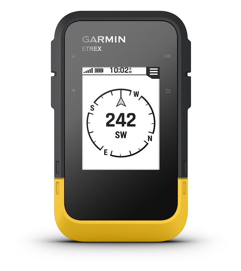
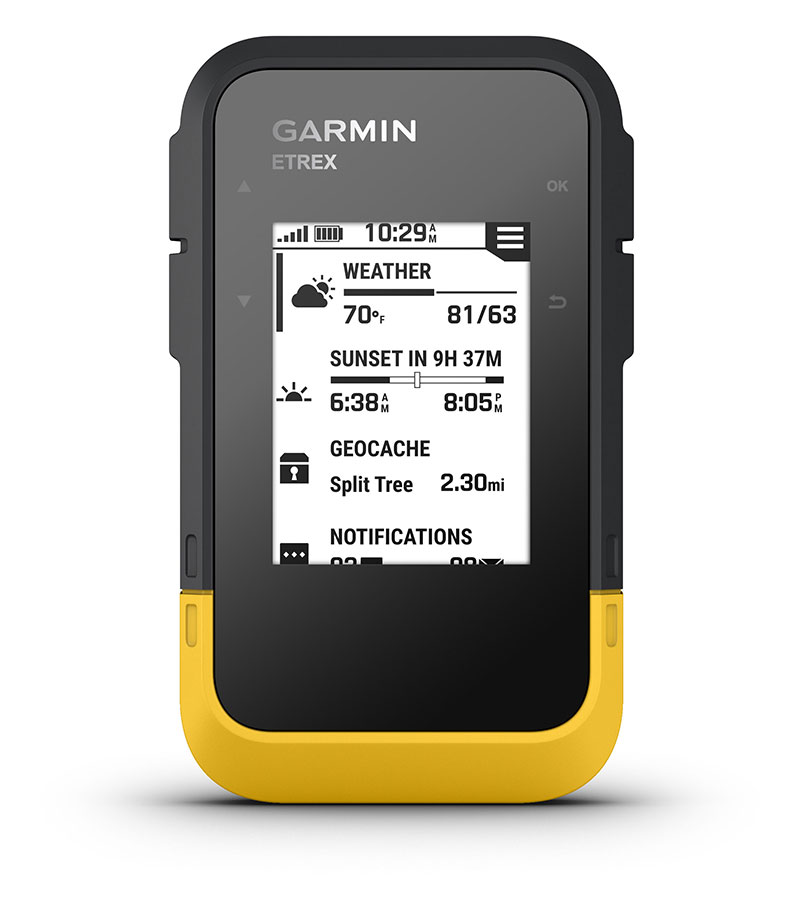
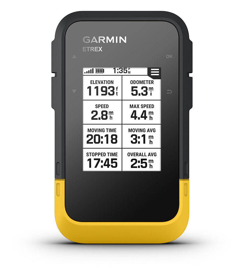
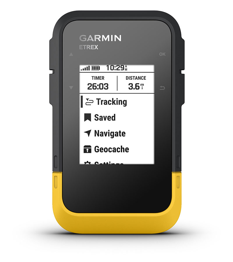
Adventure easily with this simple-to-use GPS handheld with extra battery life, wireless connectivity and multi-GNSS support — so you can enjoy exploring more.
Bright sunlight is no problem with the high-resolution 2.2” screen. | Head out more often with up to 168 hours of battery life. | Into geocaching? Get automatic updates from Geocaching Live to find your next cache. | Plan trips and more when you pair with the Garmin Explore™ smart-device app. | Need accurate tracking? You got it, even in challenging environments with multi-GNSS support. |
Keep your bearings with the digital compass so you’re always on course.
|
![]() |
MULTI-GNSS SUPPORTAccess multiple global navigation satellite systems (GPS, GLONASS, Galileo, BeiDou and QZSS) to track in more challenging environments than GPS alone. |
GEOCACHINGGet automatic cache updates from Geocaching Live, including descriptions, logs and hints. When connected to the Garmin Explore app, each find will upload to your Geocaching.com profile. |
![]() |
![]() |
DIGITAL COMPASSFollow your bearing on the digital compass, which provides an accurate heading even when stationary. |
ACTIVE WEATHERWhen connected to the Garmin Explore app, you can get real-time forecast information, so you’re aware of the changing conditions. |
![]() |
![]() |
GARMIN EXPLORE APPConnect with the Garmin Explore app for wireless software updates, cloud storage, trip planning, smart notifications and additional mapping. |
BATTERY LIFEGet long battery life of up to 168 hours in standard mode and up to 1,800 hours in expedition mode with 2 field-replaceable AA batteries (not included). |
![]() |
Note: Requires two (2) AA batteries
General |
|
---|---|
Dimension |
2.4" x 4.0" x 1.3" |
Display Size | 1.3" x 1.7" 2.16" diag |
Display Resolution | 240 x 320 pixels |
Display Type | 2.2" transflective, monochrome |
Weight | 5.5 oz with batteries |
Waterproof | IPX7 |
Battery Type | 2 AA batteries (not included) |
Battery Life | 168 hours in standard mode; 1,800 hours in expedition mode |
Interface | USB-C |
Memory/History | 28MB |
Maps and Memory | |
Basemap | yes (cities only) |
Waypoints/Favorites/Locations | 1,000 |
Courses | 50 |
TRACKS | ![]() |
Activities | 200 |
Navegation Routes | ![]() |
Sensors | |
High-Sensitivity Receiver | ![]() |
GPS | ![]() |
GLONASS | ![]() |
GALILEO | ![]() |
QZSS | ![]() |
BEIDOU | ![]() |
Compass | ![]() |
GPS Compass (While Moving) | ![]() |
Daily Smart Features | |
Smart Notifications on Handheld | ![]() |
Weather | ![]() |
Outdoor Recreation | |
Point-to-Point Navigation | ![]() |
TRACBACK® | ![]() |
Area Calculation | ![]() |
Sun and Moon Information | ![]() |
GEOCACHING-Friendly | ![]() |
Outdoor Applications | |
Compatible With GARMIN EXPLORE™ App | ![]() |
Connections | |
Connections Wireless Connectivity | yes (BLUETOOTH®) |
EO20233003
$ 479.99 USD
With high-sensitivity GPS and GLONASS satellite tracking, worldwide basemap with shaded relief and customizable buttons for 1-touch image capture and waypoint marking, Oregon 650 opens a new world of GPS mapping and positioning.
Quality Photos
Take quality photos with Oregon 650's built-in 8 MP autofocus digital camera. Each photo is geotagged, allowing you to navigate back to that exact spot. Share the photos with all your friends through Garmin Adventures. For more storage, insert a microSD™ card; you can even view pictures from other devices on microSD card with Oregon's picture viewer.
Touch and Go
Oregon 650 has reflective display technology for the most brilliant, sunlight readable touchscreen we’ve ever made. It's as vivid in full bright sunlight as it is in shade. The screen has been strengthened for impact resistance but still accommodates gloved operation. And with dual-orientation, multi-touch screen, you won’t just look at maps, you’ll interact with them when you zoom in, pan out and rotate the display.
Double Your Power
Oregon 650 features our state-of-the-art dual battery system. You’ll have the option of using the internally rechargeable NiMH pack (included) or traditional AA batteries — NiMH pack charges when the device is connected to external power.
Get Your Bearings
Oregon 650 has a built-in 3-axis electronic compass with accelerometer tilt compensation to show where you're heading even when standing still, or not holding it level. Its barometric altimeter tracks changes in pressure to pinpoint your precise altitude. You can even use it to plot barometric pressure over time to keep an eye on changing weather conditions.
With its high-sensitivity, WAAS- and GLONASS-enabled GPS receiver and HotFix® satellite prediction, Oregon 650 locates your position quickly and precisely, and maintains its GPS location even in heavy cover and deep canyons.
Share Wirelessly
With Oregon 650 you can share your waypoints, tracks, routes and geocaches up to 50 times faster with other wireless compatible Garmin handheld devices. Plus, you can share large files too like photos, Garmin Adventures and Custom Maps. Just touch “send” to transfer your information.
Add Maps
Adding more maps to Oregon is easy. Load TOPO U.S. 24K maps and hit the trail; add Trailhead Series TOPO maps and explore famous treks like the Appalachian Trail and the Pacific Crest Trail; plug in BlueChart® g2 preloaded cards for a great day on the water; or load City Navigator® map data for turn-by-turn routing on roads. Add satellite images to your maps with BirdsEye Satellite Imagery (subscription required).
Load All the Geocaches
No more picking, choosing and planning, just download them all. The Oregon 650 can hold up to 4 million. Download every cache on Geocaching.com. Load caches using your favorite program or website that supports GGZ files. All your paperless geocaching features will be there for every cache. Read full descriptions, hints and logs. Filter caches by size, terrain, difficulty and type. Connect to chirp-enabled caches. Record your logs in the field. Do it all.
Plan Your Next Trip
Take charge of your next adventure with BaseCamp™, software that lets you view and organize maps, waypoints, routes and tracks. This free trip-planning software even allows you to create Garmin Adventures that you can share with friends, family or fellow explorers. BaseCamp displays topographic map data in 2-D or 3-D on your computer screen, including contour lines and elevation profiles. It also can transfer an unlimited amount of satellite images to your device when paired with a BirdsEye Satellite Imagery subscription.
GPS de Mano Garmin GPSMAP Serie 64
$ 499.99 USD
Thanks to a redesigned antenna for better satellite reception, the Oregon 750 GPS and GLONASS handheld puts even more of the great outdoors at your fingertips. Whether you’re hiking, hunting, climbing, kayaking, trail riding or whatever, this rugged navigator is ready for anything. It features multilink wireless connectivity (Wi-Fi, Bluetooth and ANT+), Active Weather support with animated radar overlays, a 1-year BirdsEye Satellite Imagery subscription and a built-in 3-axis compass with barometric altimeter.
More Connectivity, Less Complexity
The expanded wireless capabilities of Oregon 750 make it easier than ever to download software, receive smart notifications¹ and upload adventures to Garmin Connect. You can even share LiveTrack location data or geocache discoveries, unit-to-unit, with other compatible Garmin handheld devices. Smart notifications via Bluetooth connectivity with a compatible smartphone let you receive emails, texts and alerts right on your device. So you can see what’s going on while you’re getting away from it all. Comes standard with a dual battery system that lets you use traditional AA batteries or a rechargeable NiMH power pack.
Find Fun with Geocaching.com
The wireless Wi-Fi and Bluetooth links on your Oregon 750 makes it easier than ever to enjoy a superior geocaching experience. You can set your device to automatically stay up to date with all the latest caches from Geocaching.com. No more manual entry of coordinates or printing out cache details on paper.
Take Geotagged Pictures
Capture locations and memories with the 8 megapixel digital camera. Each photo is automatically geotagged, allowing you to easily navigate back to that exact spot in the future. You can upload and share your favorite photos with friends via Garmin Adventures™, part of the Garmin online community.
Navigate Your Way
The Oregon 750 handheld provides comprehensive navigation and tracking to guide you on and off the beaten path, using GPS and GLONASS plus ABC (altimeter, barometer and compass) sensor capabilities. The built-in altimeter provides elevation data to accurately monitor ascent and descent, while the barometer can be used to predict weather changes by showing short-term trends in air pressure. The 3-axis electronic compass keeps your bearing, whether you’re moving or not. There’s also a TracBack® feature on Oregon 750 to help you navigate back to your starting point the same way you came. You can also mark locations, such as your campsite, vehicle or other points of interest, to which you'd like return navigation.
Enjoy the View on a Vivid Display
The Oregon 750 handheld features a bright, sunlight-readable 3-inch color touchscreen display with dual orientation for landscape or portrait views. It easily supports multiple mapping options such as BlueChart® g2 HD for water navigation or City Navigator® NT for turn-by-turn driving directions. Durable and water-rated to IPX7, the Oregon series is built to keep delivering vital mapping and tracking data, no matter what the elements throw at you. Plus, you can even customize your Oregon’s display with free downloads of apps, widgets and data fields from the Garmin Connect IQ™ online store².
Plan Your Next Trip
Take charge of your next adventure with BaseCamp™, software that lets you view and organize maps, waypoints, routes and tracks. This free trip-planning software even allows you to create Garmin Adventures that you can share with friends, family or fellow explorers online. BaseCamp displays on your computer screen any topographic map data stored on the device, including contour lines and elevation profiles. It also can transfer an unlimited amount of satellite images to your device when paired with a BirdsEye Satellite Imagery subscription.
¹See Garmin.com/BLE for compatibility ²Apps, widgets and data fields will be introduced when they become available; not all products may be available all the time. Please check the website for current inventory of Connect IQ products.
The Bluetooth® word mark and logos are registered trademarks owned by Bluetooth SIG, Inc. Wi-Fi® is a registered trademark of the Wi-Fi Alliance.
GPS de Mano Garmin GPSMAP Serie 64
$ 349.95 USD
Enhanced GNSS support | Preloaded Topographic Maps | Multiband Frequency Support |
---|---|---|
![]() |
![]() |
![]() |
Multi-band technology and extended GNSS support (GPS, GLONASS, Galileo, QZSS and IRNSS) provide optimum accuracy in rugged terrain, urban canyons and dense forests. | The preloaded TopoActive maps of the USA and Canada show you terrain contours, topographic elevations, summits, parks, coasts, rivers, lakes and geographical points. | Receive and use multiple frequencies sent by navigation satellites, allowing you to improve position accuracy, specifically in areas where GNSS signals are reflected, weak or normally do not penetrate. Achieve superior accuracy using state-of-the-art technology previously only available to the military. |
Physical and Performance Characteristicso | ||
---|---|---|
Ref | 65 | 65s |
Dimensiones de la Unidad (Ancho/Alto/Profundidad) | 2.4'' x 6.2'' x 14.1'' | |
Dimensiones Pantalla (Ancho/Alto) | 14.1'' x 21.6'' x 25.9'' (Diagonal) | |
Screen Resolution (Wide/High) | 160 x 240 pixels | |
Display Type | 65000 color transflective TFT | |
Weight | 217 g (With batteries) | |
Batteries | 2 Batteries AA (not included); NiMH or lithium is recommended | |
Battery Autonomy | 16 hours | |
Water Resistance Classification | IPX7 | |
Memory/History | 16 GB (the user space varies depending on the included maps) | |
Equipment Interface | mini USB Hi-Speed and NMEA 0183 | |
Maps and Memory | ||
Preinstalled Maps | Yes (TopoActive; with routing function)) | |
Ability to add maps | ![]() |
|
Base Map | ![]() |
|
Automatic Route Creation | ![]() |
|
Map Segments | 3000 | |
BirdsEye | 250 BirdsEye image files | |
Includes Hydrographic Features with a high level of detail (Shorelines, Shorelines of Lakes and Rivers, Marshes and Perennial and Seasonal Streams). |
![]() |
|
Includes Points of Interest (Parks, Camping Areas, Viewpoints and Picnic Areas). |
![]() |
|
National, Regional and Local Parks. Forests and Wilderness Areas |
![]() |
|
Storage and Payload Capacity | Yes, microSD card™;32 GB as max. (not included) | |
Waypoints | 5000 | |
Routes | 200, 250 points per route; 50 points from automatic routes | |
Navigation Tracking Log | 10 000 points, 200 saved tracks | |
Tracks | 200 | |
Sensors | 65 | 65s |
High Sensitivity Receiver | ![]() |
![]() |
GPS |
![]() |
![]() |
GLONASS |
![]() |
![]() |
GALILEO |
![]() |
![]() |
QZSS |
![]() |
![]() |
GPS Compass | ![]() |
![]() |
Compatibilidad con Frecuencia Multibanda |
![]() |
![]() |
Barometric Altimeter |
|
![]() |
Compass |
|
![]() |
Intelligent Daily Functions | ||
Notifications on Handheld GPS | ![]() |
|
Remote Control for VIRB® | ![]() |
|
Compatible with Garmin Connect™ Mobile | ![]() |
|
Outdoor Leisure Functions | ||
Geocaching mode | Yes (Paperless) | |
Hunting and Fishing Calendar | ![]() |
|
Point to Point Navigation | ![]() |
|
Cálculo de Áreas | ![]() |
|
Información Astronómica | ![]() |
|
Visor de Imágenes | ![]() |
|
Custom Map Compatibility; | Yes (500 customized map tiles) | |
Outdoor Applications | ||
Compatible with Garmin Explore™ for WayPoints, Tracks, Routes and Activities | ![]() |
|
Compatible with Garmin Explore website™ | ![]() |
|
Connections | ||
Wireless Connectivity |
Yes, Bluetooth, ANT+GPS |
(ZC20220808)